
Home
Archives Links
2010 2011
2012 Français
January February March April May June July August September October November December
1 to 15 March 2012 16 to 31 March 2012
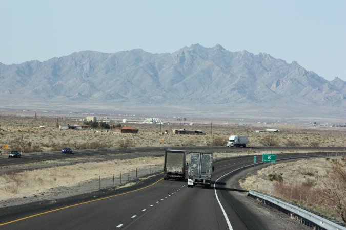
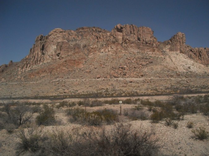
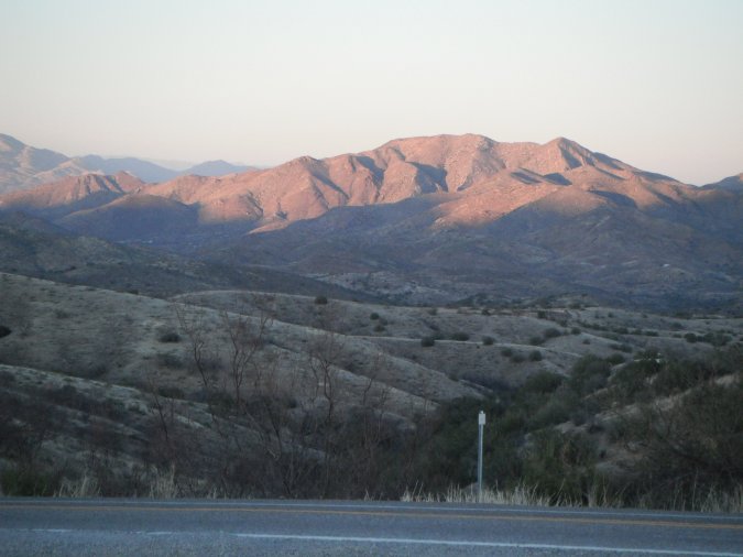
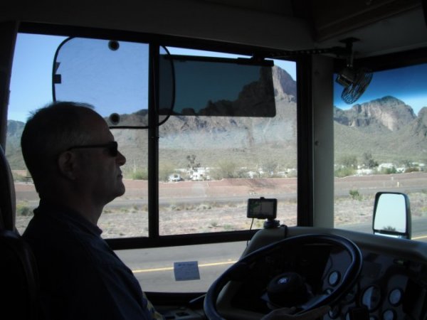
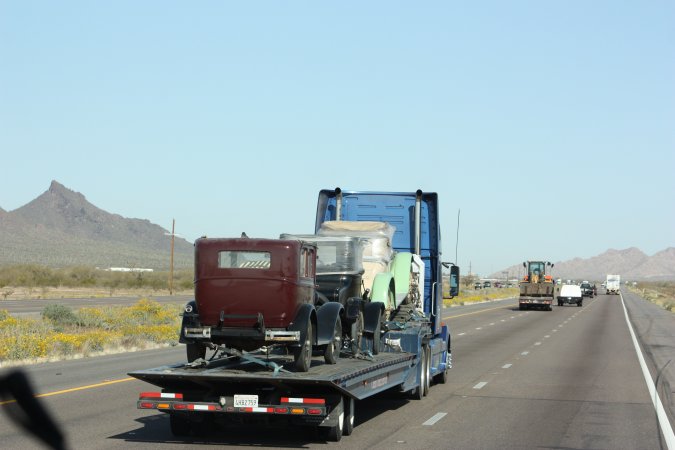
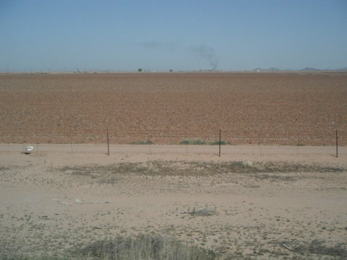
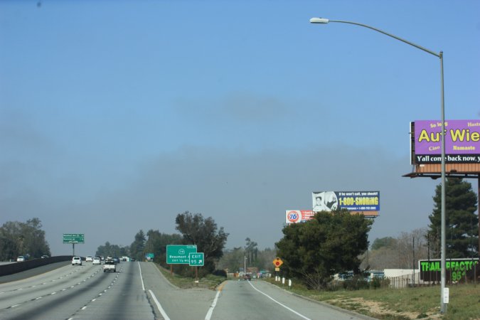
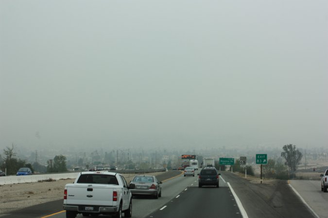
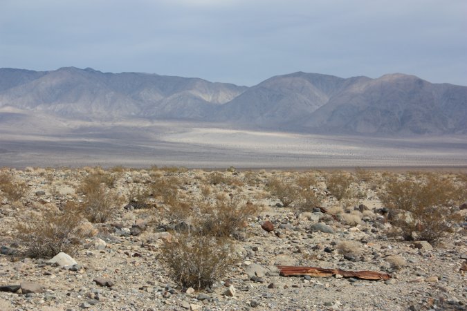
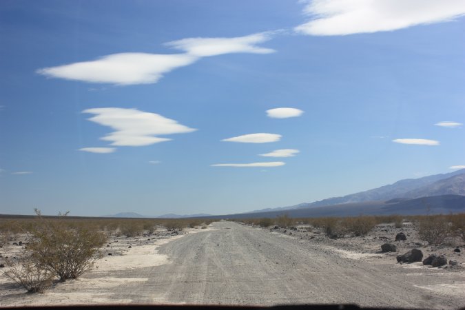
From Las Cruces, New Mexico to Tucson, Arizona, we covered some 455 kms today.
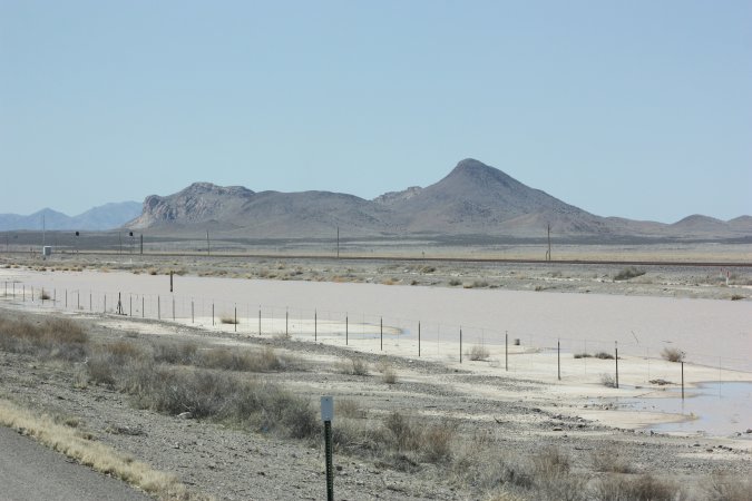
Such grandiose sights.
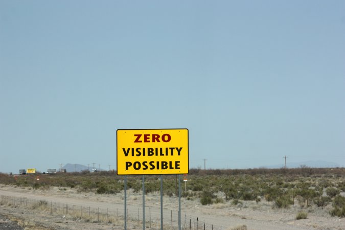
Hummm! These signs reminded me of our travel though El Paso with the high winds and dust storm. Today, very little wind and no dust.
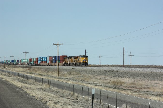
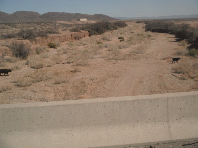
We cannot believe how many train we have seen today! Must be one every 10 minutes. All traveling east.
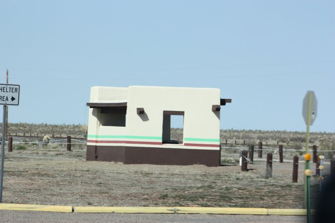
At one of the rest area on I 10, they have this pretty neat shelter!
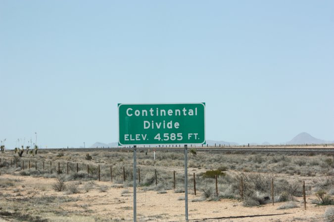
From now on, all the water should be draining west. Our highest point so far was at 5200 feet. (1585 M).
And now we are traveling downhill for the most part!
The water is brown like the dirt!
Welcome to Arizona and they are celebrating their centennial.
The photos do not compare to what we are actually seeing. So pretty!
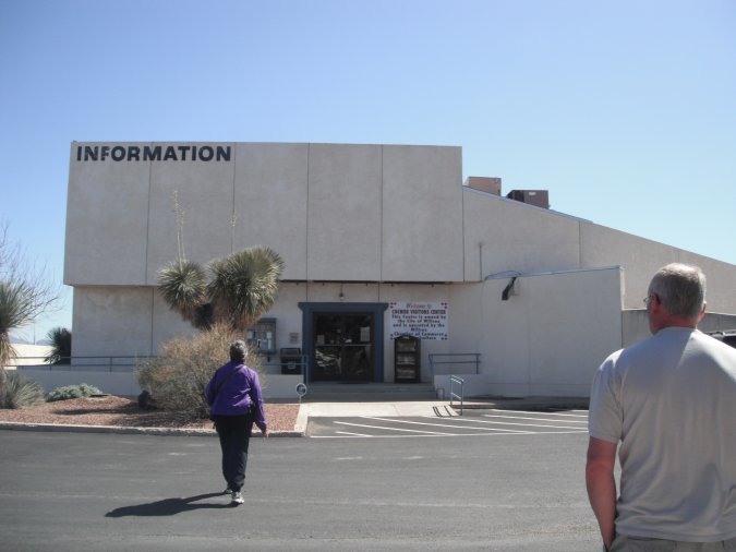
Once we got to Arizona we could not find an information center by the state line. Some75 km later in a small town, we got one, but it was more about the county then the state. It would have been easier to pull a tooth from the person working there then getting info!
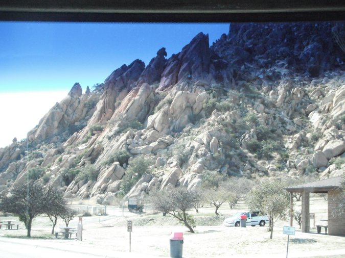
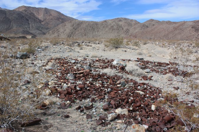
Quite a sight!
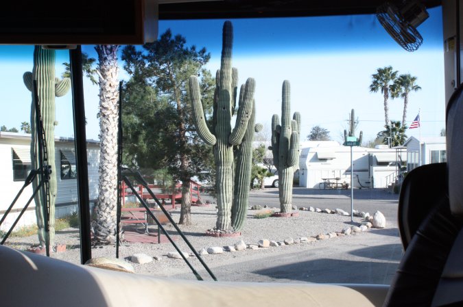
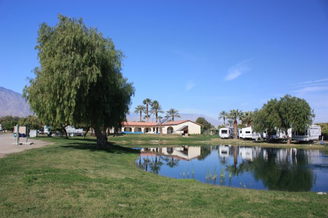
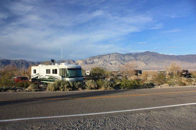
We made it to Tucson and are now at the South Forty RV Ranch.
A view from our front windows!
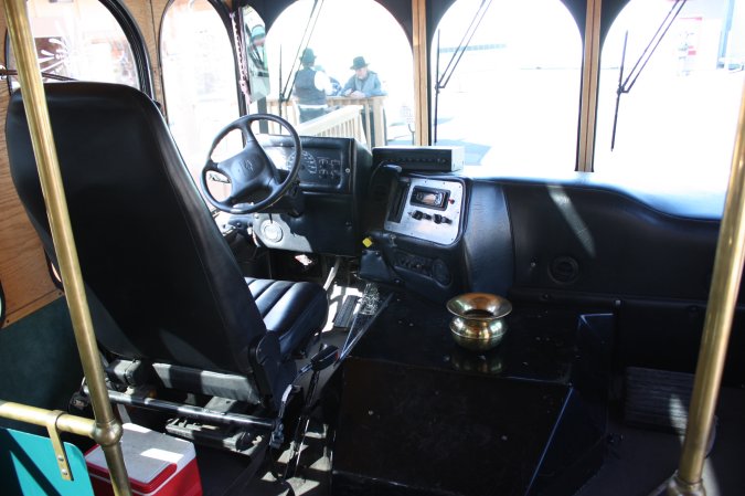
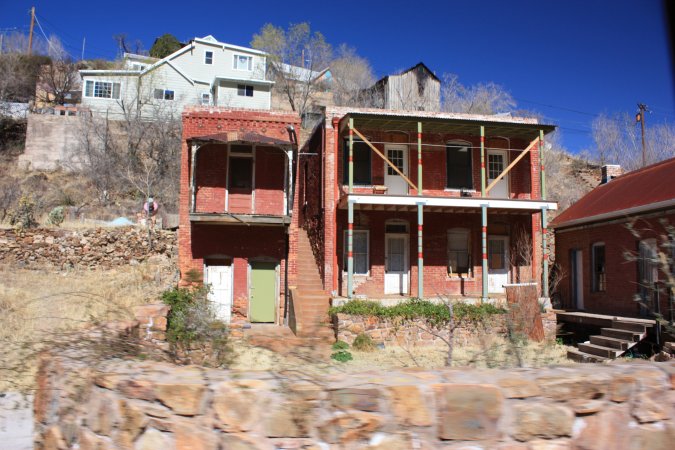
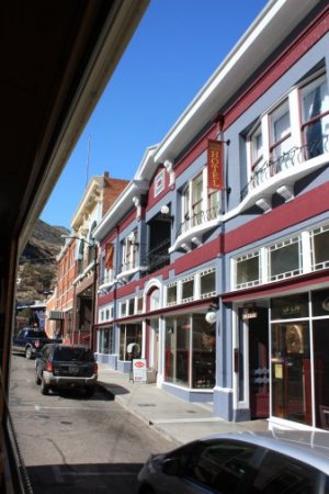
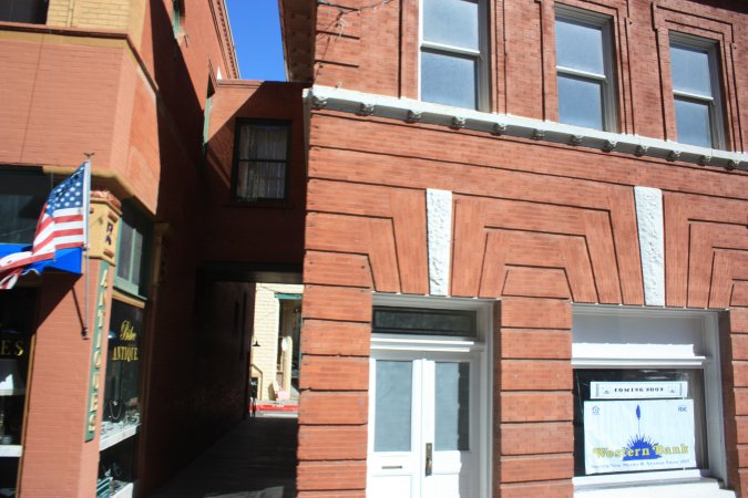
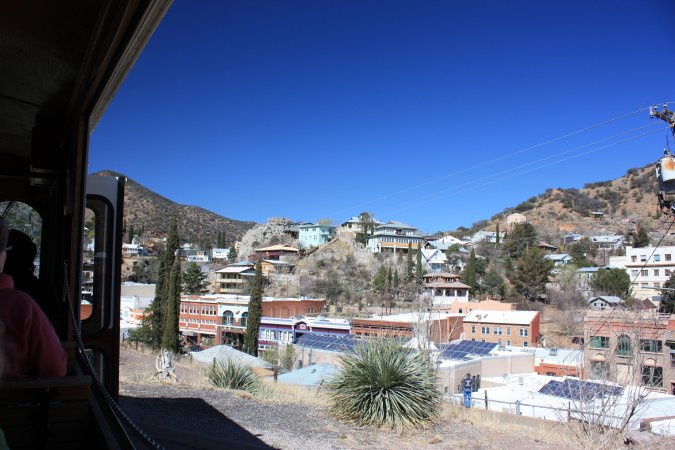
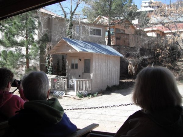
Saturday and we are visiting the town of Bisbee. A very nice little town that has more of an eastern flavor look because of its architecture. We took the tram for the guided tour.
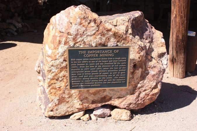
Bisbee only existed because of the copper found in the area. At the turn of the century, Bisbee was even more important than Tucson. Here are two of the houses used by the "ladies of the night" during the mining boom. The main street.
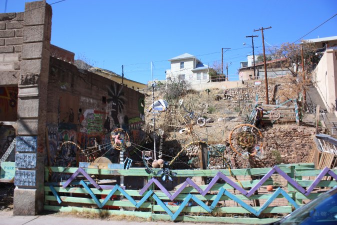
After the last mine was shut down in 1975, the hippies came here and took over the abandoned building. It actually saved the buildings from being vandalized and deteriorating. With the hippies the art took off and now it is the main industry.
You can see one of the hippie park. And if you noticed the building is made of bricks, but with very little mortar because of the lack of water. The walls look almost as if it was not made of bricks. The bricks are very wide and actually lasted a long time because of so little mortar being used.
A view of the town and of a house used by miners back in the days. Up to 8 miners could live in a small house like this one!
Since this is a mining town why not visit a mine!
We are ready to be miners!
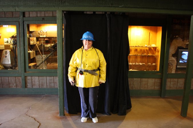
We take this small train to go down into the Queen mine.
Not a lot of photos in the mine. The lighting was poor and the flash did not make for good photos.
Very interesting place, after the visit of the mine, we left Bisbee because we want to visit Tombstone.
Tombstone, "The Town To Tough to Die".
Not a very big town!
The sheriff giving a hard time to the lady in the wheelchair?
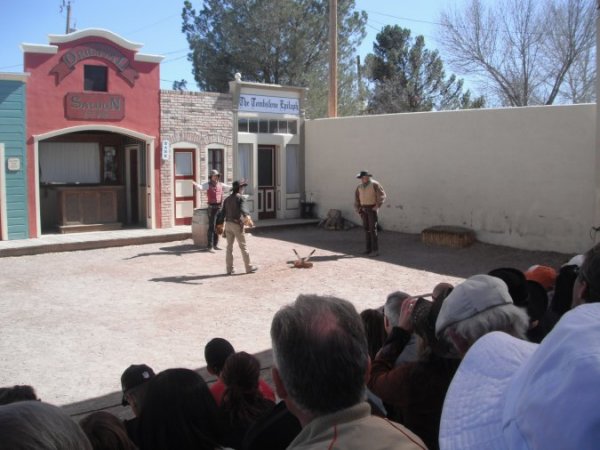
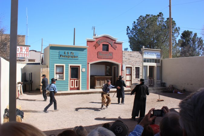
We had to check out the OK Corral gun fight!
More photos of Tombstone...
It was nice, but with so few people, it was kind of boring, would have been better with more people.
On the way out of town, we stopped at the Boothill Graveyard.
Free and a good thing it is! Not much to see really. Two of the best head stones...
We took the scenic route on the way back. We stop at a look out and there are people helping another truck. Both vehicle have Arizona plates. One of the gentleman asked me, where in Ontario I am from! He continues with "My Wife is a Newfie"!
His wife confirms that. He was born in Arizona and marry a Newfie? Wow! What are the chance of meeting someone in the middle of nowhere that is from Newfoundland!
A great day!
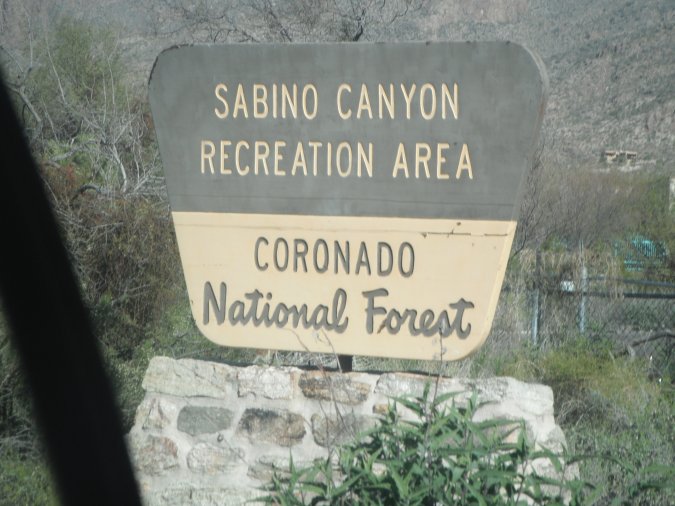
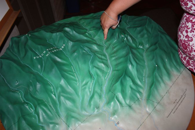
We are going for a hike in Sabino Canyon.
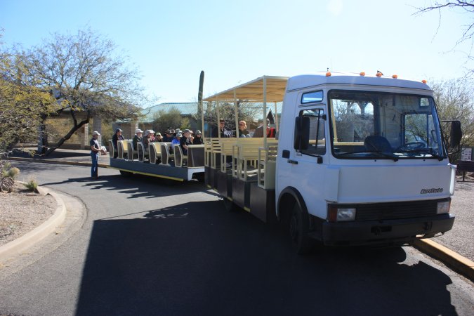
We take the shuttle to get to the top of the hill and the start of the trail backdown. Michèle is showing us where we will be starting the hike from.
A 6 KM ride with the shuttle.
The shuttle is more than a shuttle, it is also a guided tour of the canyon. The Sabino creek is dry for a few weeks every winters.
Can you see the Aztec mask?
From the shuttle drop off point to where we are now, it is only 0.8 km, but let me tell you, it is steep!
The trail behind me.
The hiking trail is named the "Phoneline trail" and it is 7.6 km long.
Spring is just getting under way and lots of flowers are coming out.
Really nice hiking trail with so many beautiful sights!
A saguaro cactus take almost 70 years before it developed an arm, but once it starts, many can come at once. Another cactus shining with the sun at it back.
In the background, you can see Tucson and in the front, my cute, Michèle!
As I was saying, spring is stating up here. Flowers and what looks like pineapples growing from this cactus?
Some more sights and view form our hike...
The view and sights are just beautiful, can't get enough of the changing colours from the rock formations.

Getting closer and closer to the end. The more we drop in altitude the more the vegetation changes. Lot more cactus and bushes.
A gorgeous day! But we think our legs will hurt a little tomorrow because we are not as active as we should be!
Monday was a rest day, and our legs reminded us of that.
Tuesday, we are off to visit Biosphere 2 of the university of Arizona in Tucson.
Build in 1986 from private fund, Biosphere 2 was used for two "missions". The missions were designed to have a group a scientist live for extended period of time in an enclosed area.
The first mission was in 1991 and lasted two years. It was stopped because of a lack of either nutrient or proteins, they were not getting enough of. It was consider a success by the research communities, but a failures by the media. Lots of data came from that experiments. The second mission in 1994 only lasted 10 months and was stopped.
The biosphere was than turned over to the university and they use it for research on the environment and many other things related to nature. A very interesting place.
Part of the biosphere is a tropical forest.
Another part is an ocean with its own coral reef.
This is an experiment conducted by a student. I cannot remember what it was all about! This was in the sub-tropical area of the biosphere.
We actually saw 2 divers working at stuff underwater.
Of course they had a few fish tank and some exhibits about the oceans.
The university actually kept a few rooms from the early missions that were conducted in the biosphere back in the days.
Here we have the kitchen where the scientist were having their meals together and discuses the day events.
Very very interesting place, you got to see this place if you come by Tucson.
Still being early, we decided to visit the Titan Missile Museum.
What is a Titan missile?
It is a big rocket with a nuclear bomb of 9 megaton at the top!
Why?
Go back in time when the enemy was the USSR. At the end of the second world war, the cold war started and with it the arm race between the west and the east, as in us and them!
The guided tour is not to explain the intricacy of the cold war, but showed us a small portion of it and the players. The crew and place of work for them. The men and women who were in the silo 24/7 for nearly 20 years.
The guide we had was just fabulous! He made it fun and very interesting. He took us deep inside the silo and showed us the control room and explained how it was impossible for one person to launch a missile.
The "cover" of the silo is now made out of glass so we can see the missile and so the Russians can see it from space and confirm it is not a "real" missile. All part of the old SALT II treaty between the US and Russia (the USSR back then).
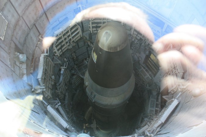
Very little to see above ground. Everything is below ground to protect it from nuclear attack.
Let's go underground!
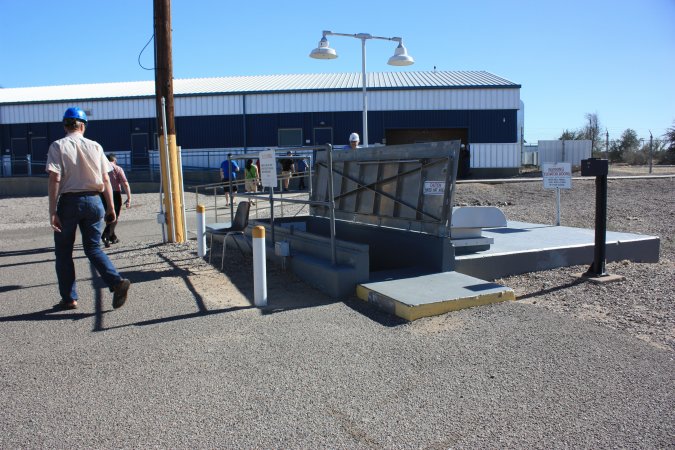
After security checkpoints, back then, we are in the control room of the Titan II missile.
Our guide made us feel like we were the crew of this silo. Notice to the right of him the big springs, the whole room is suspended by springs to absorb the shock from an attack by nuclear bombs. WOW!
The electronics may look old, but remember this was the 1980s.
Here it is!
Titan II missiles were used between 1963 and 1987.
What a tour, it is worth the trip to see this. Especially for those of us who did take part of the Cold War in NATO, but also for the new generation to learn why we did what we did back
Personal note here: In a way, I liked it better when we had the Cold War. We knew who the enemies was and most of the time both sides played by the "rules". Today with the terrorists, who is the "enemy"? What "rules' are being followed?
I want to make this clear, I do not put Muslim in the same pot as terrorist. Before we point finger maybe we should look back at what Christianity did in the past!
Only my personal opinion!
(If I upset anybody, tough!)
Our time in Tucson is over, we are leaving tomorrow morning.
Today, we "replenish" with food and stuff.
A last look at all those beautiful sights!
Our stay in Tucson was under a beautiful blue sky and warm weather. That was very good!
Leaving Tuscon today!
Here is our site. Notice that we have no grass, water is very rare and very expensive. Still very nice.
Very good warning on the way out of the campground.
In many southern states, they have "stuff" on the walls of bridges and the like. Very nice and it makes the driving a little more interesting.
On our way to the Salton Sea in California. Some of the sights, on our way there.
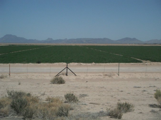
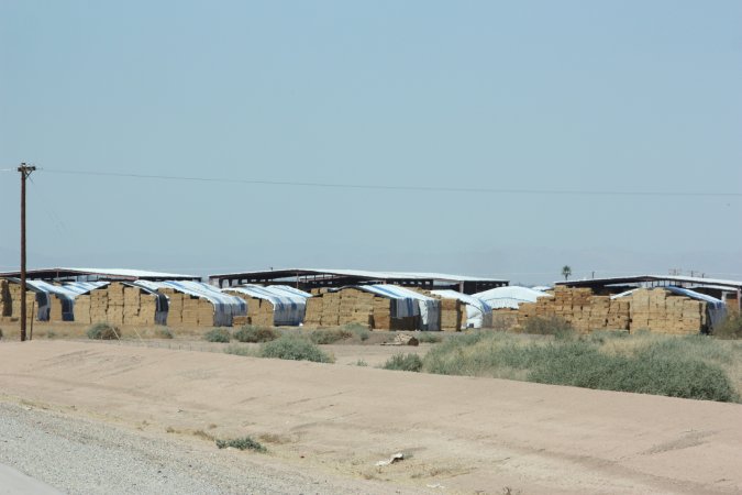
The closer we get to California the more agriculture we see.
The motorhome is not running right, whenever there is a demand for fuel, the engine hesitates.
I stopped and checked all the fluids, nothing is low and everything looks good. Back on the road and it gets worse as the time goes on.
We have to get over some mountains and let me tell you that it is pretty steep.
The motorhome is really acting up, I can only get to 45 km/h when I could have easily gone up at 80 km/h.
The engine is hesitating all the way up. This is not good!
The next city is Yuma. We stop at Walmart and left the motorhome there to look for a place that can fix our motorhome. The first one can only take the motorhome on Monday, we still book an appointment. The second place is Yuma Diesel Service and they can take us tomorrow morning. We cancel the one for Monday. We spend the night at the Yuma Diesel Service yard.
We are right next to the highway with trucks going by 24/7 and a railroad right behind us, the motorhome actually vibrates when a train goes by. It does not matter at this time...
We can already hear the $$$ leaving us!
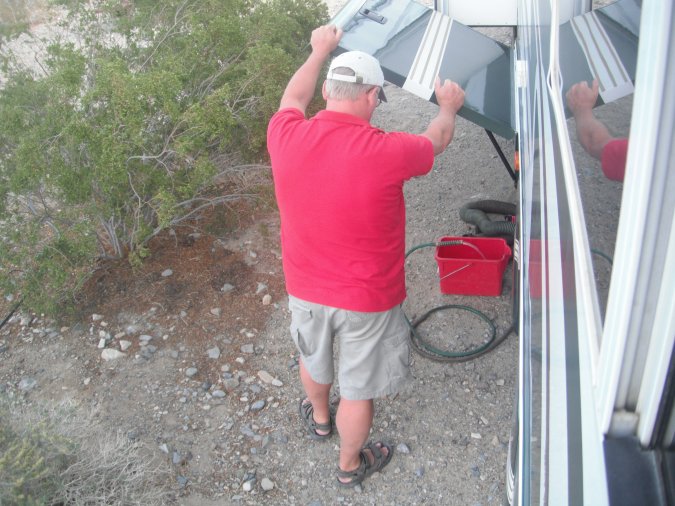
Got up early to be ready for the 8 am appointment, here we are in the "wash-bay".
Mike the mechanic is working on our motorhome. After talking about the symptoms we experienced, it was concluded that the fuel filters that were probably blocked. The motorhome was also due for an oil change so that will be done at the same time.
To be able to change one of the fuel filter, Mike has to take out the air filter and disconnect the starter.
No way I am going to let a dirty mechanic (no offense) working from inside the motorhome.
So I ended up giving him a hand from the inside.
The filter closest to the fuel pump is clean, but it is still changed just in case.
Michèle taking a break from all the work going on around her. Notice all the stuff from under the bed laying around.
No photo of the fuel filter right after the fuel tank, but let me tell you it was full of dirt and stuff. This is more than likely the problem.
We must have got some dirty fuel at one of our last fuel stop.
Mike working very hard.
In less than three hour, we are out of there at a cost of $360.00 including the oil change and fuel filters, Wow!
Back on the road with no problems.
I recommend Yuma Diesel Service if you ever need work to be done on your motorhome. They may not be the fancy place, but they get the work done.
More art to decorate the bridge.
California, here we come!
Funny advertising.

Agricultural inspection! We have to stop and a lady came inside to look for any type of citrus produce we could have. She left with 4 oranges that were bought outside California. She gave us a paper saying we were inspected, in 10 minutes we were out of there.
Shortly after we came across the Dunes. A place where you can ride you ATV or other sand type of vehicle on the dunes.
The black line you see is actually a barrier (fence) between the US and Mexico. So far, the US has built over 1126 km (700 miles) of barrier between the two country.
Agriculture is present everywhere.
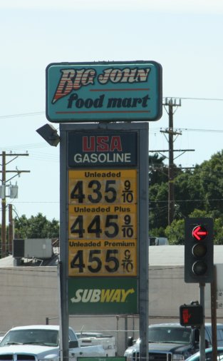
Gasoline goes up in California, $4.356 per gallons equal $1.15 per liters.
Welcome to California!
A big accident on the way to Salton Sea. Can you see the small pickup truck on the right photo? Outch!
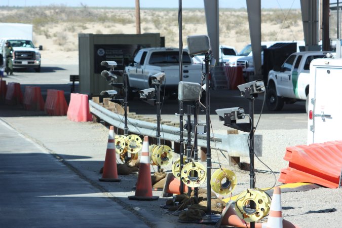
Another stop, this time a border patrol station looking for illegal aliens. We make it to the other side no problems.
We are getting closer to the Salton Sea, we can see it on the right. Have you ever seen a road sign like this one?
Oh my God! The palm trees have fur!
Some Date-Palm.
We make it no problems, the motorhome is working perfectly. The fuel filter was the problem!
Here we are at Oasis Palm RV Park.
Because we have Passport America membership, we only pay $11.00 per night for a site with water and electricity! WOW!
We have no problems with 4 nights without sewers, our tanks are big enough, but first, I have to empty them to make sure.
Our new home.
A very nice campground with heated pool, free WIFI.
Only a little too close to the highway with the trucks 24/7!
I find those palm tree so funny with all the fur! Actually dead leaves still attached.
The Salton Sea is 69 Meters (226 feet) below sea level.
A very nice information center at the state park. On top of that it is manned by Canadians from Calgary, small world!
We got lots of information and also learned that tomorrow they have a free kayak tour on the Salton sea. We got our name on the waiting list.
With all the info from the center we continue down on the east side of the Salton sea.
Got our first Roadrunner!
Some of those wash can be pretty deep and wide, we would not like to be near when they are flooded.
The region around the Salton sea was the place to be for the summer from the 1920 until the late 70s. At that time two storms/tornadoes hit the area back to back, on top of that the water level of the sea was starting to fluctuate and the salt contain was going up. All these thing hit hard and nobody wanted to re-invest in the infrastructures. The area never recovered.
Here in Bombay Beach you can still see some of the damage done over the years.
The little town is now protected by a man-made berm, here is the un-protected side.
Something was being film here. After talking to someone we found that the show "Extreme Chef" from the Food network was being film today. We could not get closer!
Some more photos of Bombay Beach...
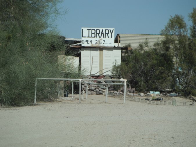
Still traveling south, we came to the village of Niland.
To the east there are two places I wanted to visit once in my life.
The first is Salvation Mountain.
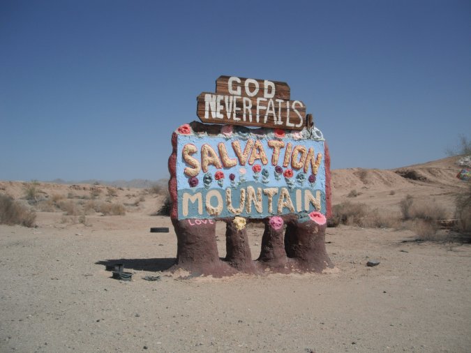
Salvation Mountain is the dream of Leonard Knight who at the age of 35 "found" God. In 1984, now 62 years old, he arrives in Slab City. Wanting to share his love for God, he started to paint a small hill with messages. For the next 27 years, he worked at it. Only working with was given to him, mostly paint and other small stuff, he worked hard at it.
Sadly in 2011 he had to stop because of health problems at the age of 80 years old.
Today a group of people is looking for a way to preserve this "Folk" art for future generation.
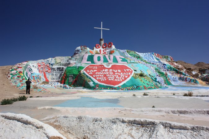
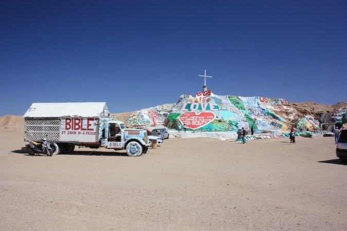
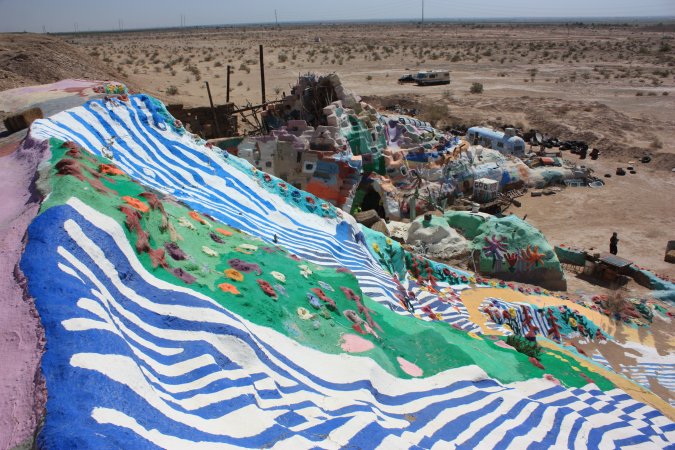
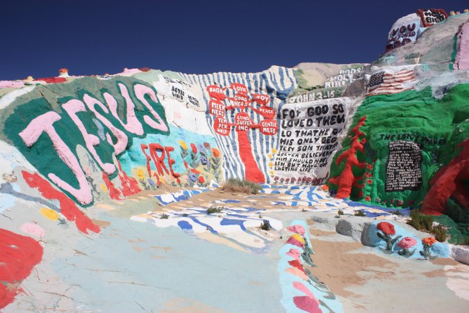
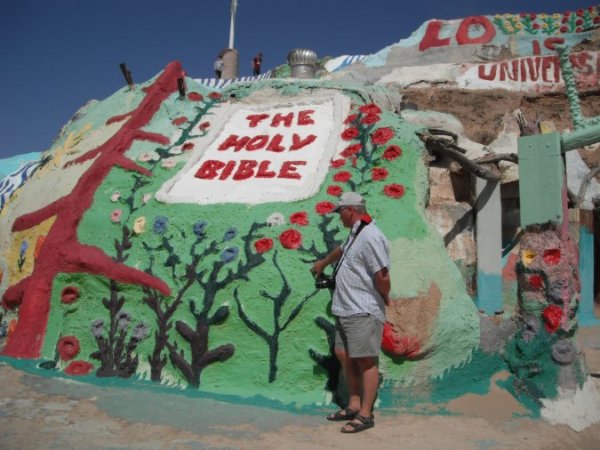
If you ever come to Salvation Mountain, do not expect a Walt Disney kind of place. It is very small, but so big for one man to build this out of love for God.
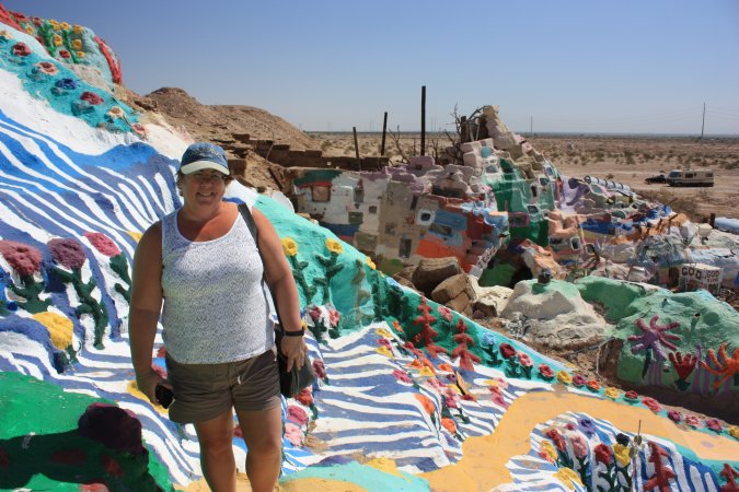
I really like this place.
A few hundred meters down the road, we are coming up to the second place, I always wanted to visit.
Slab City. Here is another web site.
So what is Slab City?
Slab City started out as a Marine Training base in the second World War. At the end of the war, the base was closed down and all the building were removed leaving behind only the slabs they were built on. Not long after that, people started to come here for the winter. Over the years a permanent population of 120 settled in and comes the winter the population grows to over 1000.
Don't forget, there are no services here. No water, sewer or electricity. You have to be self-contained. A few clubs actually come here for the winter.
If we ever come back this way we will come to Slab City and stay for a while. Pretty neat place.
Some photos of the places...
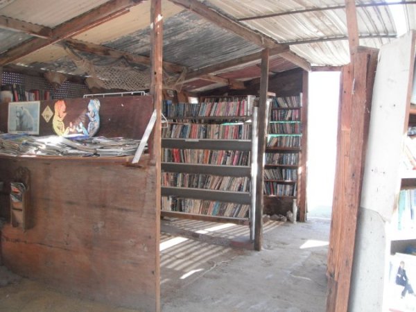
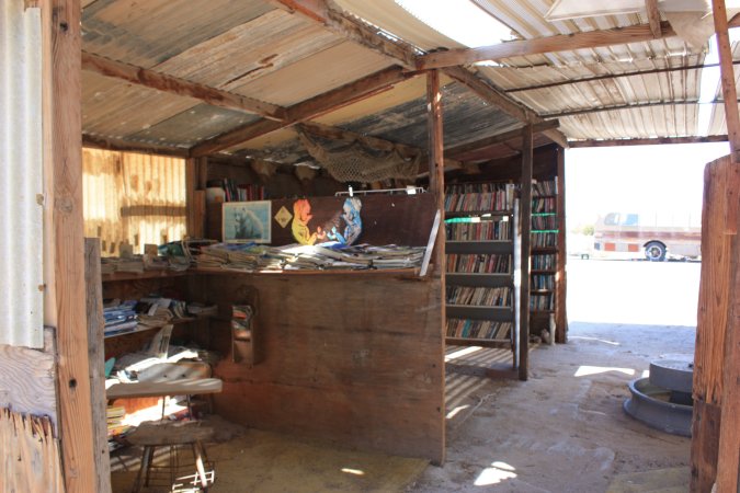
The photos do not even show you half the place. It is actually a very safe place to be.
We hope to go kayaking today.
Here we are at the information center at the Salton sea park, waiting to find out if we can go!
Two persons did not show up, we are in!
Some instructions before we leave.
Once launched, we have to wait for the others.
Here we go!
Beautiful day without a cloud, hardly any wave, we head south into the light wind.
Lots of fun and free on top of that. We were on the water for about 1 hour 10 minutes.
After the kayak, lunch!
After this, we are going back home to do some pool time.
A beautiful day!
A day of rest today.
Tomorrow morning, we will be heading to Death Valley National Park.
Some photos of our campground.
Our site, a little tight, but still OK because our neighbor is gone.
Beach Boy?
Cute little painting in the laundry room.
The campground is full of fruit trees, oranges, citrus and grapefruits.
Harvest time!
All of the fruits are ready for picking. Our harvest in 15 minutes, and we picked only the best.
They are the best tasting fruit we ever had. Not like the ones you buy at the store.
We get ready for our departure tomorrow morning. After that we head to the pool one last time.
Heading to Death Valley. On our way there, we will go a little higher than 1524 meters (5000 feet) and finish close to sea level.
Lots of wind turbines in California. Big ones and little ones.
In the distance we see a sand storm and we will go thought it.
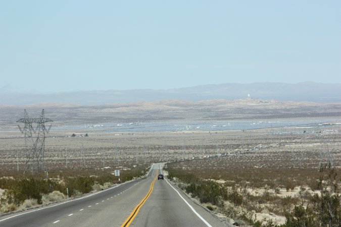
30 minutes later and it is over. Down in the valley you can see solar panels.
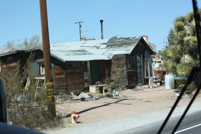
Unbelievable the numbers of small villages that are simply abandoned. I do not recall ever seen this in Canada!
House is gone, but the shit house is still there!
Finally in Death Valley!
Now we have to go down from 1220 meters (4000 feet) to about 304 meters (1000 feet) in less than 18 km (11 Miles).
Can you see the road?
Even the big transport trucks are not allowed to use this road! Beautiful road, just very steep!
We have to get to the bottom of the valley.
Once at the bottom, we have to go back up to 1220 meters and back down to sea level.
We turn around to go to the last campground we saw a few kilometers back.
Right now, we are very tired from the last 100 km and more photos of the campground soon!
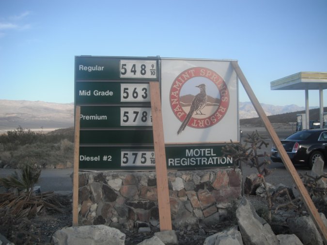
Our campsite is right next to the road. We are at Panamint Springs Resort in Death Valley and it only cost $15.00 per night without services. Luckily this road is not very busy this time of year.
It is actually very quiet. Total silence!
Some more photos of the campground and the view we have. We are at 587 m (1925 feet) above sea level.
As you can see, no grass here! Only rocks, sands and small brushes. This is dessert country.
The sand dunes we see in the distance are about 13 km away from the campground.
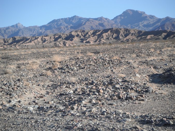
As you can see, the first people that came here were not very protective of nature. A view below the soil.
No strenuous things on our plate today, only a car ride to Aguereberry Point.
To get there, we have to drive over the Towne Pass at 1511 m (4956 feet), but first we check out the road we took to get here.
On the photo on the right, you can see the Panamint Valley, the road we took and at the far end of the road, our campground.
Once at the top of the Towne Pass, we are heading down towards the Death Valley floor. It is really going down...
But before we get to the bottom of the valley, we turn off on to a gravel road towards Aguereberry Point.
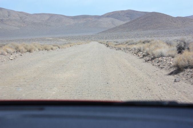
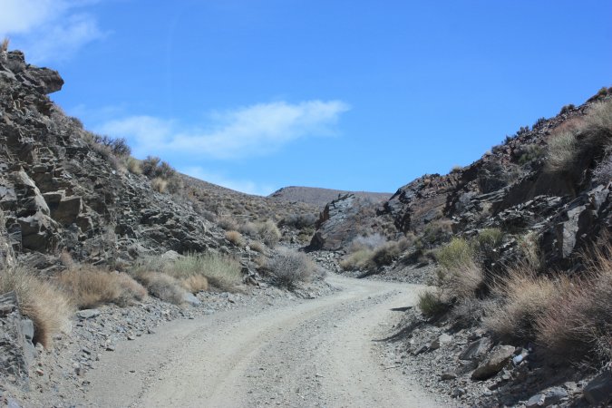
And up we go again, this time with lots of dust.
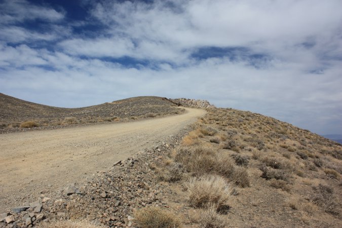
At the top we are at 1961 m above sea level.
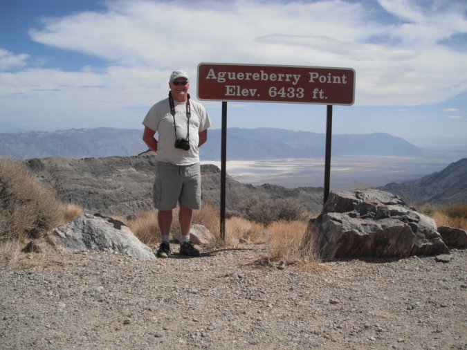
From here we have a breathtaking view of Death Valley.
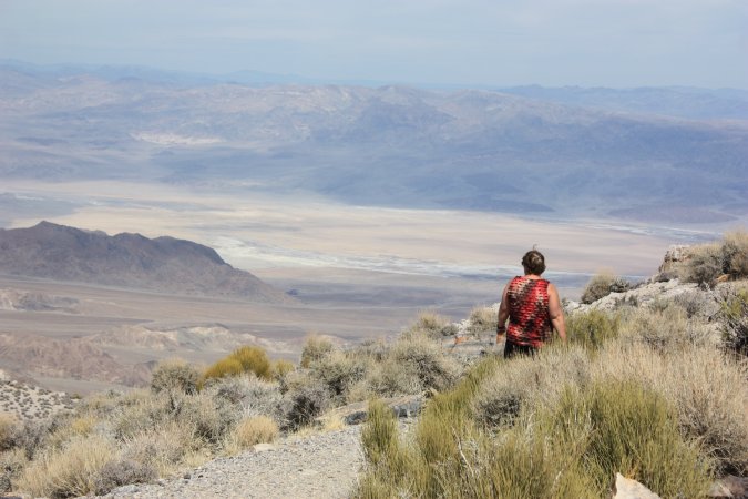
Just to see all of the valley is worth the trip on that dirt road. I highly recommend the Aguereberry Point.
Back in the Panamint Valley, some more photos.
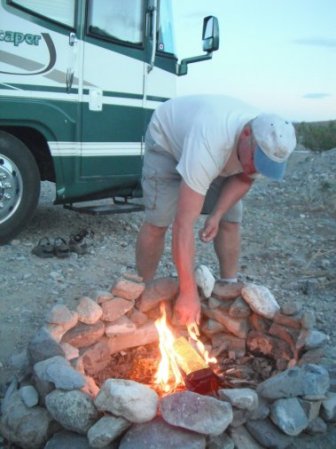
To a great day, a great end, a campfire. Wood is very expensive here so we use one of our "chemical" log.
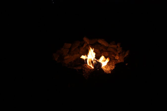
A beautiful day in this desert place. The nights are cool, but the silence is golden.
A big day ahead of us. To see everything we want, we will have to travel more the 300 km.
Here in Death Valley everything is far apart.
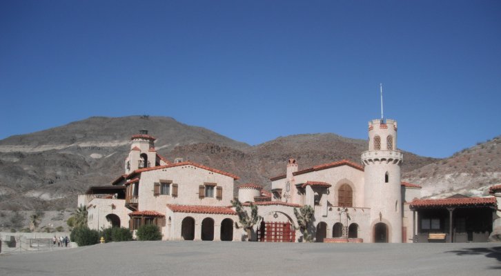
We start with Scotty's Castle, which is at 120 km from here . To get there we go over Towne Pass (1511 m) and than down to Death Valley at - 27 m to get back up to 914 m at the castle.
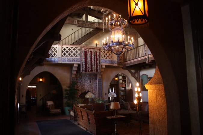
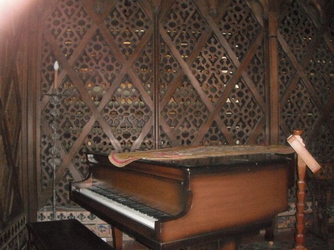
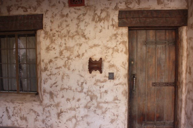
Here we are at the castle. Quite a story about this castle..
The story of a man, his adventure, excentricity, and cunning...
The story goes like this... (a short version) Walter Scott was successful a "taking" money from investors for a gold mine in Death Valley. One of the investor was Albert Johnson, Johnson wanted to go and see the mine (which did not exist). Scotty (Walter Scott) told him all kinds of stories and lies, but Albert saw through all the lies and still made friends with Scotty. Albert really love the area and decided to build this house as a summer home and Scotty could live there. Not long after the completion of the "castle", people started to stop and wanted to visit the castle. Albert gave Scotty the permission to give guided tour, but he could not mentioned the Johnson in any of the tour. It did not take long for Scotty to invent all kinds of stories related to the castle and the area around the castle. Over time it became known as Scotty's Castle. Now the castle belongs to the National Parks and they are having a hard time to differentiate between some of the lies and the truth.
Our guide, Kevin.
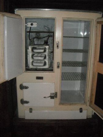
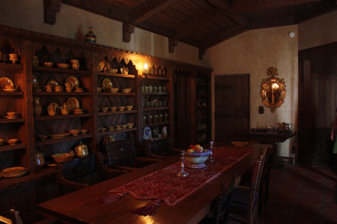
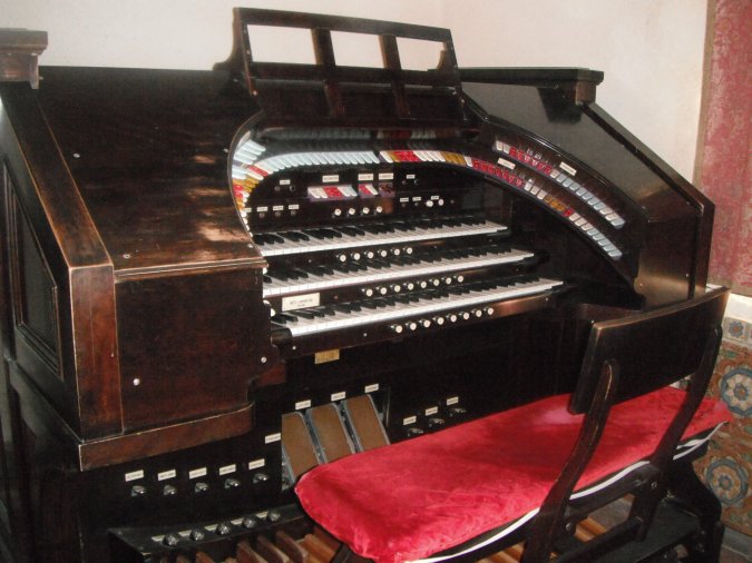
The inside is very simple, but at the same time very classy. Don't forget, we are in 1922 and they even had a fridge...
Behind this wall, you have an automated music box, a big music box! Nobody can play this instrument...
In the center of the photo, you have this piece of metal that look like a butterfly. It covers a hole in the wall and when bad people are at the door and window, you shoot in the hole and the shot will split in two and kills the bad people at both place, the door and the window. Pretty smart (if it works!).
A very well-done tour by the park employees and what a story!
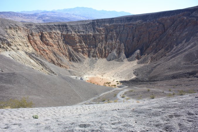
Not too far from the castle is the Ubehebe crater. Let's go and see that.
A few hundred years ago a hot lava flow hit a natural spring and exploded. This is the result!
A crater that is 182 m deep and about 750 m wide.
Just spectacular!
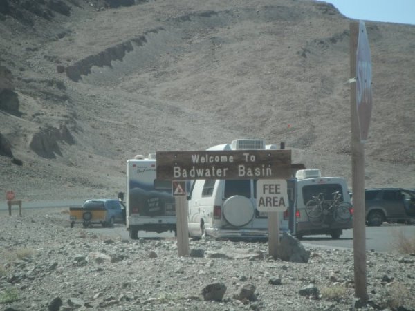
Back on the road for another 120 km to Badwater.
From 914 m to sea level and than 100 feet below sea level...
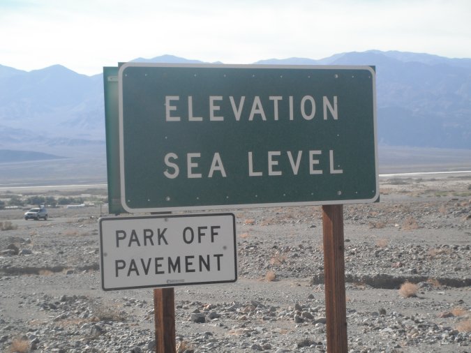
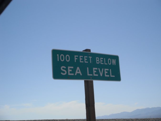
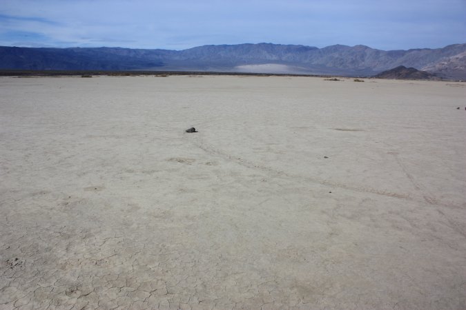
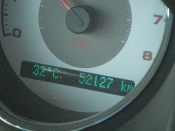
In Badwater, a nice +32 C. Badwater is the lowest point on the continent.
At 85.5 m below sea level, WOW!
Sometimes after heavy rain, water will actually pool in Badwater.
Can you see the little red line in the rocks? This is sea level!
It is salt, I tasted it and it is really salt! To get to the other side you have to hike 8 km.
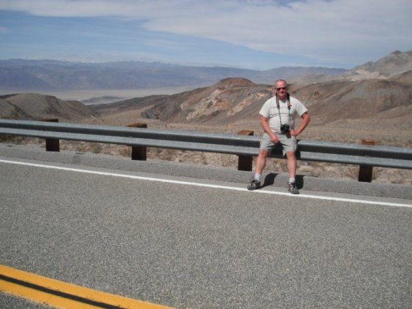
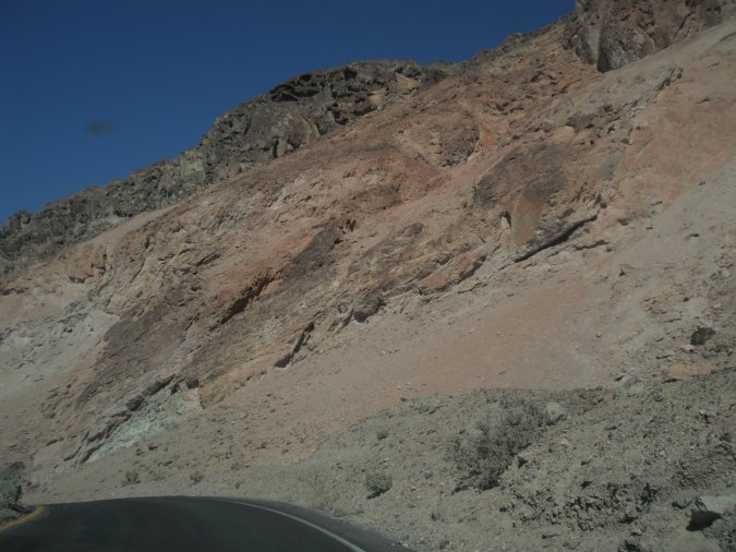
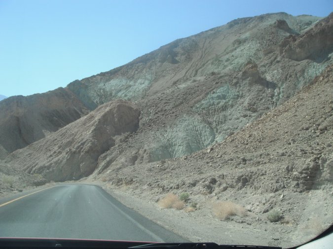
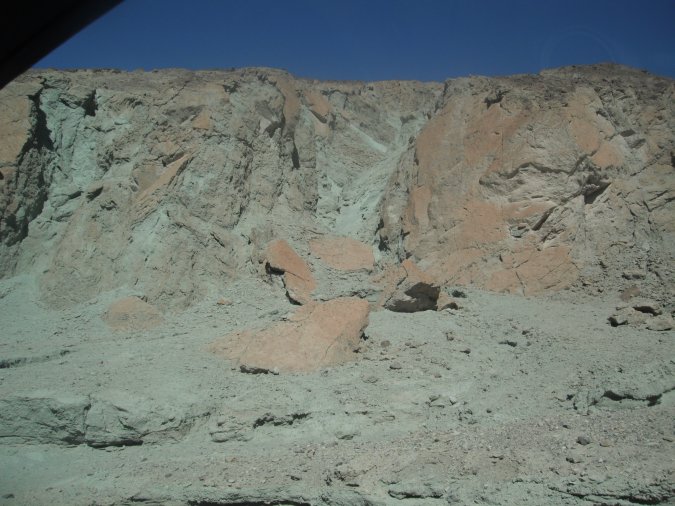
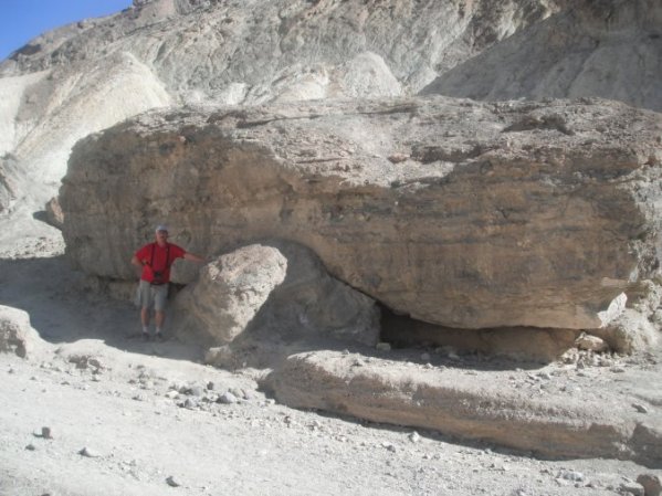
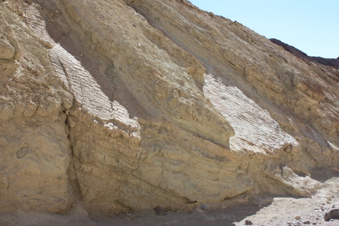
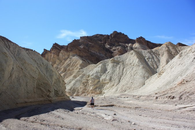
On our way back from Badwater, we stop at the "Artist Drive". A 15 km loop where you drive through multi-hued volcanic and sedimentary hills. Just like an artist's Palette. The photos do not give you the true colors because of the light.
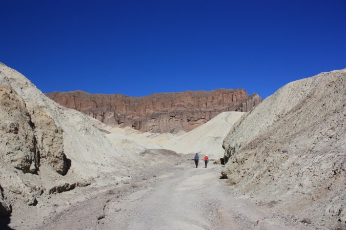
And we continue to the Golden Canyon where a short hike of 3.2 km will take us through twisting narrows and colourful rock formation to red Cathedral.
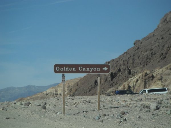
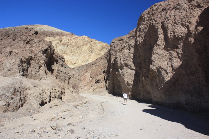
A pretty special place. On the right photo, you can see some ripples on the rocks. They come from a sea many, many years ago and they got covered by silt. This is why we can see them today. Amazing!
At the end of the canyon, we come to the Red Cathedral!
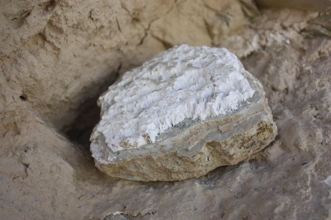
This looks like salt, but it is borax and it does not taste good!
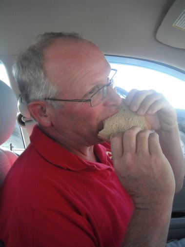
After all that, I am hungry for a good sandwich.
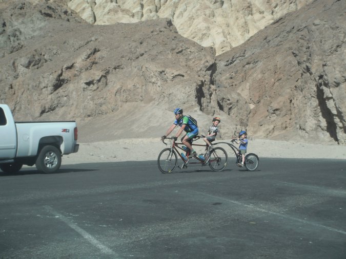
WOW, what a bicycle, the back crank was modified so the kid could pedal.
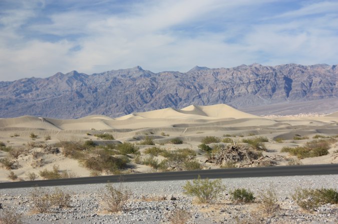
In Mesquite Flat, the sand dunes are about 30 m high.
Another beautiful scene from the dessert.
I have to empty my gray water tank because of a leak at the bottom. You cannot leave "dirty" water drain on the ground in California, specially in a national park. And they are right. Not being able to fix it here, I have two choices, first to pack the motorhome and drive to the dump station or dump in a bucket and make many trips to the washroom.
I take option two, nine trips later I am done. Good for a few more days.
What a busy day, full of so many beautiful sights.
Until next time.
Life is good...
January February March April May June July August September October November December
1 to 15 March 2012 16 to 31 March 2012
Thursday March 1, 2012
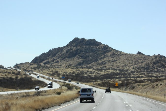
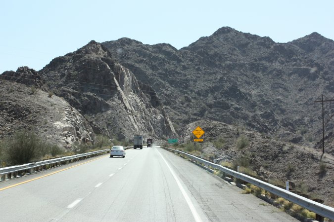
From Las Cruces, New Mexico to Tucson, Arizona, we covered some 455 kms today.
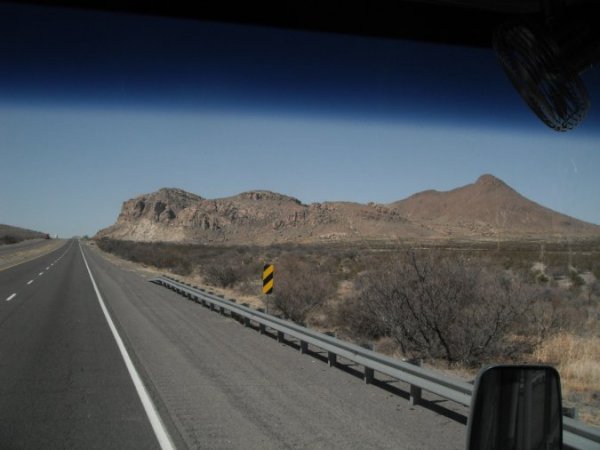
Such grandiose sights.
Hummm! These signs reminded me of our travel though El Paso with the high winds and dust storm. Today, very little wind and no dust.
We cannot believe how many train we have seen today! Must be one every 10 minutes. All traveling east.
At one of the rest area on I 10, they have this pretty neat shelter!
From now on, all the water should be draining west. Our highest point so far was at 5200 feet. (1585 M).
And now we are traveling downhill for the most part!
The water is brown like the dirt!
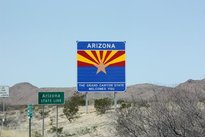
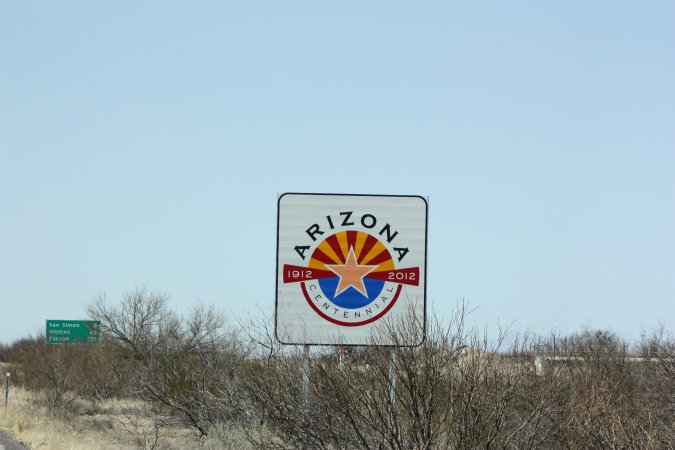
Welcome to Arizona and they are celebrating their centennial.
The photos do not compare to what we are actually seeing. So pretty!
Once we got to Arizona we could not find an information center by the state line. Some75 km later in a small town, we got one, but it was more about the county then the state. It would have been easier to pull a tooth from the person working there then getting info!
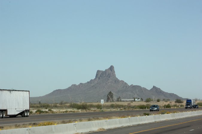
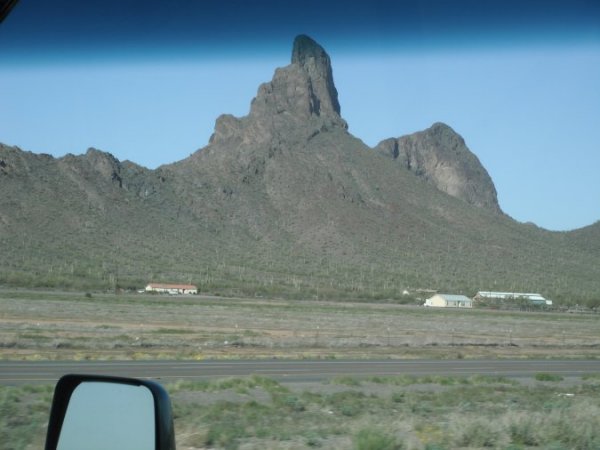
Quite a sight!
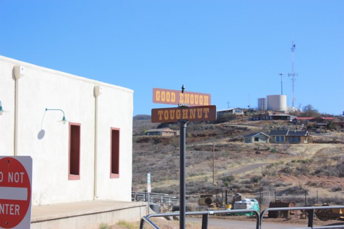
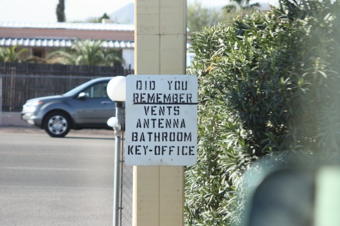
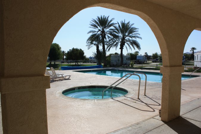
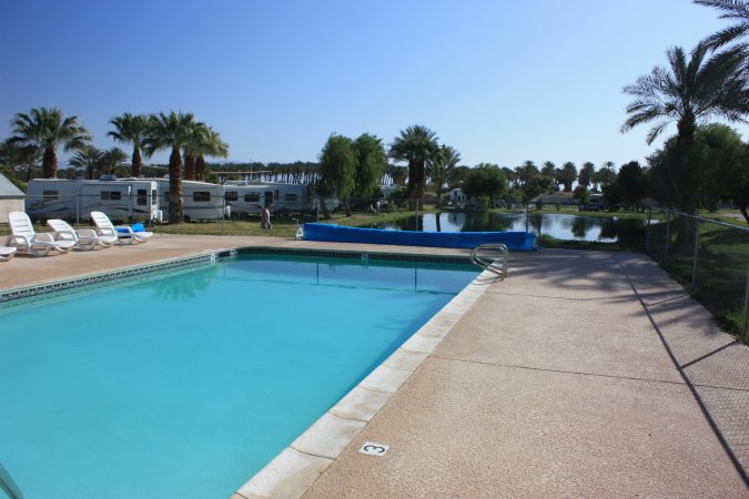
We made it to Tucson and are now at the South Forty RV Ranch.
Friday and Saturday, March 2 and 3, 2012
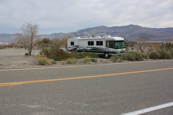
A view from our front windows!
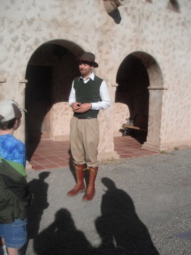
Saturday and we are visiting the town of Bisbee. A very nice little town that has more of an eastern flavor look because of its architecture. We took the tram for the guided tour.
Bisbee only existed because of the copper found in the area. At the turn of the century, Bisbee was even more important than Tucson. Here are two of the houses used by the "ladies of the night" during the mining boom. The main street.
After the last mine was shut down in 1975, the hippies came here and took over the abandoned building. It actually saved the buildings from being vandalized and deteriorating. With the hippies the art took off and now it is the main industry.
You can see one of the hippie park. And if you noticed the building is made of bricks, but with very little mortar because of the lack of water. The walls look almost as if it was not made of bricks. The bricks are very wide and actually lasted a long time because of so little mortar being used.
A view of the town and of a house used by miners back in the days. Up to 8 miners could live in a small house like this one!
Since this is a mining town why not visit a mine!
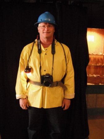
We are ready to be miners!
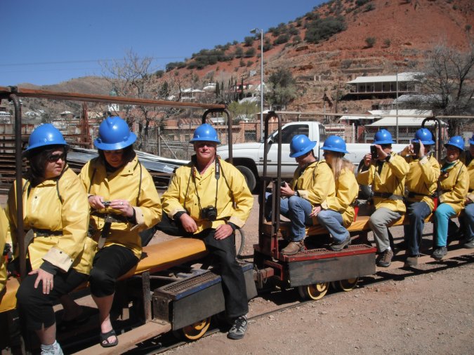
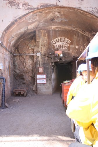
We take this small train to go down into the Queen mine.
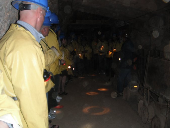
Not a lot of photos in the mine. The lighting was poor and the flash did not make for good photos.
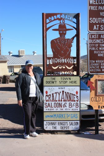
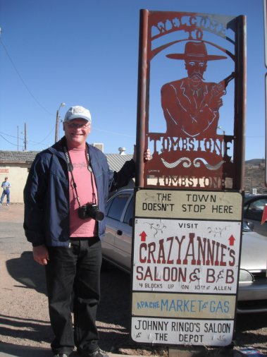
Very interesting place, after the visit of the mine, we left Bisbee because we want to visit Tombstone.
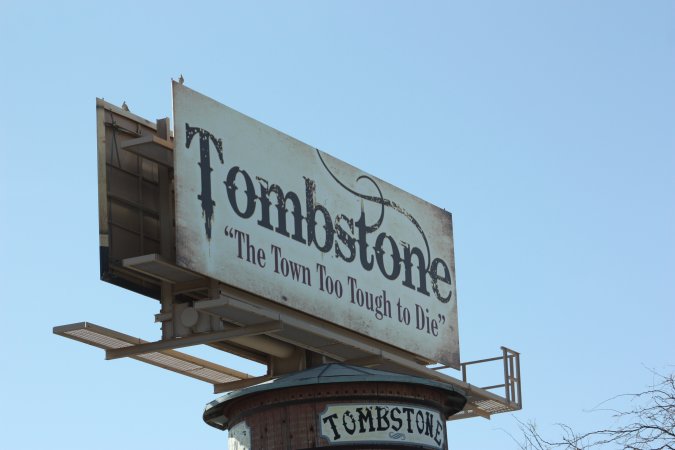
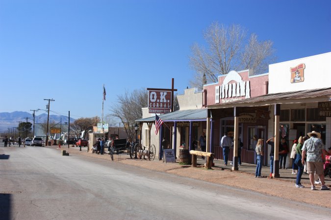
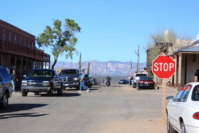
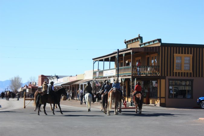
Tombstone, "The Town To Tough to Die".
Not a very big town!
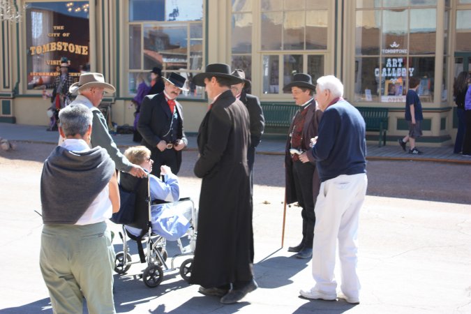
The sheriff giving a hard time to the lady in the wheelchair?
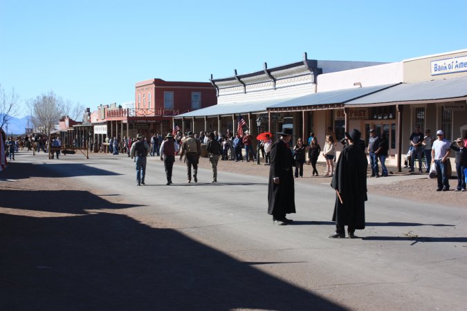
We had to check out the OK Corral gun fight!
More photos of Tombstone...
It was nice, but with so few people, it was kind of boring, would have been better with more people.
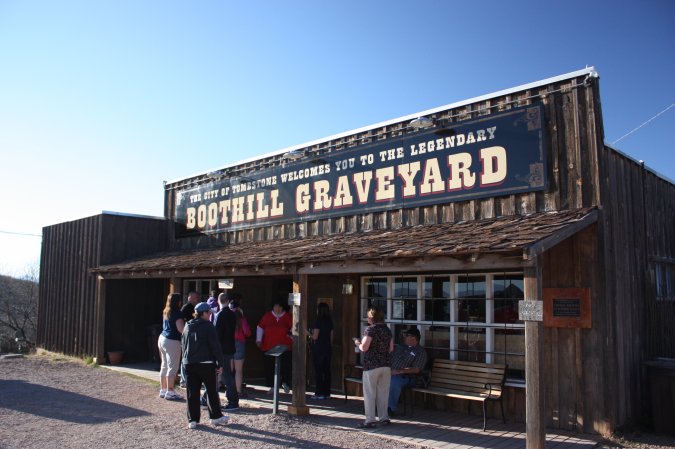
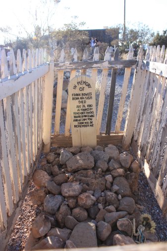
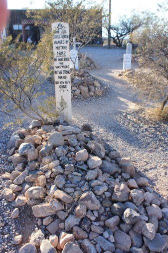
On the way out of town, we stopped at the Boothill Graveyard.
Free and a good thing it is! Not much to see really. Two of the best head stones...
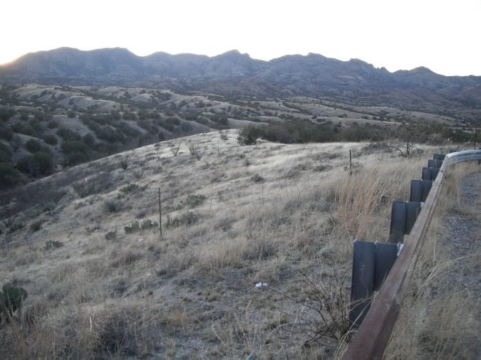
We took the scenic route on the way back. We stop at a look out and there are people helping another truck. Both vehicle have Arizona plates. One of the gentleman asked me, where in Ontario I am from! He continues with "My Wife is a Newfie"!
His wife confirms that. He was born in Arizona and marry a Newfie? Wow! What are the chance of meeting someone in the middle of nowhere that is from Newfoundland!
A great day!
Sunday March 4, 2012
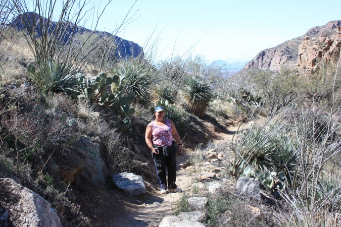
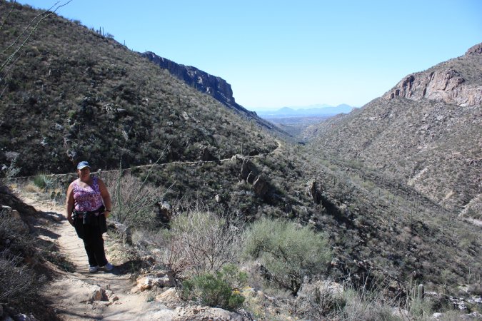
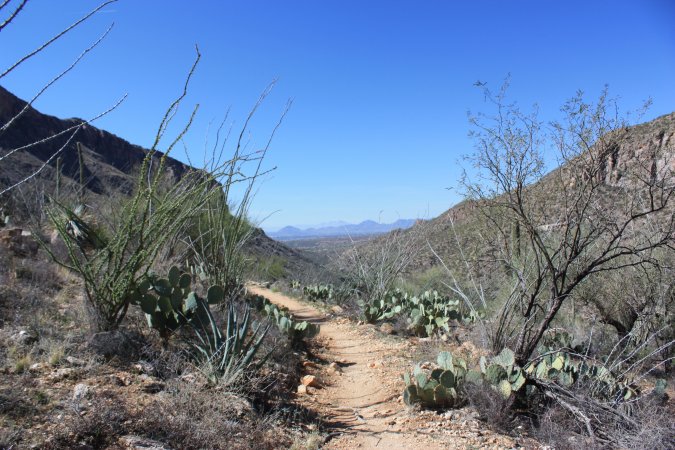
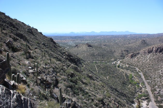
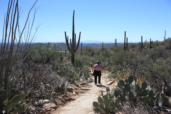
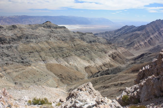
We are going for a hike in Sabino Canyon.
We take the shuttle to get to the top of the hill and the start of the trail backdown. Michèle is showing us where we will be starting the hike from.
A 6 KM ride with the shuttle.
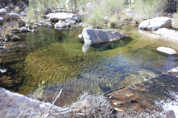
The shuttle is more than a shuttle, it is also a guided tour of the canyon. The Sabino creek is dry for a few weeks every winters.
Can you see the Aztec mask?
From the shuttle drop off point to where we are now, it is only 0.8 km, but let me tell you, it is steep!
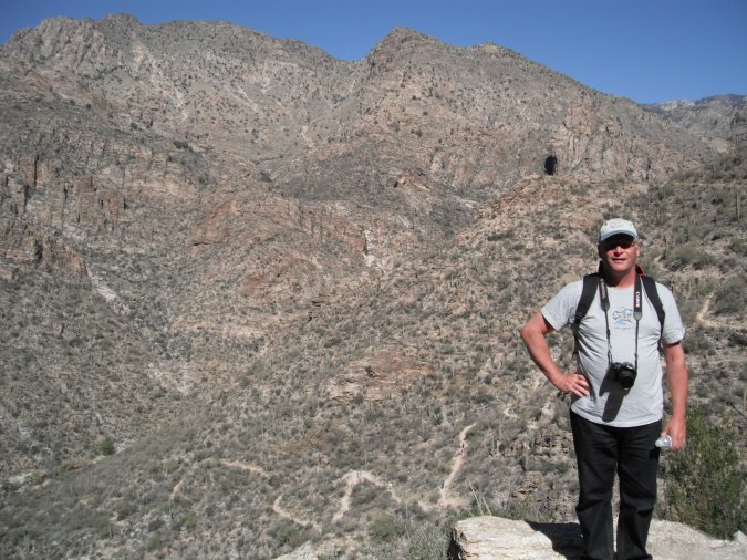
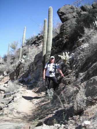
The trail behind me.
The hiking trail is named the "Phoneline trail" and it is 7.6 km long.
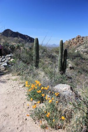
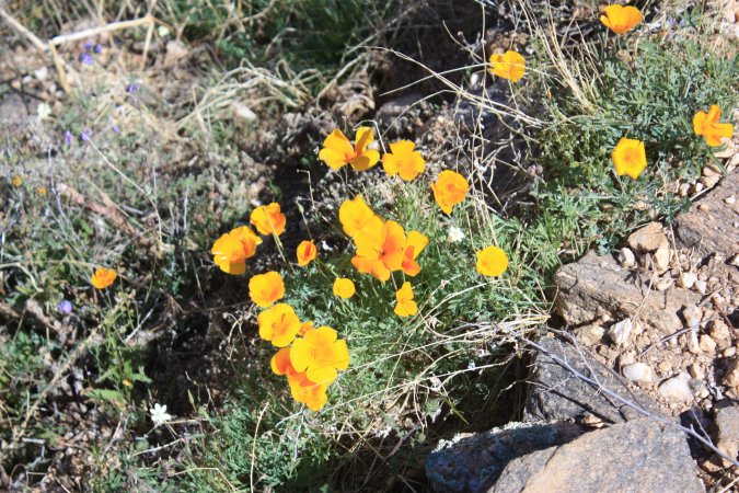
Spring is just getting under way and lots of flowers are coming out.
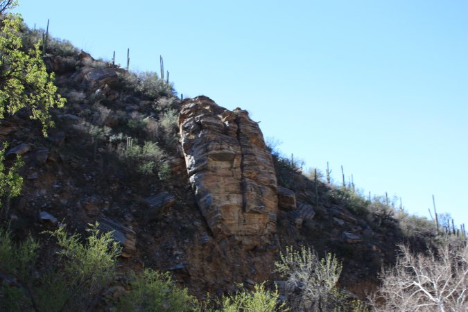
Really nice hiking trail with so many beautiful sights!
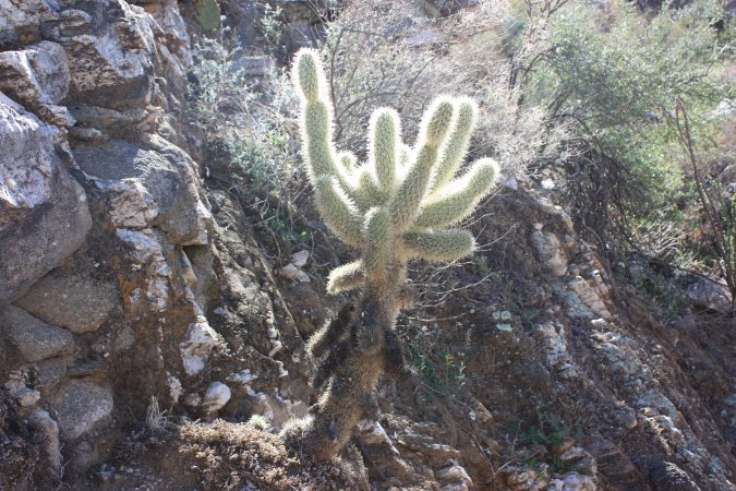
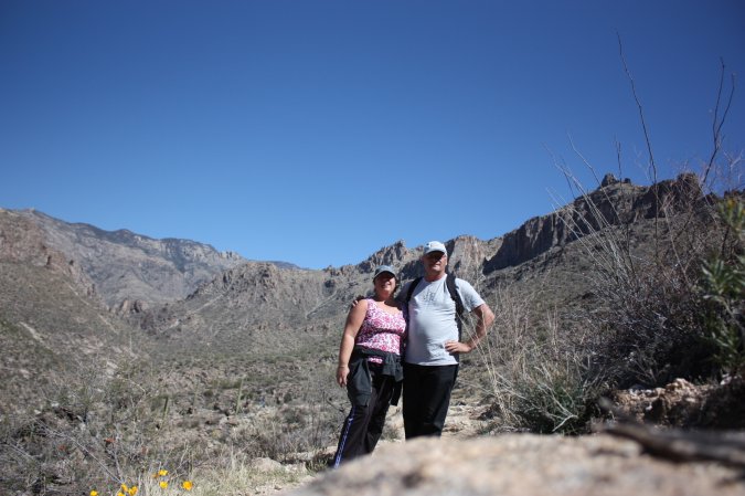
A saguaro cactus take almost 70 years before it developed an arm, but once it starts, many can come at once. Another cactus shining with the sun at it back.
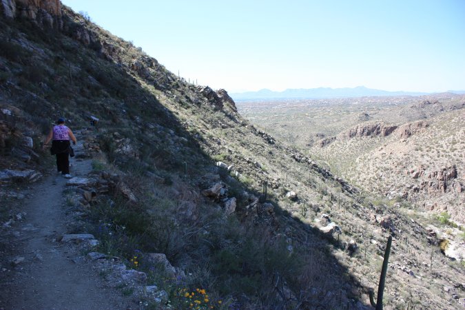
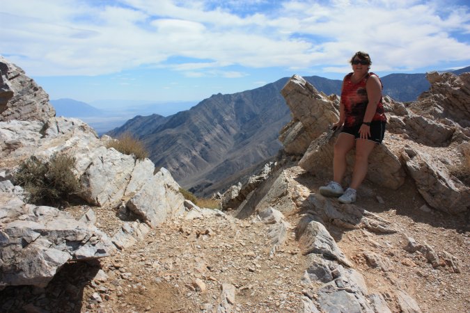
In the background, you can see Tucson and in the front, my cute, Michèle!
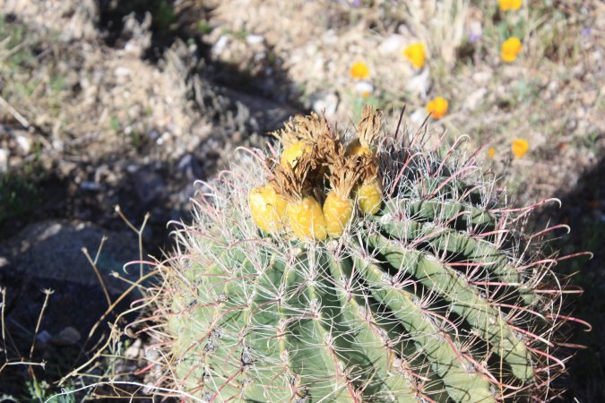
As I was saying, spring is stating up here. Flowers and what looks like pineapples growing from this cactus?
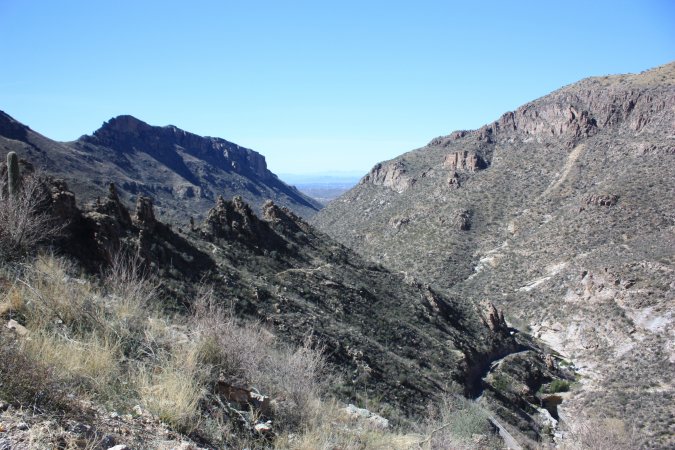
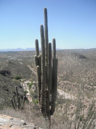
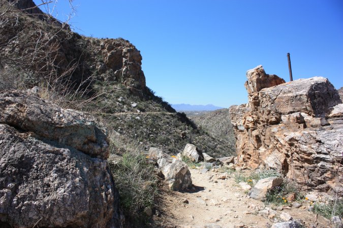
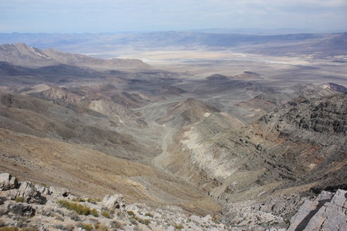
Some more sights and view form our hike...
The view and sights are just beautiful, can't get enough of the changing colours from the rock formations.
Getting closer and closer to the end. The more we drop in altitude the more the vegetation changes. Lot more cactus and bushes.
A gorgeous day! But we think our legs will hurt a little tomorrow because we are not as active as we should be!
Monday and Tuesday, March 5 and 6, 2012
Monday was a rest day, and our legs reminded us of that.
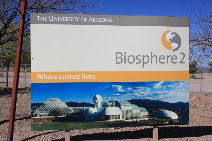
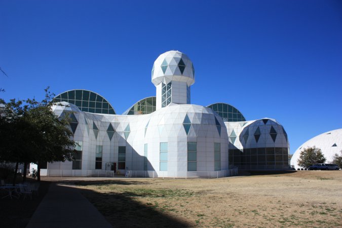
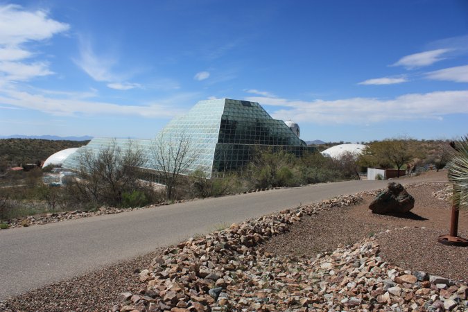
Tuesday, we are off to visit Biosphere 2 of the university of Arizona in Tucson.
Build in 1986 from private fund, Biosphere 2 was used for two "missions". The missions were designed to have a group a scientist live for extended period of time in an enclosed area.
The first mission was in 1991 and lasted two years. It was stopped because of a lack of either nutrient or proteins, they were not getting enough of. It was consider a success by the research communities, but a failures by the media. Lots of data came from that experiments. The second mission in 1994 only lasted 10 months and was stopped.
The biosphere was than turned over to the university and they use it for research on the environment and many other things related to nature. A very interesting place.
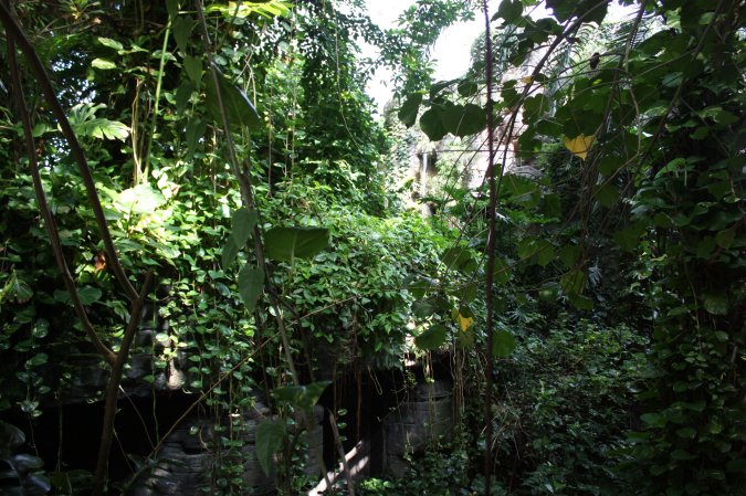
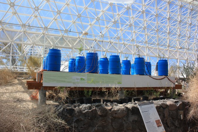
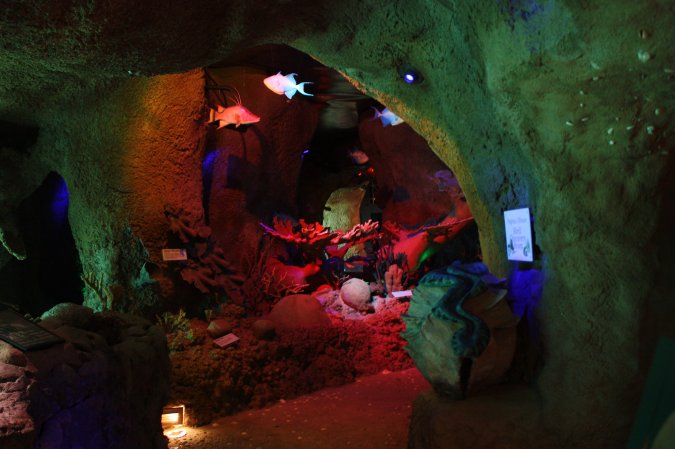
Part of the biosphere is a tropical forest.
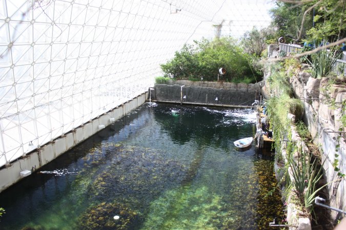
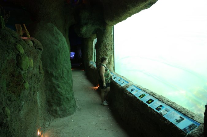
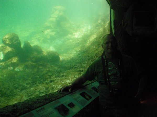
Another part is an ocean with its own coral reef.
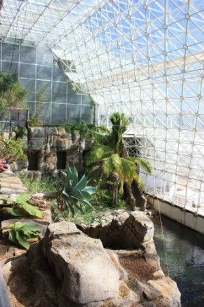
This is an experiment conducted by a student. I cannot remember what it was all about! This was in the sub-tropical area of the biosphere.
We actually saw 2 divers working at stuff underwater.
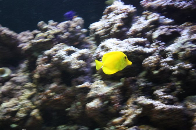
Of course they had a few fish tank and some exhibits about the oceans.
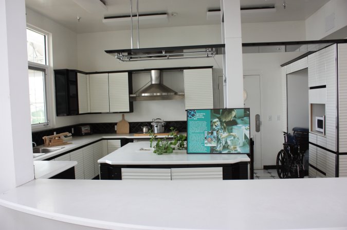
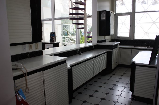
The university actually kept a few rooms from the early missions that were conducted in the biosphere back in the days.
Here we have the kitchen where the scientist were having their meals together and discuses the day events.
Very very interesting place, you got to see this place if you come by Tucson.
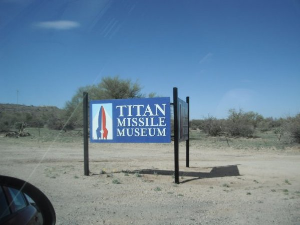
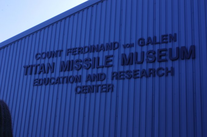
Still being early, we decided to visit the Titan Missile Museum.
What is a Titan missile?
It is a big rocket with a nuclear bomb of 9 megaton at the top!
Why?
Go back in time when the enemy was the USSR. At the end of the second world war, the cold war started and with it the arm race between the west and the east, as in us and them!
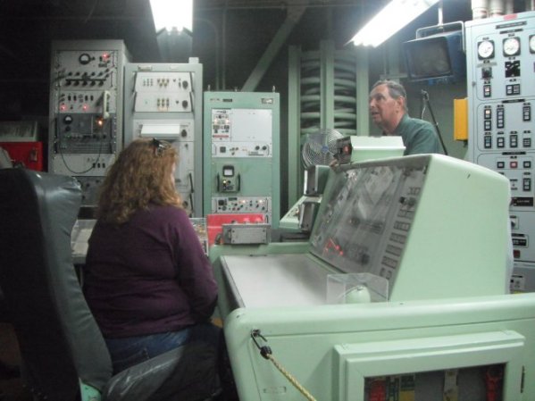
The guided tour is not to explain the intricacy of the cold war, but showed us a small portion of it and the players. The crew and place of work for them. The men and women who were in the silo 24/7 for nearly 20 years.
The guide we had was just fabulous! He made it fun and very interesting. He took us deep inside the silo and showed us the control room and explained how it was impossible for one person to launch a missile.
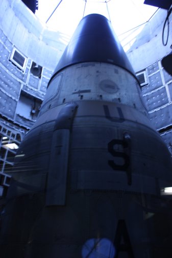
The "cover" of the silo is now made out of glass so we can see the missile and so the Russians can see it from space and confirm it is not a "real" missile. All part of the old SALT II treaty between the US and Russia (the USSR back then).
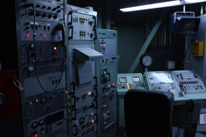
Very little to see above ground. Everything is below ground to protect it from nuclear attack.
Let's go underground!
After security checkpoints, back then, we are in the control room of the Titan II missile.
Our guide made us feel like we were the crew of this silo. Notice to the right of him the big springs, the whole room is suspended by springs to absorb the shock from an attack by nuclear bombs. WOW!
The electronics may look old, but remember this was the 1980s.
Here it is!
Titan II missiles were used between 1963 and 1987.
What a tour, it is worth the trip to see this. Especially for those of us who did take part of the Cold War in NATO, but also for the new generation to learn why we did what we did back
Personal note here: In a way, I liked it better when we had the Cold War. We knew who the enemies was and most of the time both sides played by the "rules". Today with the terrorists, who is the "enemy"? What "rules' are being followed?
I want to make this clear, I do not put Muslim in the same pot as terrorist. Before we point finger maybe we should look back at what Christianity did in the past!
Only my personal opinion!
(If I upset anybody, tough!)
Wednesday March 7, 2012
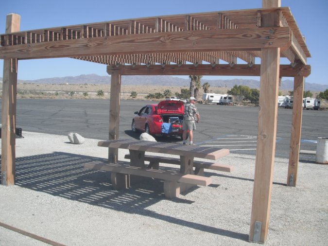
Our time in Tucson is over, we are leaving tomorrow morning.
Today, we "replenish" with food and stuff.
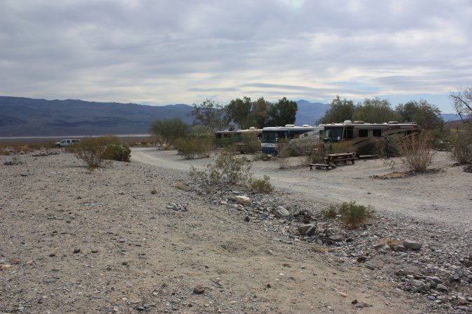
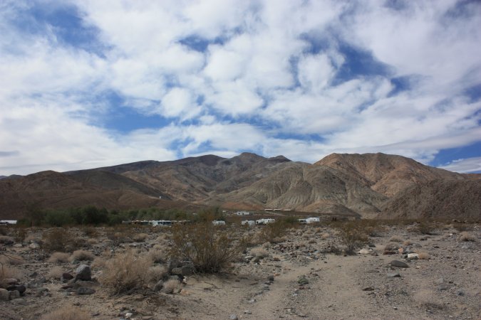
A last look at all those beautiful sights!
Our stay in Tucson was under a beautiful blue sky and warm weather. That was very good!
Thursday March 8, 2012
Leaving Tuscon today!
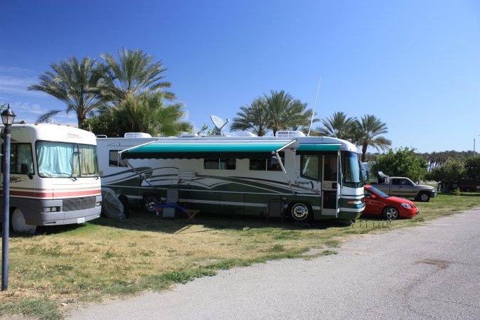
Here is our site. Notice that we have no grass, water is very rare and very expensive. Still very nice.
Very good warning on the way out of the campground.
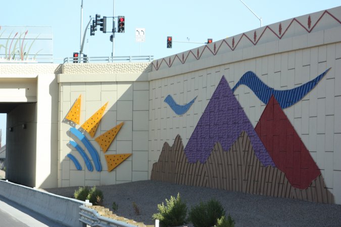
In many southern states, they have "stuff" on the walls of bridges and the like. Very nice and it makes the driving a little more interesting.
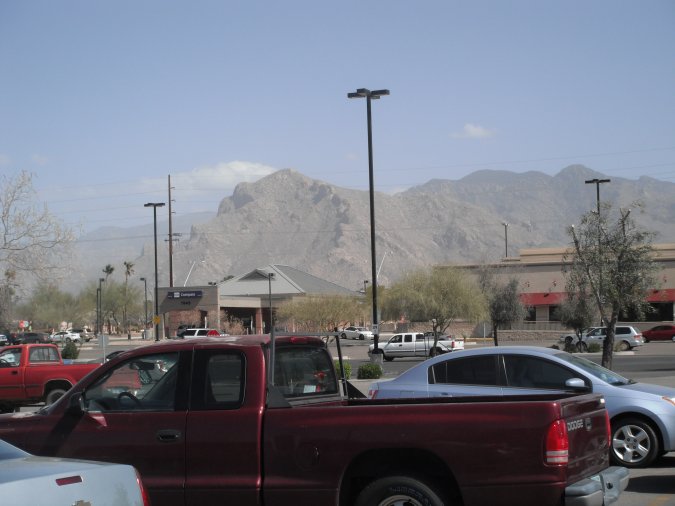
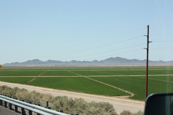
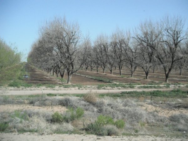
On our way to the Salton Sea in California. Some of the sights, on our way there.
The closer we get to California the more agriculture we see.
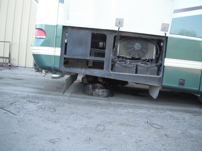
The motorhome is not running right, whenever there is a demand for fuel, the engine hesitates.
I stopped and checked all the fluids, nothing is low and everything looks good. Back on the road and it gets worse as the time goes on.
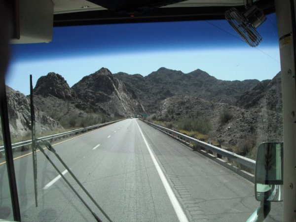
We have to get over some mountains and let me tell you that it is pretty steep.
The motorhome is really acting up, I can only get to 45 km/h when I could have easily gone up at 80 km/h.
The engine is hesitating all the way up. This is not good!
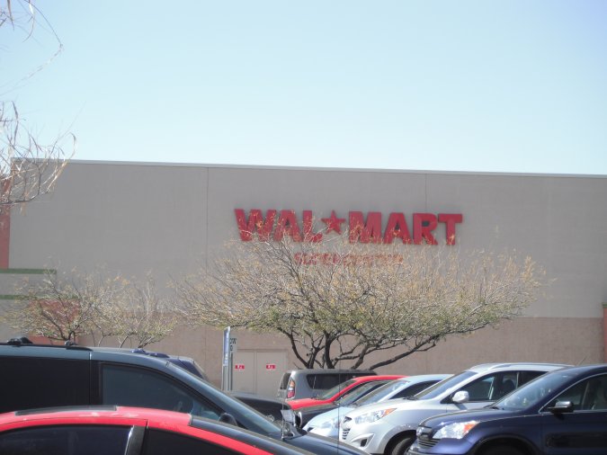
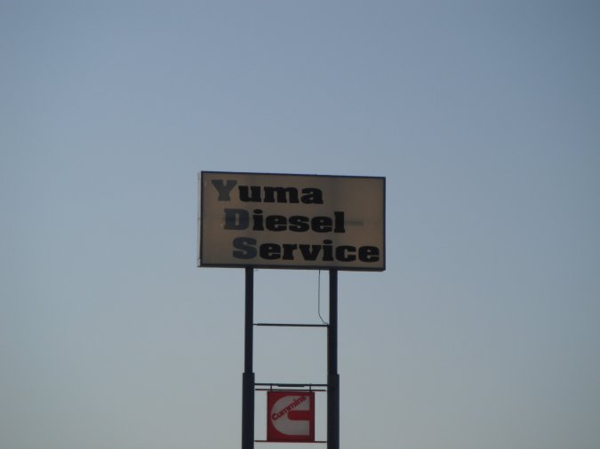
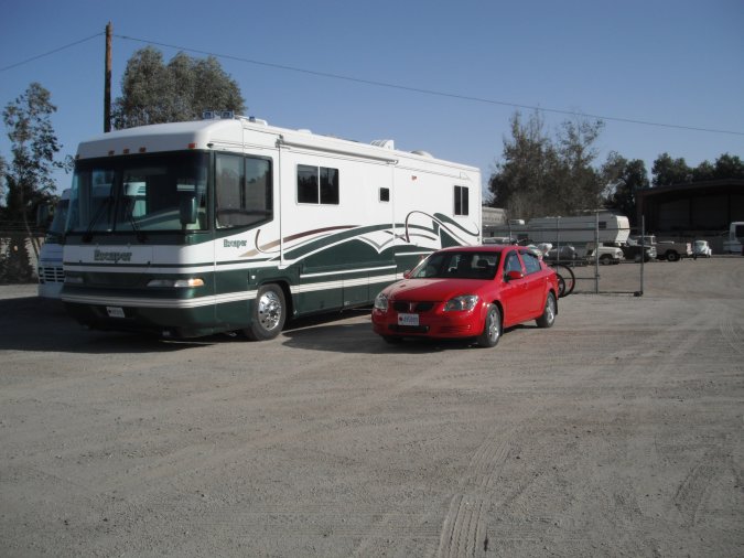
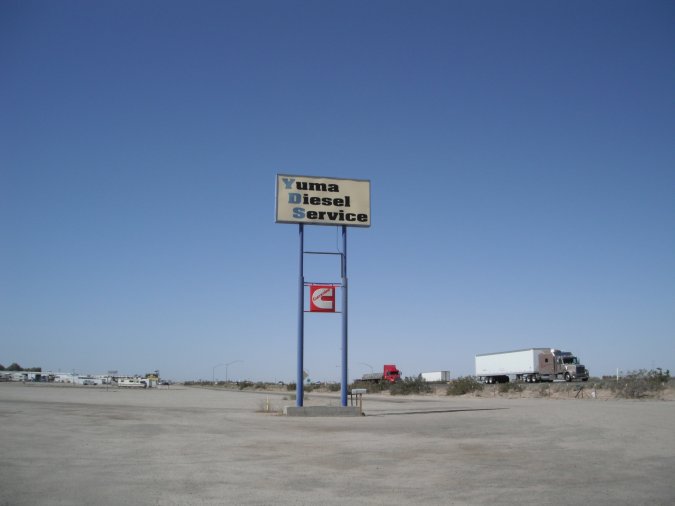
The next city is Yuma. We stop at Walmart and left the motorhome there to look for a place that can fix our motorhome. The first one can only take the motorhome on Monday, we still book an appointment. The second place is Yuma Diesel Service and they can take us tomorrow morning. We cancel the one for Monday. We spend the night at the Yuma Diesel Service yard.
We are right next to the highway with trucks going by 24/7 and a railroad right behind us, the motorhome actually vibrates when a train goes by. It does not matter at this time...
We can already hear the $$$ leaving us!
Friday March 9, 2012
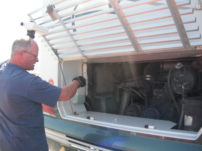
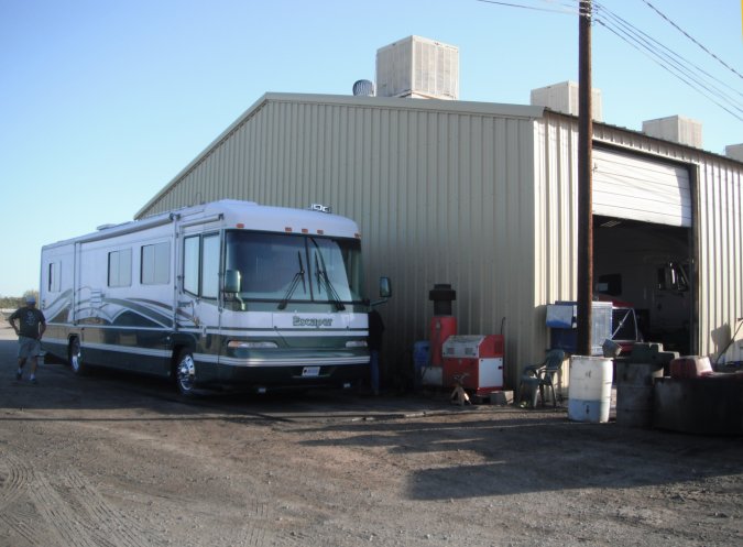
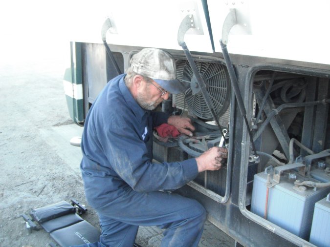
Got up early to be ready for the 8 am appointment, here we are in the "wash-bay".
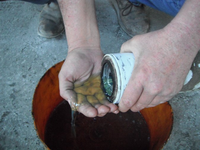
Mike the mechanic is working on our motorhome. After talking about the symptoms we experienced, it was concluded that the fuel filters that were probably blocked. The motorhome was also due for an oil change so that will be done at the same time.
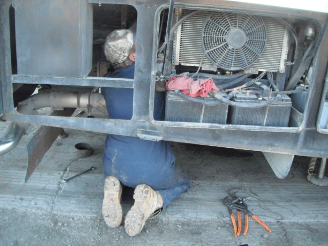
To be able to change one of the fuel filter, Mike has to take out the air filter and disconnect the starter.
No way I am going to let a dirty mechanic (no offense) working from inside the motorhome.
So I ended up giving him a hand from the inside.
The filter closest to the fuel pump is clean, but it is still changed just in case.
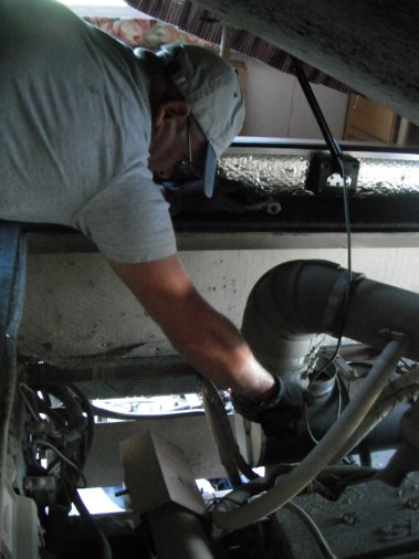
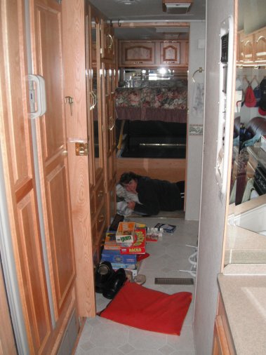
Michèle taking a break from all the work going on around her. Notice all the stuff from under the bed laying around.
No photo of the fuel filter right after the fuel tank, but let me tell you it was full of dirt and stuff. This is more than likely the problem.
We must have got some dirty fuel at one of our last fuel stop.
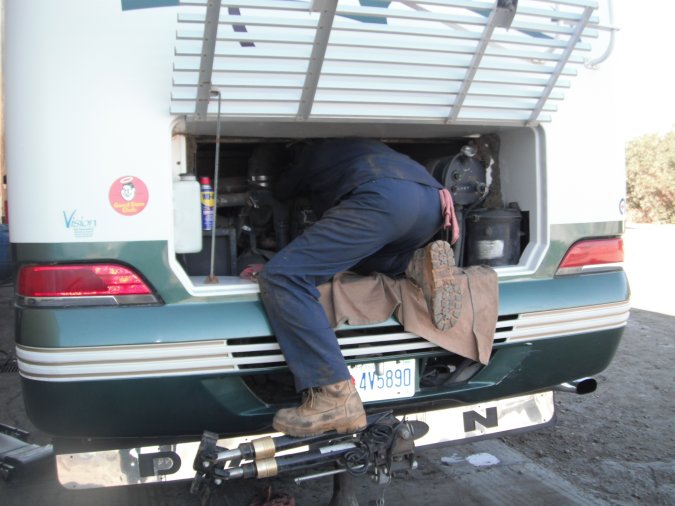
Mike working very hard.
In less than three hour, we are out of there at a cost of $360.00 including the oil change and fuel filters, Wow!
Back on the road with no problems.
I recommend Yuma Diesel Service if you ever need work to be done on your motorhome. They may not be the fancy place, but they get the work done.
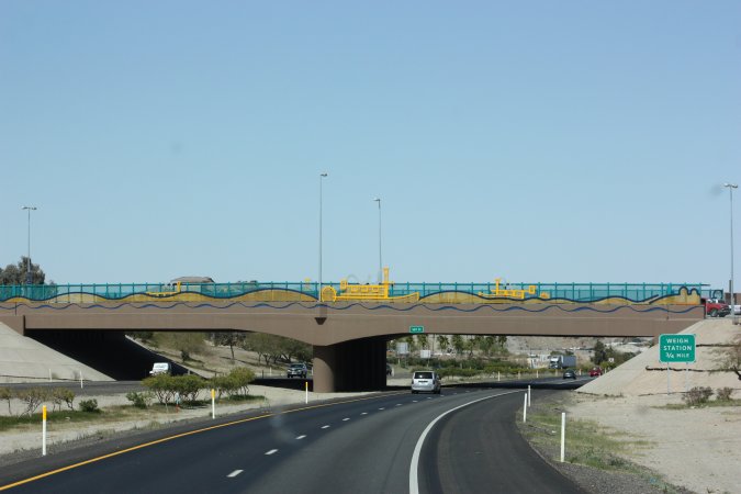
More art to decorate the bridge.
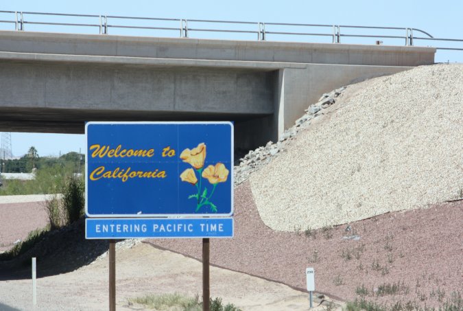
California, here we come!
Funny advertising.
Agricultural inspection! We have to stop and a lady came inside to look for any type of citrus produce we could have. She left with 4 oranges that were bought outside California. She gave us a paper saying we were inspected, in 10 minutes we were out of there.
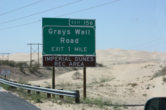
Shortly after we came across the Dunes. A place where you can ride you ATV or other sand type of vehicle on the dunes.
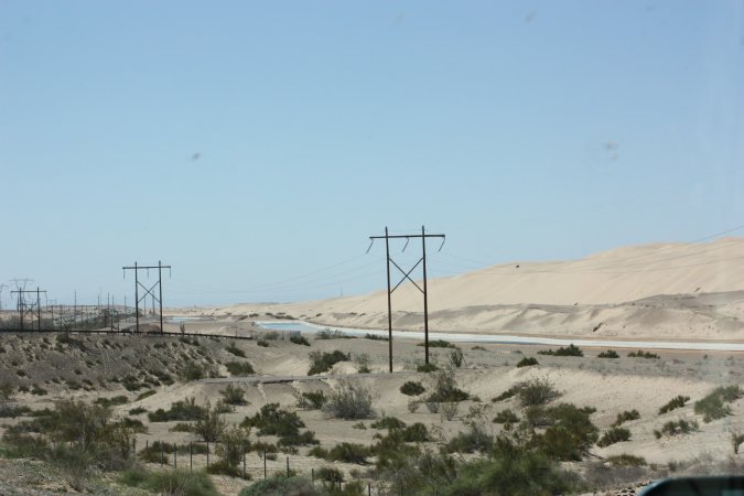
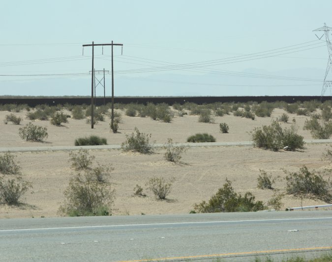
The black line you see is actually a barrier (fence) between the US and Mexico. So far, the US has built over 1126 km (700 miles) of barrier between the two country.
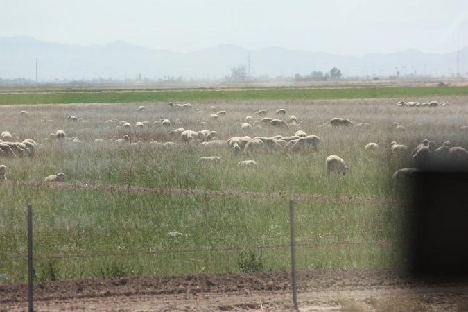
Agriculture is present everywhere.
Gasoline goes up in California, $4.356 per gallons equal $1.15 per liters.
Welcome to California!
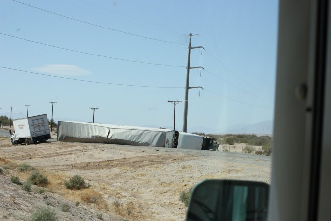
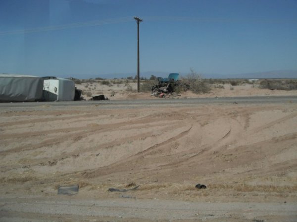
A big accident on the way to Salton Sea. Can you see the small pickup truck on the right photo? Outch!
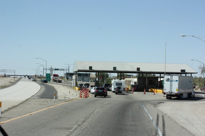
Another stop, this time a border patrol station looking for illegal aliens. We make it to the other side no problems.
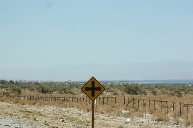
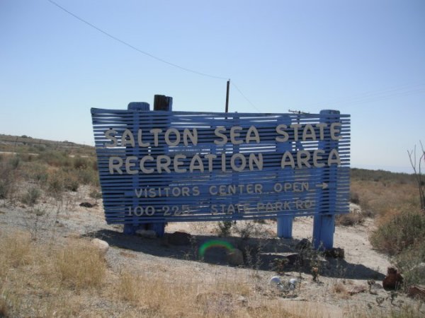
We are getting closer to the Salton Sea, we can see it on the right. Have you ever seen a road sign like this one?
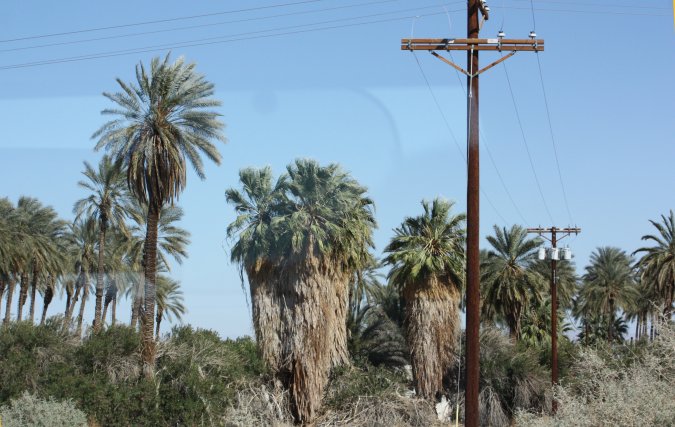
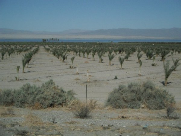
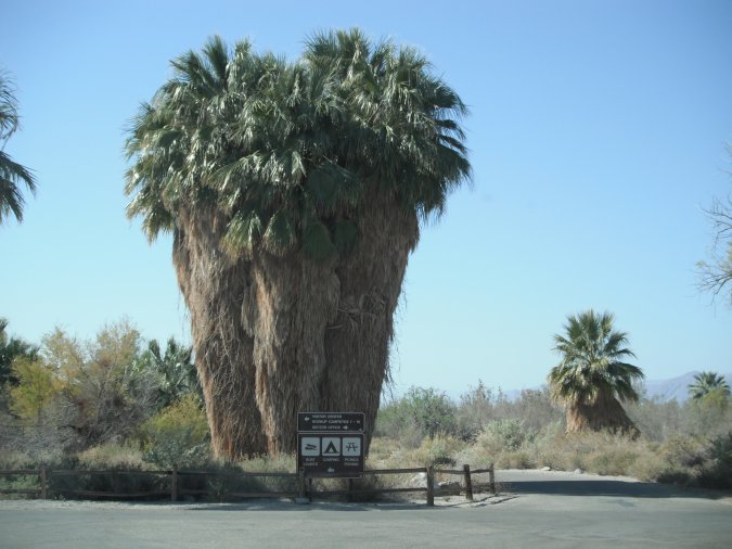
Oh my God! The palm trees have fur!
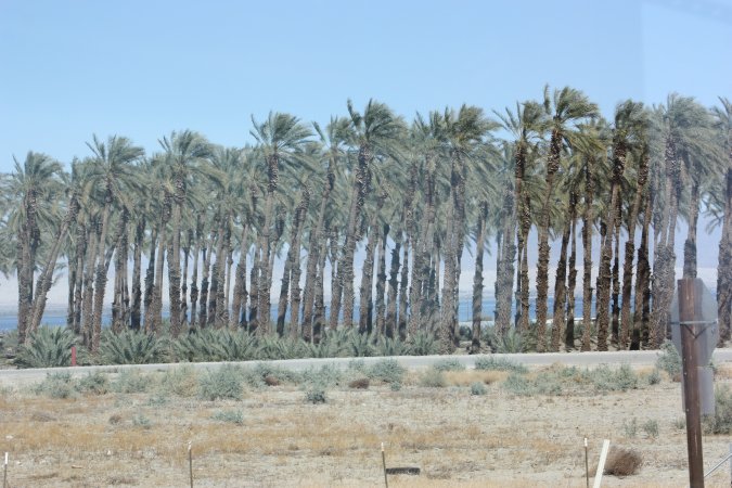
Some Date-Palm.
We make it no problems, the motorhome is working perfectly. The fuel filter was the problem!
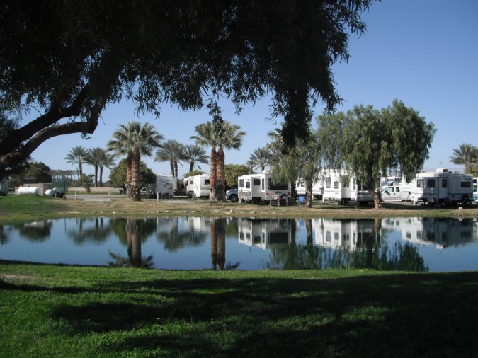
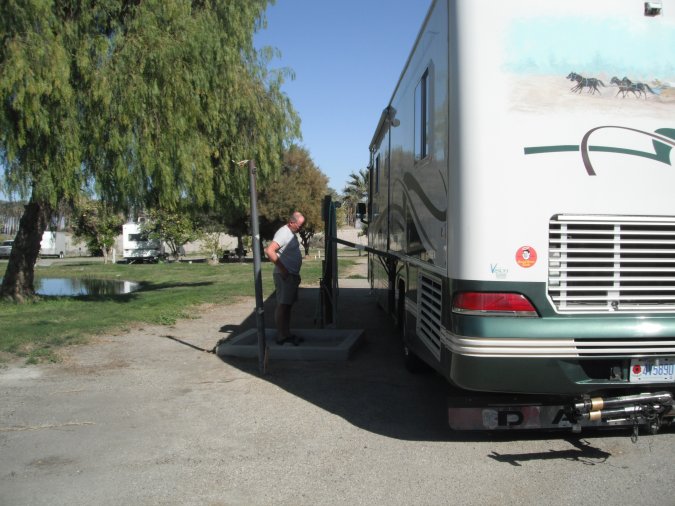
Here we are at Oasis Palm RV Park.
Because we have Passport America membership, we only pay $11.00 per night for a site with water and electricity! WOW!
We have no problems with 4 nights without sewers, our tanks are big enough, but first, I have to empty them to make sure.
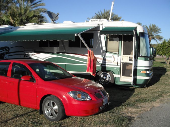
Our new home.
A very nice campground with heated pool, free WIFI.
Only a little too close to the highway with the trucks 24/7!
Saturday March 10, 2012
I find those palm tree so funny with all the fur! Actually dead leaves still attached.
The Salton Sea is 69 Meters (226 feet) below sea level.
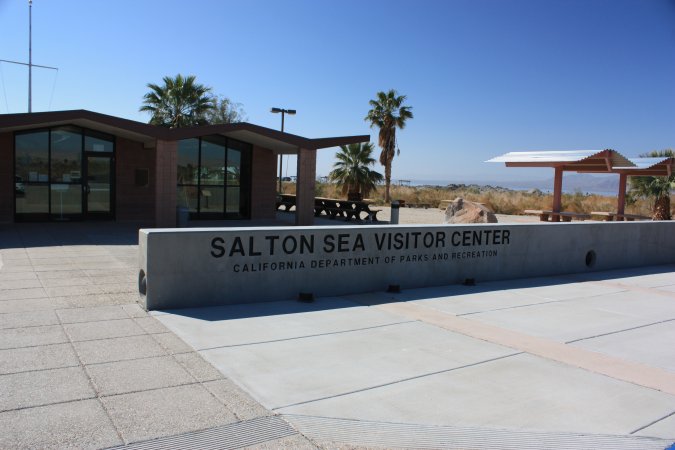
A very nice information center at the state park. On top of that it is manned by Canadians from Calgary, small world!
We got lots of information and also learned that tomorrow they have a free kayak tour on the Salton sea. We got our name on the waiting list.
With all the info from the center we continue down on the east side of the Salton sea.
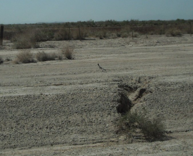
Got our first Roadrunner!
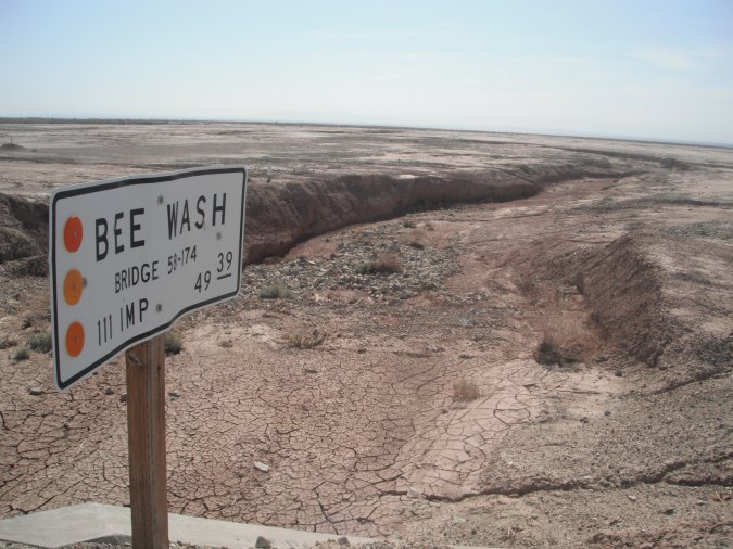
Some of those wash can be pretty deep and wide, we would not like to be near when they are flooded.
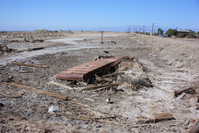
The region around the Salton sea was the place to be for the summer from the 1920 until the late 70s. At that time two storms/tornadoes hit the area back to back, on top of that the water level of the sea was starting to fluctuate and the salt contain was going up. All these thing hit hard and nobody wanted to re-invest in the infrastructures. The area never recovered.
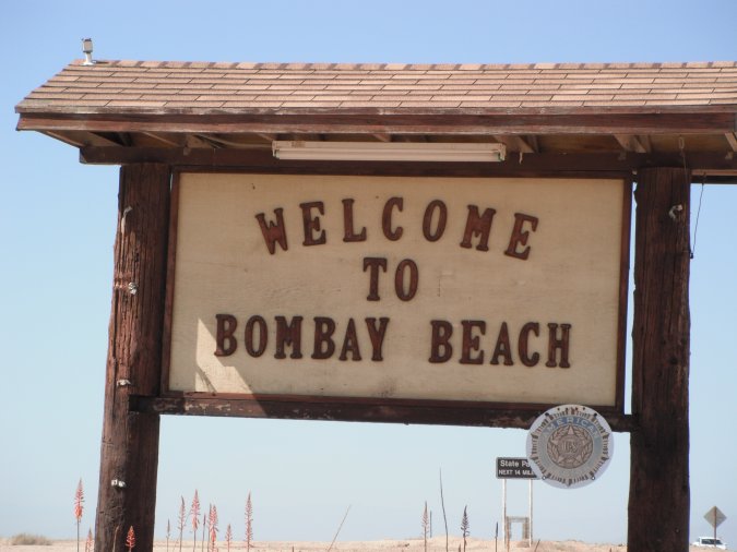
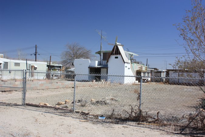
Here in Bombay Beach you can still see some of the damage done over the years.
The little town is now protected by a man-made berm, here is the un-protected side.
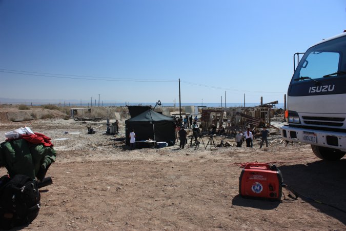
Something was being film here. After talking to someone we found that the show "Extreme Chef" from the Food network was being film today. We could not get closer!
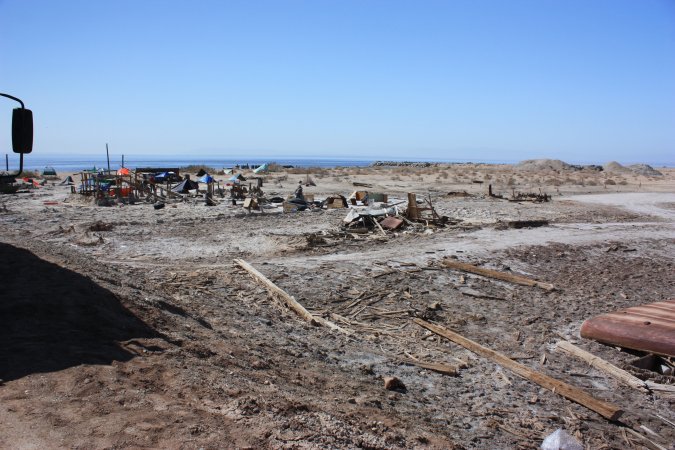
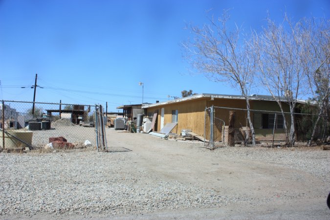
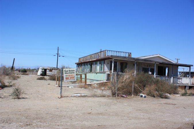
Some more photos of Bombay Beach...
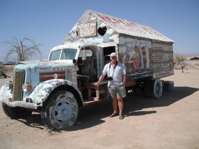
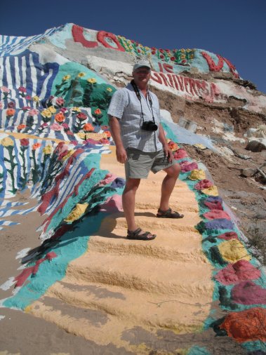
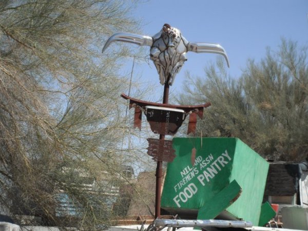
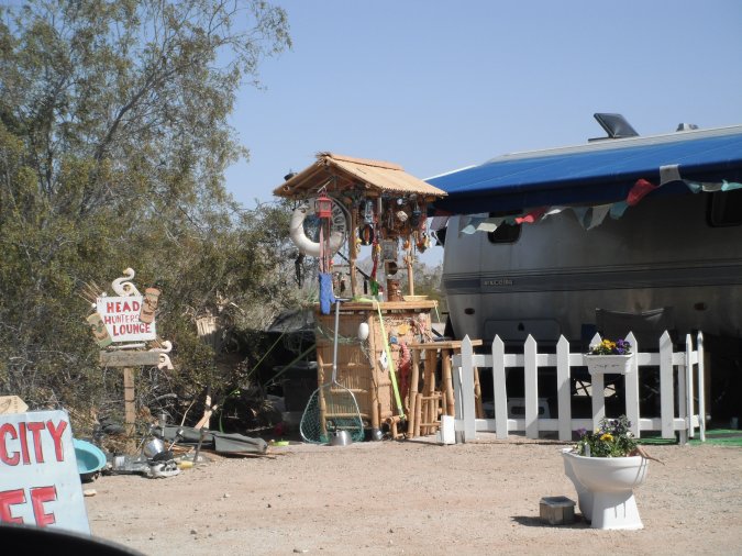
Still traveling south, we came to the village of Niland.
To the east there are two places I wanted to visit once in my life.
The first is Salvation Mountain.
Salvation Mountain is the dream of Leonard Knight who at the age of 35 "found" God. In 1984, now 62 years old, he arrives in Slab City. Wanting to share his love for God, he started to paint a small hill with messages. For the next 27 years, he worked at it. Only working with was given to him, mostly paint and other small stuff, he worked hard at it.
Sadly in 2011 he had to stop because of health problems at the age of 80 years old.
Today a group of people is looking for a way to preserve this "Folk" art for future generation.
If you ever come to Salvation Mountain, do not expect a Walt Disney kind of place. It is very small, but so big for one man to build this out of love for God.
I really like this place.
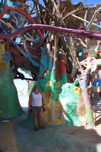
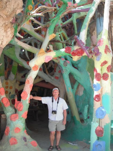
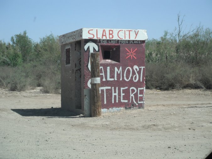
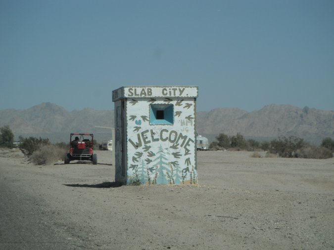
A few hundred meters down the road, we are coming up to the second place, I always wanted to visit.
Slab City. Here is another web site.
So what is Slab City?
Slab City started out as a Marine Training base in the second World War. At the end of the war, the base was closed down and all the building were removed leaving behind only the slabs they were built on. Not long after that, people started to come here for the winter. Over the years a permanent population of 120 settled in and comes the winter the population grows to over 1000.
Don't forget, there are no services here. No water, sewer or electricity. You have to be self-contained. A few clubs actually come here for the winter.
If we ever come back this way we will come to Slab City and stay for a while. Pretty neat place.
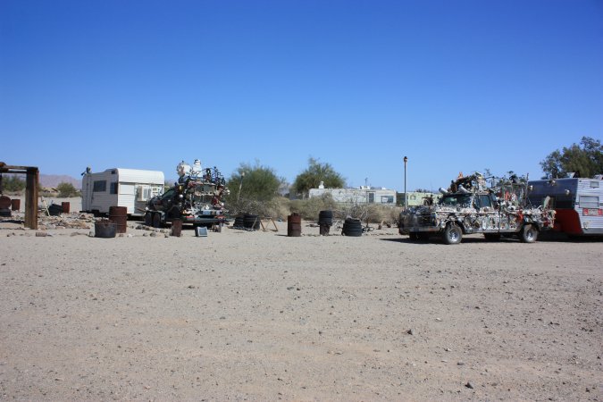
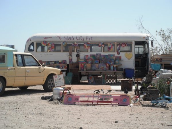
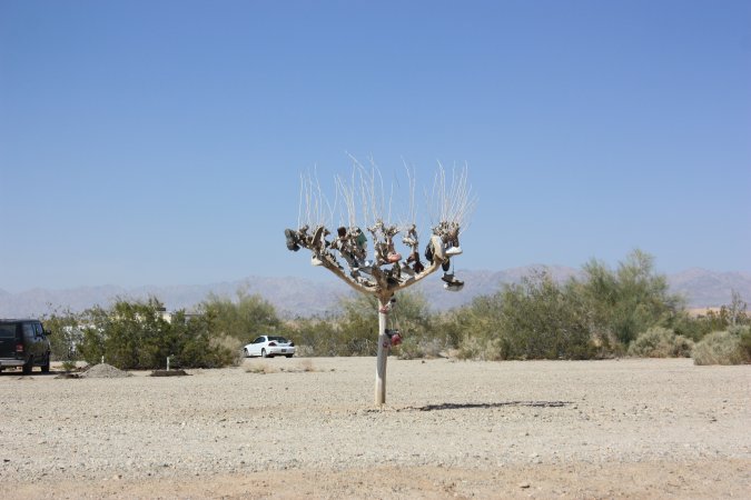
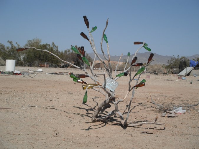
Some photos of the places...
The photos do not even show you half the place. It is actually a very safe place to be.
Sunday March 11, 2012
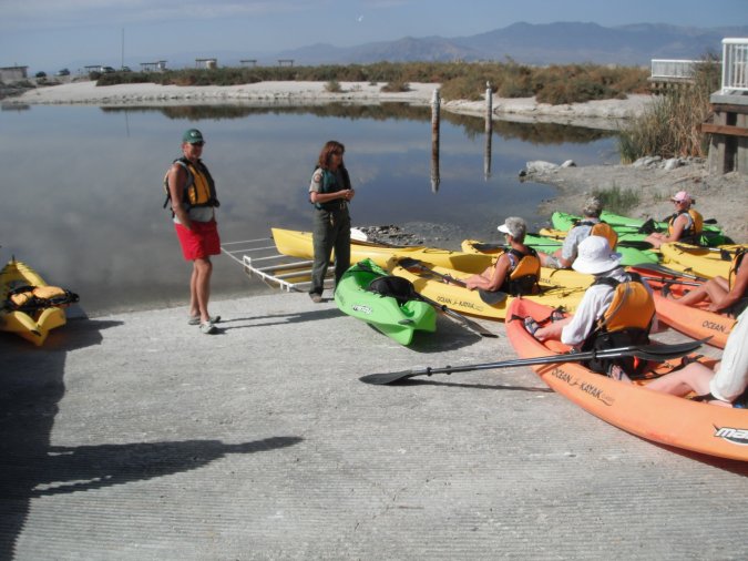
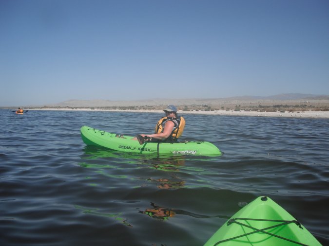
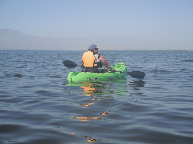
We hope to go kayaking today.
Here we are at the information center at the Salton sea park, waiting to find out if we can go!
Two persons did not show up, we are in!
Some instructions before we leave.
Once launched, we have to wait for the others.
Here we go!
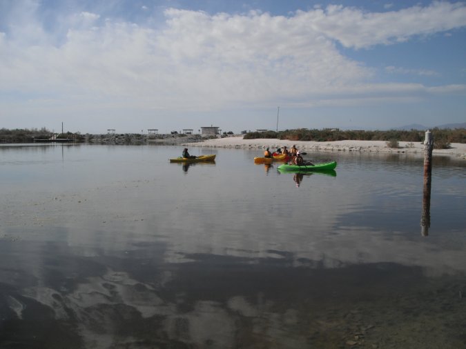
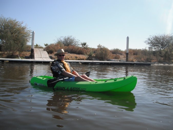
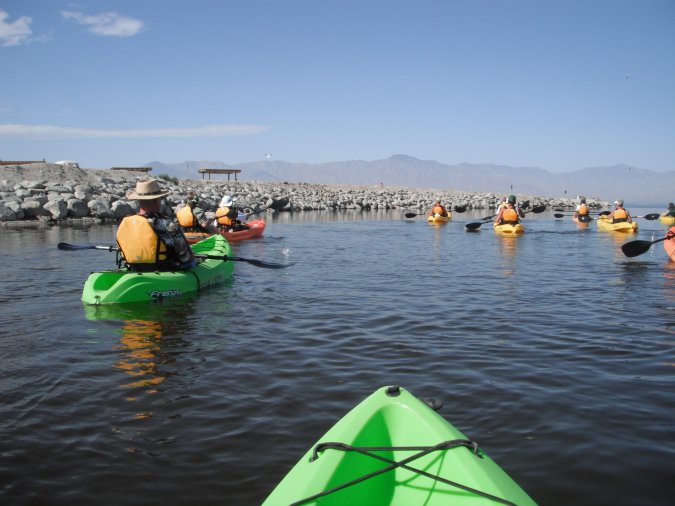
Beautiful day without a cloud, hardly any wave, we head south into the light wind.
Lots of fun and free on top of that. We were on the water for about 1 hour 10 minutes.
After the kayak, lunch!
After this, we are going back home to do some pool time.
A beautiful day!
Monday March 12, 2012
A day of rest today.
Tomorrow morning, we will be heading to Death Valley National Park.
Some photos of our campground.
Our site, a little tight, but still OK because our neighbor is gone.
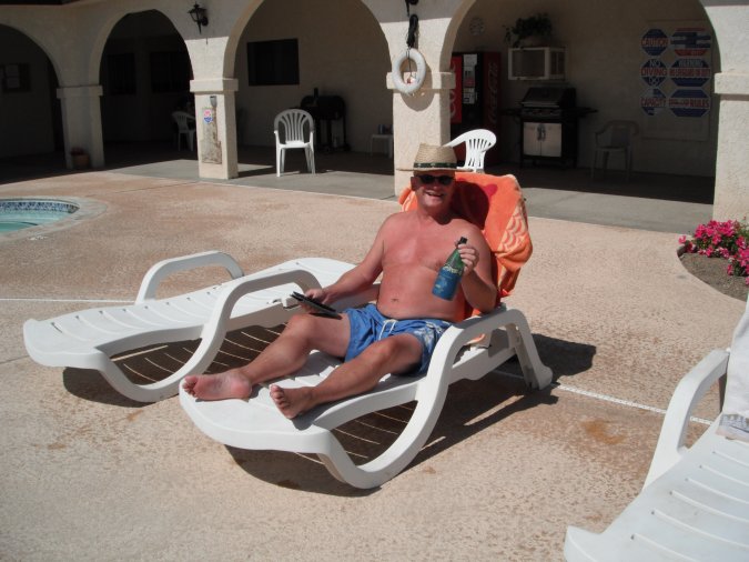
Beach Boy?
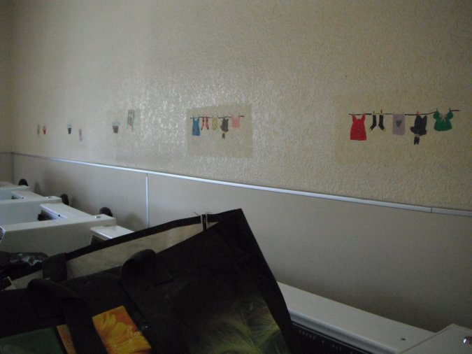
Cute little painting in the laundry room.
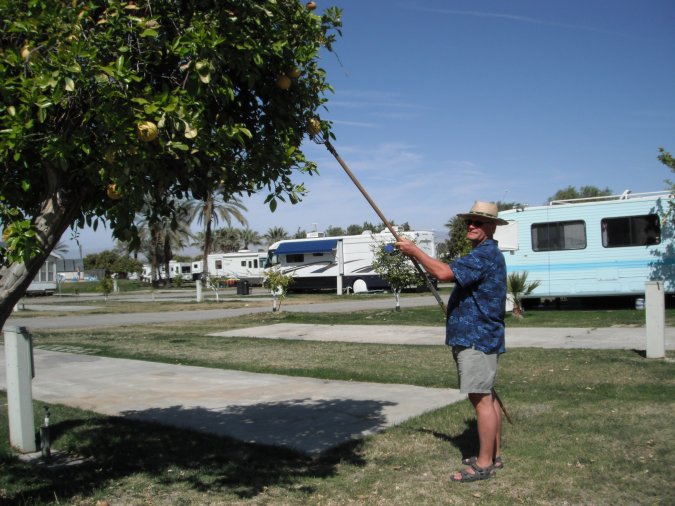
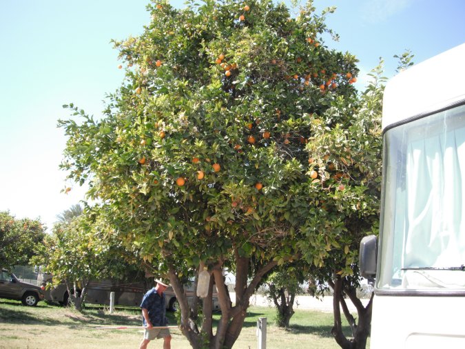
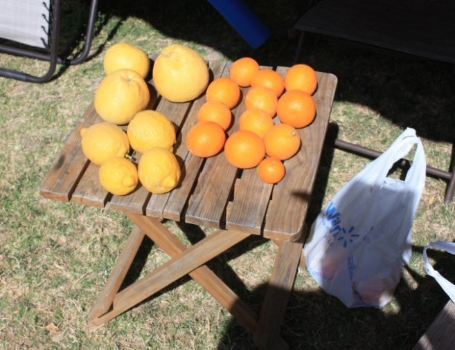
The campground is full of fruit trees, oranges, citrus and grapefruits.
Harvest time!
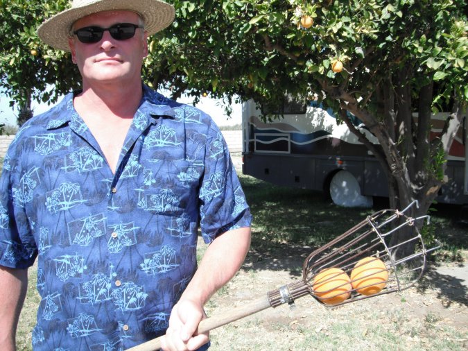
All of the fruits are ready for picking. Our harvest in 15 minutes, and we picked only the best.
They are the best tasting fruit we ever had. Not like the ones you buy at the store.
We get ready for our departure tomorrow morning. After that we head to the pool one last time.
Tuesday March 13, 2012
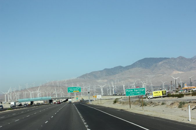
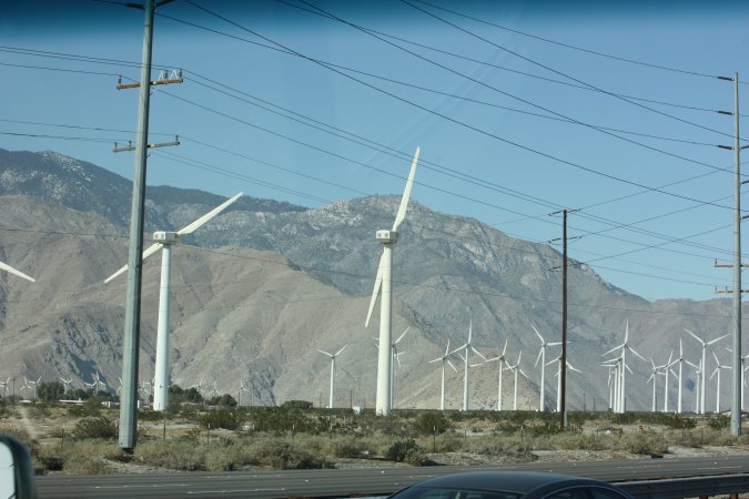
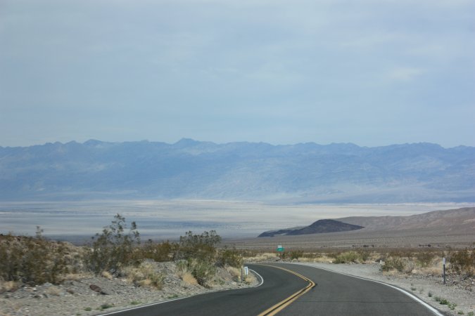
Heading to Death Valley. On our way there, we will go a little higher than 1524 meters (5000 feet) and finish close to sea level.
Lots of wind turbines in California. Big ones and little ones.
In the distance we see a sand storm and we will go thought it.
30 minutes later and it is over. Down in the valley you can see solar panels.
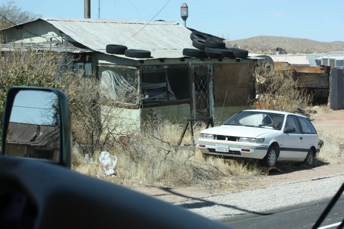
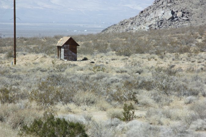
Unbelievable the numbers of small villages that are simply abandoned. I do not recall ever seen this in Canada!
House is gone, but the shit house is still there!
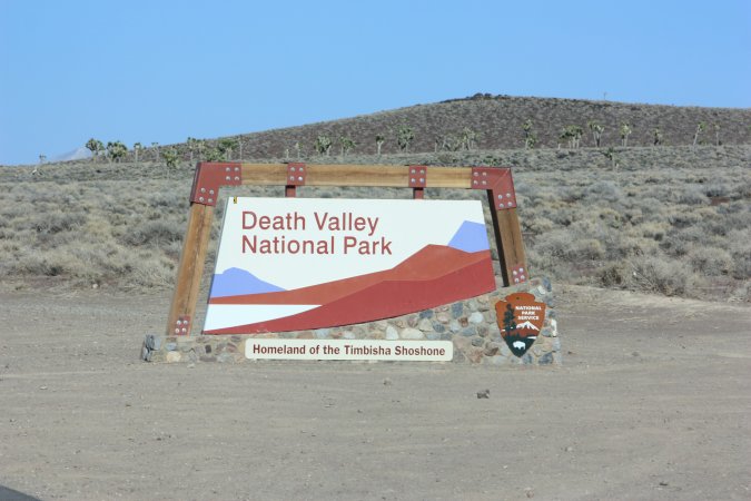
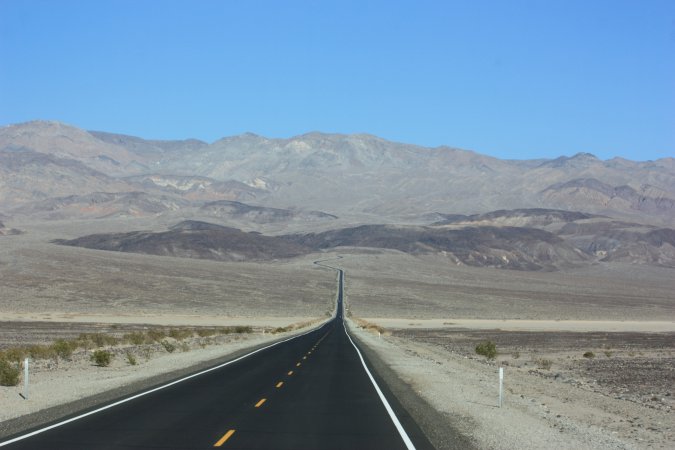
Finally in Death Valley!
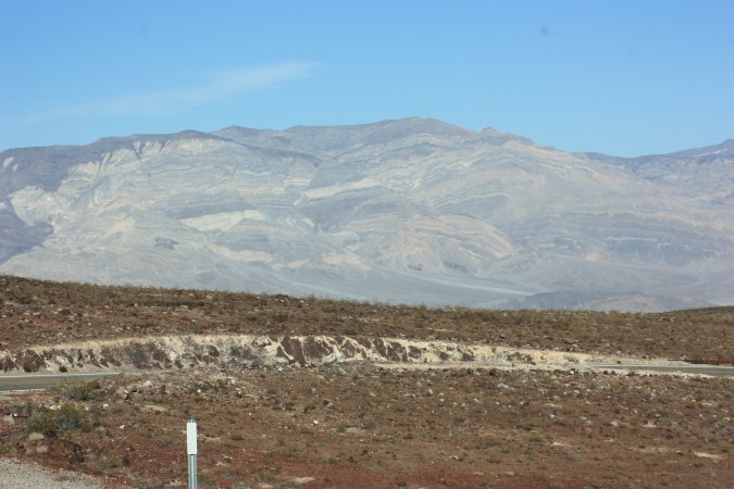
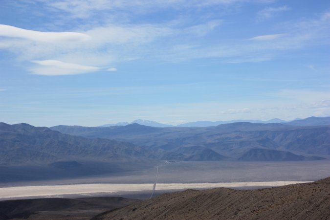
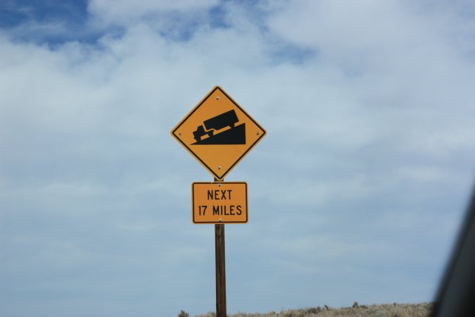
Now we have to go down from 1220 meters (4000 feet) to about 304 meters (1000 feet) in less than 18 km (11 Miles).
Can you see the road?
Even the big transport trucks are not allowed to use this road! Beautiful road, just very steep!
We have to get to the bottom of the valley.
Once at the bottom, we have to go back up to 1220 meters and back down to sea level.
We turn around to go to the last campground we saw a few kilometers back.
Right now, we are very tired from the last 100 km and more photos of the campground soon!
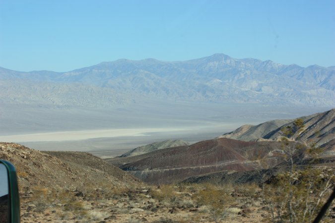
Wednesday March 14, 2012
Our campsite is right next to the road. We are at Panamint Springs Resort in Death Valley and it only cost $15.00 per night without services. Luckily this road is not very busy this time of year.
It is actually very quiet. Total silence!
Some more photos of the campground and the view we have. We are at 587 m (1925 feet) above sea level.
As you can see, no grass here! Only rocks, sands and small brushes. This is dessert country.
The sand dunes we see in the distance are about 13 km away from the campground.
As you can see, the first people that came here were not very protective of nature. A view below the soil.
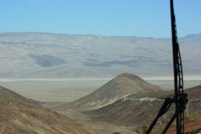
No strenuous things on our plate today, only a car ride to Aguereberry Point.
To get there, we have to drive over the Towne Pass at 1511 m (4956 feet), but first we check out the road we took to get here.
On the photo on the right, you can see the Panamint Valley, the road we took and at the far end of the road, our campground.
Once at the top of the Towne Pass, we are heading down towards the Death Valley floor. It is really going down...
But before we get to the bottom of the valley, we turn off on to a gravel road towards Aguereberry Point.
And up we go again, this time with lots of dust.
At the top we are at 1961 m above sea level.
From here we have a breathtaking view of Death Valley.
Just to see all of the valley is worth the trip on that dirt road. I highly recommend the Aguereberry Point.
Back in the Panamint Valley, some more photos.
To a great day, a great end, a campfire. Wood is very expensive here so we use one of our "chemical" log.
A beautiful day in this desert place. The nights are cool, but the silence is golden.
Thursday March 15, 2012
A big day ahead of us. To see everything we want, we will have to travel more the 300 km.
Here in Death Valley everything is far apart.
We start with Scotty's Castle, which is at 120 km from here . To get there we go over Towne Pass (1511 m) and than down to Death Valley at - 27 m to get back up to 914 m at the castle.
Here we are at the castle. Quite a story about this castle..
The story of a man, his adventure, excentricity, and cunning...
The story goes like this... (a short version) Walter Scott was successful a "taking" money from investors for a gold mine in Death Valley. One of the investor was Albert Johnson, Johnson wanted to go and see the mine (which did not exist). Scotty (Walter Scott) told him all kinds of stories and lies, but Albert saw through all the lies and still made friends with Scotty. Albert really love the area and decided to build this house as a summer home and Scotty could live there. Not long after the completion of the "castle", people started to stop and wanted to visit the castle. Albert gave Scotty the permission to give guided tour, but he could not mentioned the Johnson in any of the tour. It did not take long for Scotty to invent all kinds of stories related to the castle and the area around the castle. Over time it became known as Scotty's Castle. Now the castle belongs to the National Parks and they are having a hard time to differentiate between some of the lies and the truth.
Our guide, Kevin.
The inside is very simple, but at the same time very classy. Don't forget, we are in 1922 and they even had a fridge...
Behind this wall, you have an automated music box, a big music box! Nobody can play this instrument...
In the center of the photo, you have this piece of metal that look like a butterfly. It covers a hole in the wall and when bad people are at the door and window, you shoot in the hole and the shot will split in two and kills the bad people at both place, the door and the window. Pretty smart (if it works!).
A very well-done tour by the park employees and what a story!
Not too far from the castle is the Ubehebe crater. Let's go and see that.
A few hundred years ago a hot lava flow hit a natural spring and exploded. This is the result!
A crater that is 182 m deep and about 750 m wide.
Just spectacular!
Back on the road for another 120 km to Badwater.
From 914 m to sea level and than 100 feet below sea level...
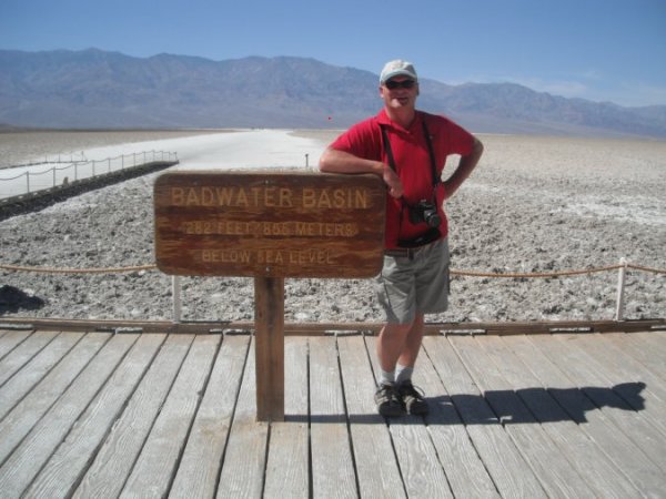
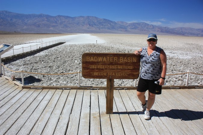
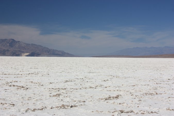
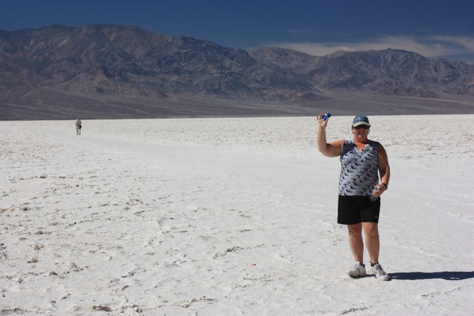
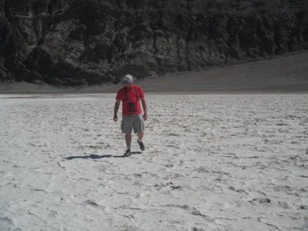
In Badwater, a nice +32 C. Badwater is the lowest point on the continent.
At 85.5 m below sea level, WOW!
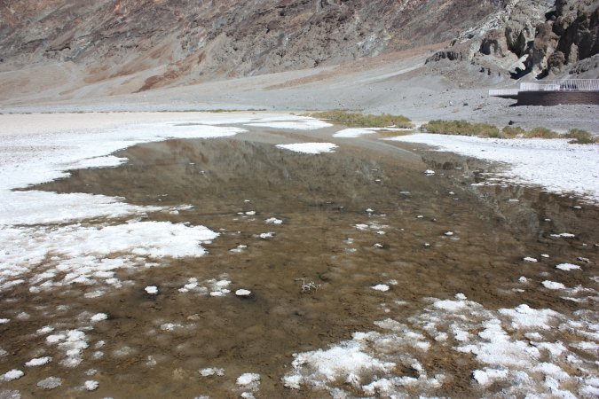
Sometimes after heavy rain, water will actually pool in Badwater.
Can you see the little red line in the rocks? This is sea level!
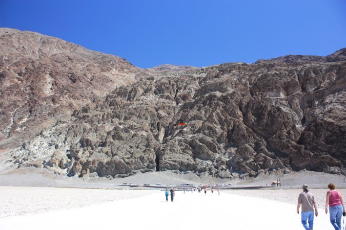
It is salt, I tasted it and it is really salt! To get to the other side you have to hike 8 km.
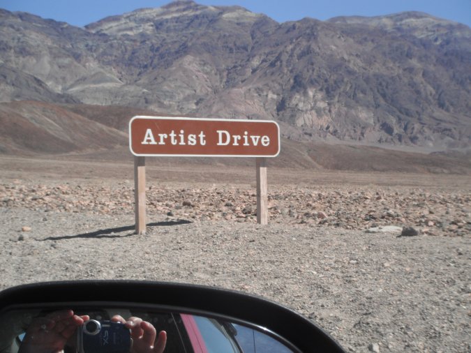
On our way back from Badwater, we stop at the "Artist Drive". A 15 km loop where you drive through multi-hued volcanic and sedimentary hills. Just like an artist's Palette. The photos do not give you the true colors because of the light.
And we continue to the Golden Canyon where a short hike of 3.2 km will take us through twisting narrows and colourful rock formation to red Cathedral.
A pretty special place. On the right photo, you can see some ripples on the rocks. They come from a sea many, many years ago and they got covered by silt. This is why we can see them today. Amazing!
At the end of the canyon, we come to the Red Cathedral!
This looks like salt, but it is borax and it does not taste good!
After all that, I am hungry for a good sandwich.
WOW, what a bicycle, the back crank was modified so the kid could pedal.
In Mesquite Flat, the sand dunes are about 30 m high.
Another beautiful scene from the dessert.
I have to empty my gray water tank because of a leak at the bottom. You cannot leave "dirty" water drain on the ground in California, specially in a national park. And they are right. Not being able to fix it here, I have two choices, first to pack the motorhome and drive to the dump station or dump in a bucket and make many trips to the washroom.
I take option two, nine trips later I am done. Good for a few more days.
What a busy day, full of so many beautiful sights.
Until next time.
Life is good...
If you think you have missed an update, just click on the "2012", "2011" or "2010" tab at the top of the page and pick the month you want to read.
  © COPYRIGHT 2012 ALL RIGHTS RESERVED MICHELE-DENIS.COM |
 |