
Home
Archives Français
December 1 to June 3, 2006 June 4 to 11, 2006 June 12 to 18, 2006 June 19 to 23, 2006
Late morning, it was raining, only +10. Forecast for the day, rain and +10. No hiking or biking today. Good time to visit museums.
I went to the info center of the town...
OK, it opens at 1 pm.
I went to the Wood Buffalo info center...
Opens at 1 pm.
I went to the Northern Life museum...
It does not even open today...
It was 11 am... I went and filled up.
Not too expensive, $1.239, I take $120.00 for 97 liters.
So far, I have driven 1953 km, burnt 501 liters of gas for $501.00. The average I paid for gas was $1.16 per liter. My average is 27 L / 100 Km. Not bad.
Back at the info center, it was 1:15 pm. It was not open...
So I went to the Wood Buffalo info center.
They were open.
Small, but super well done and they even had a video on the park. The 2 employees were well informed and resourceful. They suggested I go to Salt River Day Use Area and check out the trails. I can go on to the Pine Lake campground. I was not sure if I would go to Pine Lake as it was another 60 km on gravel roads... If it is not raining, I may go.
OK, I returned to the info center for the town.
Nobody there... I guess, Sunday you only have to show up if you want to...
As I was driving around town looking for an Internet connection (WarDriving) I found only one. I only had time to upload my blog. Did not get to send an e-mail and the connection was broken!!!
What do I think of Fort Smith?
A contradiction of a town. Lots of very nice homes, a few not so nice, 1 out of 3 had a scrapyard in their front yard (even the nice ones) from the last 20 years. Lots of commercial buildings were boarded up, other stores were in private houses, like Radio Shack, Saan, etc.
I went to the Truck Wash, which was outside, and removed 50 lbs of mud...
Now I could see through my back window.
I checked out the price of milk and 4 liters of 2% cost $5.36. Not so bad compare to Cold Lake.
Back at the campground at 4 pm, supper and update to the blog.
When I woke up... It was raining!
I left for Pine Lake, about 60 km away (south-west of Fort Smith). I was back in Alberta right after I left Fort Smith. Here we go, gravel road for the next 55 km.
My first stop was at Salt River, where there was a trail system. I did the Karstland Trail first, a long 750m.
A nice little trail with some information panels explaining the formation of Karst. Really interesting. The Karst also creates caves. In the caves, the Red-sided Garter Snake spends the winter. This is as far north as any reptiles live.
Guess what? It rains...
Next, I did the Salt River Meadows trail. Pretty, lots of birds. Sadly, no bison, but lots of tracks.
I cannot help it, "Do bear shit in the woods?" Well! I have the answer! NO! They shit on the trails, so do the bison.
And you know what?
Animals have a sense of humor!
A fox had a shit on top of a bison poop.
What did he mean by that?
OK, OK, enough of my very interesting observation of the animal kingdom.
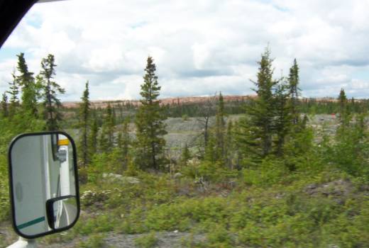
On the next trail, I could see rocks sitting in the middle of... Nothing. It was a kind of moonscape. Those rocks were left behind from the last Ice Age.
Me and my "Bear Bell".
Back on the road towards Pine Lake. 36 campsites, and I had the choice, I was the only one here. It was nice, $14, no services or showers.
Pine Lake is a water-filed "uvala", formed by a series of sinkholes (Karst). This is what gives it its aquamarine waters.
Alright! I took my bike and did the Lakeside Trail... But... I had a flat tire. Lesson for Denis, when you place your bike on the stand, do not place the valve at the bottom because rocks will get to it and break it. I fixed my flat. There was even sand in my tire.
Lesson number 2, remove wheel when traveling because rocks from the road do a wonderful job on the wheel part. I did go to bed a lot smarter tonight.
OK! The trail was 6.4km, not easy on bikes because bison use the trail and "dig" and make all the roots show up. Oh well! In the end, I had a choice to come back the same way or take the road. I took the road. This gave me a little ride of about 16 km.
It was very windy at the site. It allowed me to stay outside because there were no bugs! I even made a fire... It was not raining!
There are some tracks of bison and bears. I sure hope to see one tonight or tomorrow morning.
Speaking of morning, I will be on my way to Hay River for a top-up of fuel and then down to Enterprise and Highway 1 to Kakisa.
Before I am done with Wood Buffalo Park, here are a few bits and pieces...
Wood Buffalo is part of a World Heritage since 1983.
Originally created to protect the bison, later it became a vital part in the recovery of the Whooping Crane.
The Peace-Athabasca Delta, one of the largest freshwater delta in the world.
So many other little things.....A great place!!!
It is now 9 pm. It is raining
I was in Kakisa after 500km.
OK, let go back to this morning.
My wheels got turning at 10 am. A small, 60km stretch of gravel. In Fort Smith, I treated myself to coffee and then on the way to Hay River and Kakisa. Out of Fort Smith, I had another 120km of gravel. And it rained, the road was getting pretty bad, I would even say stressing. Ah! I saw 2 more bisons today.
There were many patches of dirt on the side of the road.
These patches were created by the bison as they roll around to get covered in dirt to protect themselves from bugs.
There was more truck traffic. When I did hit the pavement, a big truck, met me with rocks (lots of rocks) and one broke my windshield. Tabarnak! Oh well! It was bound to happen. I still cannot see through my rear window (mud).
The first stop is Hay River. I filled up, did some laundry and washed the motorhome. I could see through my rear window now. The motorhome must weigh at least 100lbs more just in mud. I left Hay River at around 2:30 pm, direction Kakisa. I was back on highway 1, what a nice road! In Enterprise, there was a sign on the road that stated "Fort Providence is Overflowed"???
What does that mean? We'll see when I get there.
The next stop is McNallie Falls. Nice little falls.
The story of the fall is a special one. The name comes from a Foreman who was working on the construction of the first road (highway1). When he crossed the river on a canoe, he miss judged the current and was taken downstream toward the fall. He managed to get to shore, but not his canoe. His crew named (unofficially) the small creek with its name. Later on, the president of the company officially asked the government to name the creek in honour of McNallie. And they did!
In Kakisa, I found myself a campsite. Nice Park. $15 including showers. Back to the "I find myself a campsite". Another lesson. I always get out and look before I back up in a site. Well, this time it looked OK from inside the motorhome, I backed up... And a tree jumped and hit my cargo carrier.
Good thing, I removed my bike wheel before I left this morning. On the plate for tomorrow, biking the trails around Lady Evelyn Falls. Here is a little price info, 24 cans of beer, $47.89 in Hay River.
Brrr! A little chilly last night, a nice 0 C. Super campsite, you can hear the falls in the background. The washrooms were very clean. The picture was taken at 1130 pm, still daylight.
I did the Lady Evelyn Falls trail. A small 2km. The falls themselves were at the same level as the campground, but the trail took you lower than the falls. The water level in the river was very high and you could not walk on the river's shore. With the rain from the past 5 or 6 days, no wonder. The trail went upstream and came up to a very nice small fall.
The Lady Evelyn Falls are 15 meters high and very nice with the rainbow.
A little further upstream, there was almost another set of falls, only 1 or 2 meters high.
10 am, back on the road, on my way to Kakisa. A very nice looking Native village, nice houses, not poor at all. I have to say that all the Native villages were very clean and not poor looking. On Highway 1 at the junction of highway 1 and 3, there was a barricade that said the highway was closed? No explanation! Oh well! I turned onto highway 3 towards Yellowknife. 21km later I came to the ferry Merv Hardie for the crossing of the MacKenzie. Chocolate, it was a big river...
Out of the ferry, there was a sign that warns us about bison on the highway.
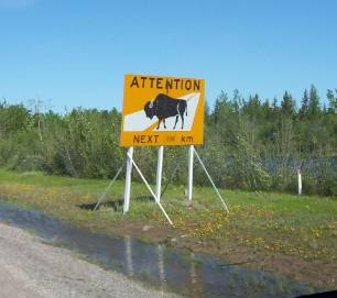
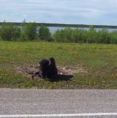
Not even 100 meters and... A bison.
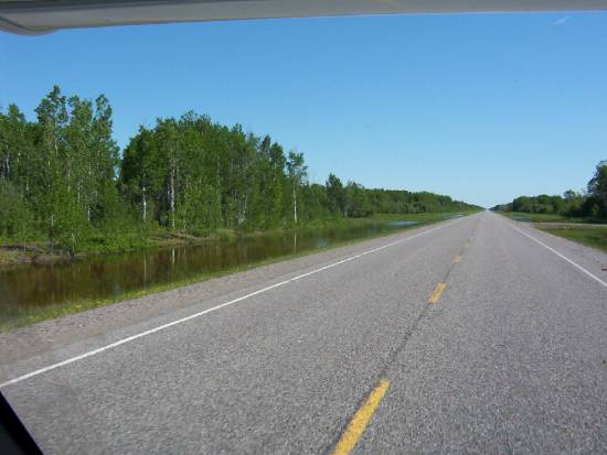
At Fort Providence, I filled up. Onward for 200km towards Yellowknife. Nice road, lots of water in the ditches.
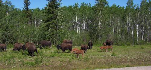
Remember I said it rained. Impressive the number of bison on the highway. Some bulls and some cows with little ones. Sometimes they just crossed the highway just as you get there... Stupid animals!!!
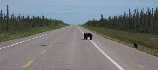
I was thinking, I had not seen any bears since I started my trip. Well, a sow and 2 cubs crossed the road in front of me not 10km later.
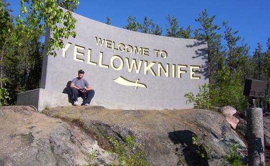
Yellowknife.
I got a campsite for 3 days. Nice campground, but located by the highway and just across the airport, a little noisy. At 5 pm I took off with my bike for the BIG city. I took a trail system end... chocolate... I had to come back because there was so much water and mud. Back on the road, into downtown. I was not visiting anything just checking the hours for the info center and the Prince of Wales museum... Chocolate... The museum was closed until August... Who closes a museum in the summer??? Back at the campground after a little 16km ride. Supper at 8pm and made plans for tomorrow...
I had a good sleep, but... Man, it really did not get dark here! That is why I have a second pillow, I used it to cover my head. 9:30 am and I was on my way to the city. I stopped at the info center. The guy that works there was awesome. I got to connect to the internet and updated my pages again and did some emails. After that I visited the info center, I found it to be very interesting, a lot to see. Even an elevator that was like a small airplane interior, with a TV and they take you for a tour of the Yellowknife/NWT area. Really neat way of presenting the area. By the way, Yellowknife got its name not from the gold, but from an explorer, Samuel Hearne, who, when he saw the Dene with their knives made out of almost pure copper. He called the Natives, Yellowknifes. Now you know the rest of the story...
I left my bike at the info center and took a walk downtown. I came across the "bad side" of town, lots of people, poor ones, sad to say, but mostly natives, drunk by noon. I know it is only a minority, but it sure is visible now! I found a small café with free internet, tomorrow I will treat myself to a good coffee and surfing for a while. I also visited the Diavik Corp. who exploit the Diavik diamond mine. WOW! What a nice info center. The Diavik and 2 other mine will give, in their lifetime (20 Years) about 40 billion $$ worth of diamonds. That is a sh*t load of money! Canada is the 3rd largest producer of diamonds in the world.
Back at the info center I picked up my bike and traveled to the Old Town. Lots of colours, even the garbage cans were painted. Some of the buildings were "kept" in a state of "old" for the tourists. On recommendation from the info center, I decided to have lunch at the Bullock restaurant. A little while back, the Reader's Digest ask/did a survey to find the 10 best places to have a Fish&Chips. This place was one of them. Really cool place, only 5 tables, a counter and about 5 outside tables.
All the walls and ceilings had writing on them from the people who were there before. It gave a style to the place.
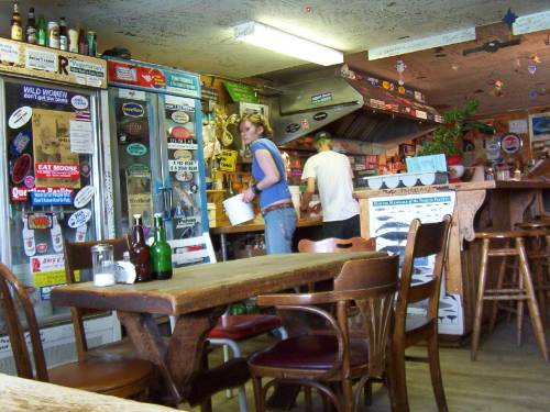
A little note on the wall before you enter, "In keeping with the pioneer spirit on which Yellowknife was founded, we encourage you to enjoy the intimate nature of this place by joining another table". This sure reminded me of Germany. Back to the food.
I had Arctic Char, WOW! The size of the plate! The taste! Man, I am gonna have a hard time biking this afternoon! Chocolate it was good. A nice beer with that, it was worth the (high) price. I recommend this place at least once (or more) in your lifetime.
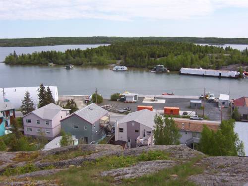
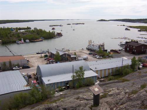
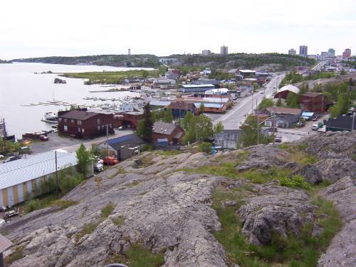
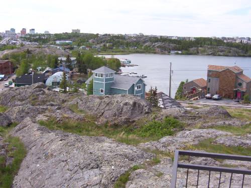
I continued my visit of the Old Town with a climb to Pilot's Monument which commemorates the Bush Pilots from year passed. It gives you a nice panoramic view of the Old Town and Latham Island.
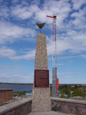
We could see some of the floating houses on the bay.
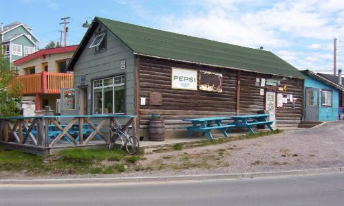
I visited Latham Island, which is also an Indians Reserve for the D'Dilo. They are Dene. Before I left the Old Town, I had a little beverage (beer) at the Wild Cat Café.
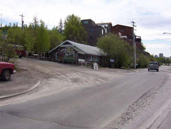
The Wild Cat Café was built in 1937. Sometime later, it became the first Chinese restaurant in YK. The Wild Cat Café closed its door in the early '50s. In the '70s, there was talks about destroying the Wild Cat. A group got together to save and renovate the Wild Cat Café. In 1979 it was re-open for the summer.
What was that saying again?
Now you know the rest of the story... Again...
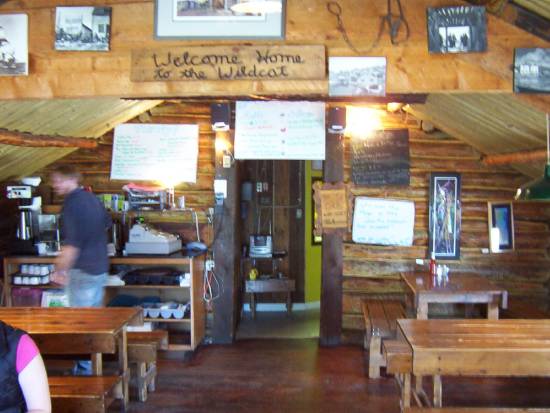
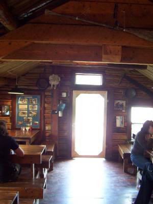
The same rules apply at the Wild Cat Café, a stranger can sit at your table. Another nice place, small, cozy, loved it.
On the menu for tomorrow, spend some time at the internet cafe. There are also some guided visits of the Legislature building of the NWT. A special place.
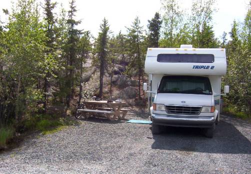
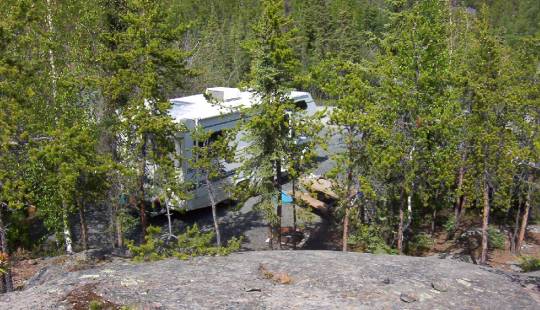
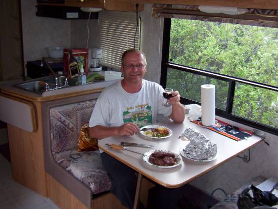
OK! Here are some pictures of my campsite here in YK.
A good dinner!
To finish on a good news, the road to Fort Simpson is now open.
Woke up at 8 am and, it rains! Really! Still! Chocolate! Oh well!
This was my day to take it easy. I took a couple of coffee while reading the local papers. The paper talked about the same problems as in Cold Lake. Because of the rain, I took the motorhome to go into town.
I filled up. Hummm! Only $1.134 per liters. WOW! I still get about 26L/100Km (or about 11 miles per gallon).
I emptied my used water reservoirs and filled my freshwater water tank with fresh water.
I took the guided tour of the Legislative Assembly Building at 10:30 am. WOW! Really good tour! The girl giving the tour was very knowledgeable about the building and the inner working of the NWT Legislative Assembly. There is no political party here, everyone is an independent, then they vote a "Premier", who in turn assign portfolios to "Minister" and the rest are the "opposition". This government works on a consensus system. I highly recommend a visit to this building.
For lunch, I went downtown to the Javaroma where the internet is free. I treated myself with a really good coffee and a Santa Fe Bagel. I surfed for a while, did emails, but could not update my pages. I looked outside at people on the street and watch the rain (still) coming down.
I got back to the info center and watched a few videos about the NWT.
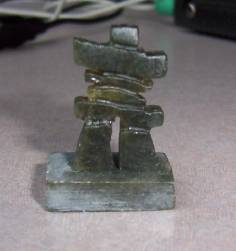
I purchased a few souvenirs, an Inuksuk.
And a book titled "Yellowknife Tales", 60 years of stories from Yellowknife.
Back at the campground at 3:30 pm.
I read until 7 pm, I had a nice diner, worked on my page and continued reading for the rest of the evening.
Easy day today!
And... It is not raining!
I went back to the info center to watch a diamond cutter. I got there a little early to update my pages. I checked the weather for Yellowknife, rain, Fort Providence, sunny for the next week, something for Fort Simpson.
Back to the diamond cutter, he is from... France, really, Olivier came to Yellowknife at 18 (1998) because he wanted to live with the native in the wild country. He had to go back to France because his visa expired. Back in Yellowknife, he studied in diamond cutting, until he can get his Canadian citizenship. OK, back to diamond cutting, I am the only one here! This is super! We talked about the cutting of stones, how is a diamond build, composed of, I can touch and manipulate the diamond. The salary of a diamond cutter is about $17 per hour (2006), but with bonuses, it can easily double or even triple. My nose was even closer than his nose when he was cutting the diamond. He cuts and we talk for the next 2 hours. The information I got about diamonds! WOW!
Around noon, I got on the "Ingraham Trail". That's a road to "cottage country" for Yellowknife. Beautiful road with a maximum speed of 70 km. There was a group cleaning the ditches and to warn us, there was a spot-check. They gave you a little collapsible bucket.
I made a stop at the Prelude Lake Territorial Park and did a small trail of 4 km with my bike, mostly on rocks. On the way out, I continued on Highway 4 (68.9 km long), but the road was gravel, for the next 3km I tried, but I had to turn around because of the washboard. Even my Styrofoam plates and my carpet made noise. I turned around, I was even thinking this will make my motorhome fall apart. The highest speed I got was 15 km. I had never seen such a bad road.
Back in Yellowknife, I decided to stay at the same campground for one more night and leave tomorrow morning for Fort Providence.
The next picture is from around Yellowknife.
Slow night reading by the fire. Ah! I would like to talk about bugs... Compare to Cold Lake, Shawbridge or any other place... Chocolate, there is a lot here. The nice "Skin so soft" was good for about 10 minutes, you need ''OFF Deep Woods'' and put it on thick. Here, they call it the "perfume of the north".
Can't way to get back on the road...
June 11, 2006
This morning, I left for Fort Providence. It was 8:30 am and I was on highway n.3 southbound. Yes! I was going back on my tracks! I saw some (a lot) of bison, some I think I remember.
I got to Fort Providence at 1 pm. Nothing here! I decided to carry on until Sambaa Deh Falls. About 150 km away, I saw a bear, a baby bear with no mama! A little fox and a little I do not know what.
Before I took the ferry, I filled up. $126.16 for 103.495 liters at $1.219 for an average of 26L/100Km. (11 miles to the gallon).
The sun was out and I could tell the temperature was going up, it was getting warm inside the motorhome. The forecast was for +25 today.
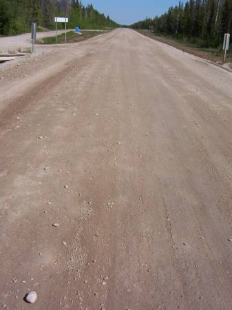
Back on highway 1, westbound, on gravel. When I say gravel I mean hard pack dirt.
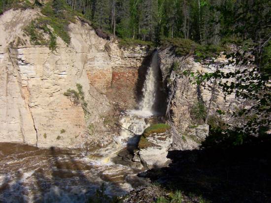
My first stop was at Wallace Creek where there was a trial that led to a small fall. The water was very high. The fall is pretty good. It was worth the stop.

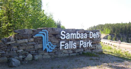
After 575 km, 5 pm, I got to Sambaa Deh Park.
Pfiouuu!
The gravel road was not so bad, I could drive about 80 km without too much "shacking". Not much traffic on this road, I met, on average, one car every 45 minutes.
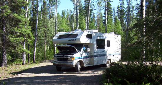
Nice campground, no electricity, but free showers, at $15 it was OK. I had the hood open just to let some of the heat escape that way so it did not seep in the motorhome.
I took the trail to the Coral Falls which were about 1 km to the south of here.
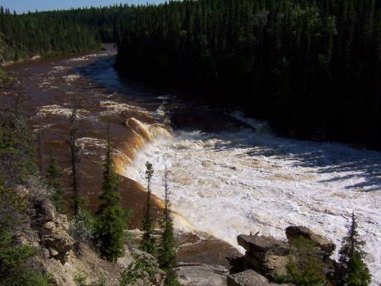
The falls were named this way because at the base you can get fossils from the shores, but the river was so high, it was not possible at that time. Back at the campground, I crossed the highway and got to the Sambaa Deh Falls (in another book it was called Wittaker falls).
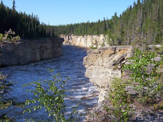
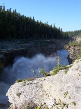
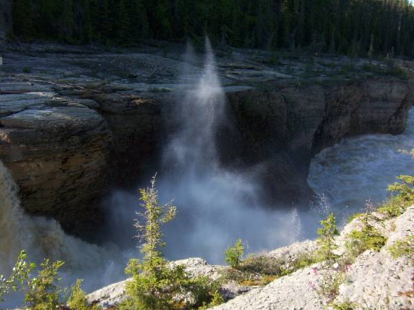
WOW! Awesome falls.
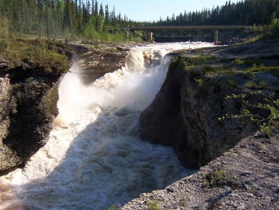
I took the west side of the canyon of the Sambaa Deh river (in English, trout river).
There is even another small fall on the Eastside.
Back to the bridge, I did the east side trail that went along the river.
Dam! It is beautiful!
Sun was there, it was +28, almost no bugs (well, less than 25 around you).
What more did I need?
I forgot, my cracked windshield is now a form of a .... "T".
Back to the campground, a beer, a shower, a nice diner and updated my page and at about 12, sleep!
Next, June 12 to 18, 2006
December 1 to June 3, 2006 June 4 to 11, 2006 June 12 to 18, 2006 June 19 to 23, 2006
Traveling the Deh Cho.
June 4 to 11, 2006.
June 4, 2006
Late morning, it was raining, only +10. Forecast for the day, rain and +10. No hiking or biking today. Good time to visit museums.
I went to the info center of the town...
OK, it opens at 1 pm.
I went to the Wood Buffalo info center...
Opens at 1 pm.
I went to the Northern Life museum...
It does not even open today...
It was 11 am... I went and filled up.
Not too expensive, $1.239, I take $120.00 for 97 liters.
So far, I have driven 1953 km, burnt 501 liters of gas for $501.00. The average I paid for gas was $1.16 per liter. My average is 27 L / 100 Km. Not bad.
Back at the info center, it was 1:15 pm. It was not open...
So I went to the Wood Buffalo info center.
They were open.
Small, but super well done and they even had a video on the park. The 2 employees were well informed and resourceful. They suggested I go to Salt River Day Use Area and check out the trails. I can go on to the Pine Lake campground. I was not sure if I would go to Pine Lake as it was another 60 km on gravel roads... If it is not raining, I may go.
OK, I returned to the info center for the town.
Nobody there... I guess, Sunday you only have to show up if you want to...
As I was driving around town looking for an Internet connection (WarDriving) I found only one. I only had time to upload my blog. Did not get to send an e-mail and the connection was broken!!!
What do I think of Fort Smith?
A contradiction of a town. Lots of very nice homes, a few not so nice, 1 out of 3 had a scrapyard in their front yard (even the nice ones) from the last 20 years. Lots of commercial buildings were boarded up, other stores were in private houses, like Radio Shack, Saan, etc.
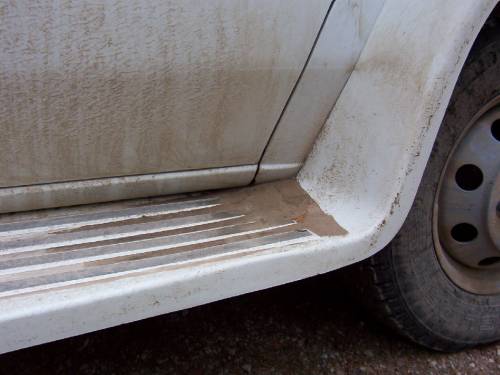
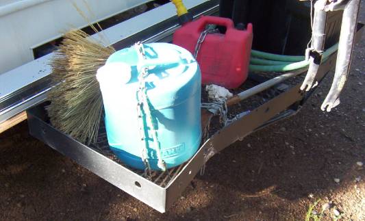
I went to the Truck Wash, which was outside, and removed 50 lbs of mud...
Now I could see through my back window.
I checked out the price of milk and 4 liters of 2% cost $5.36. Not so bad compare to Cold Lake.
Back at the campground at 4 pm, supper and update to the blog.
June 5, 2006
When I woke up... It was raining!
I left for Pine Lake, about 60 km away (south-west of Fort Smith). I was back in Alberta right after I left Fort Smith. Here we go, gravel road for the next 55 km.
My first stop was at Salt River, where there was a trail system. I did the Karstland Trail first, a long 750m.
A nice little trail with some information panels explaining the formation of Karst. Really interesting. The Karst also creates caves. In the caves, the Red-sided Garter Snake spends the winter. This is as far north as any reptiles live.
Guess what? It rains...
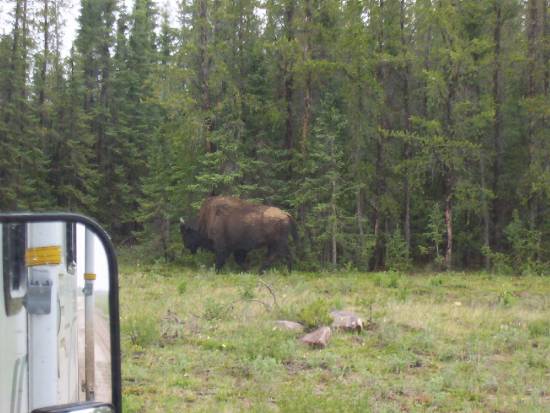
Next, I did the Salt River Meadows trail. Pretty, lots of birds. Sadly, no bison, but lots of tracks.
I cannot help it, "Do bear shit in the woods?" Well! I have the answer! NO! They shit on the trails, so do the bison.
And you know what?
Animals have a sense of humor!
A fox had a shit on top of a bison poop.
What did he mean by that?
OK, OK, enough of my very interesting observation of the animal kingdom.
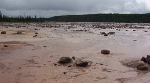
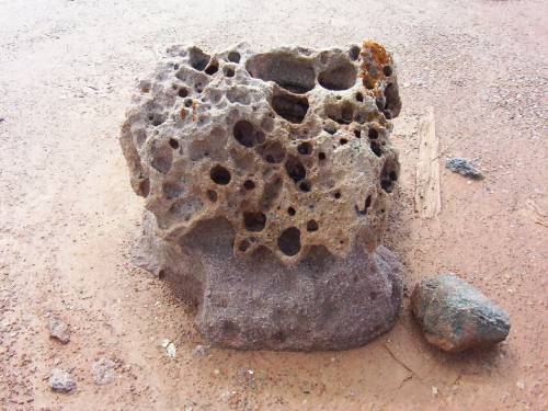
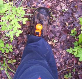
On the next trail, I could see rocks sitting in the middle of... Nothing. It was a kind of moonscape. Those rocks were left behind from the last Ice Age.
Me and my "Bear Bell".
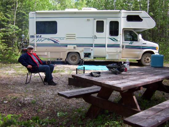
Back on the road towards Pine Lake. 36 campsites, and I had the choice, I was the only one here. It was nice, $14, no services or showers.
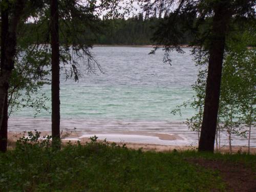
Pine Lake is a water-filed "uvala", formed by a series of sinkholes (Karst). This is what gives it its aquamarine waters.
Alright! I took my bike and did the Lakeside Trail... But... I had a flat tire. Lesson for Denis, when you place your bike on the stand, do not place the valve at the bottom because rocks will get to it and break it. I fixed my flat. There was even sand in my tire.
Lesson number 2, remove wheel when traveling because rocks from the road do a wonderful job on the wheel part. I did go to bed a lot smarter tonight.
OK! The trail was 6.4km, not easy on bikes because bison use the trail and "dig" and make all the roots show up. Oh well! In the end, I had a choice to come back the same way or take the road. I took the road. This gave me a little ride of about 16 km.
It was very windy at the site. It allowed me to stay outside because there were no bugs! I even made a fire... It was not raining!
There are some tracks of bison and bears. I sure hope to see one tonight or tomorrow morning.
Speaking of morning, I will be on my way to Hay River for a top-up of fuel and then down to Enterprise and Highway 1 to Kakisa.
Before I am done with Wood Buffalo Park, here are a few bits and pieces...
Wood Buffalo is part of a World Heritage since 1983.
Originally created to protect the bison, later it became a vital part in the recovery of the Whooping Crane.
The Peace-Athabasca Delta, one of the largest freshwater delta in the world.
So many other little things.....A great place!!!
It is now 9 pm. It is raining
June 6, 2006
I was in Kakisa after 500km.
OK, let go back to this morning.
My wheels got turning at 10 am. A small, 60km stretch of gravel. In Fort Smith, I treated myself to coffee and then on the way to Hay River and Kakisa. Out of Fort Smith, I had another 120km of gravel. And it rained, the road was getting pretty bad, I would even say stressing. Ah! I saw 2 more bisons today.
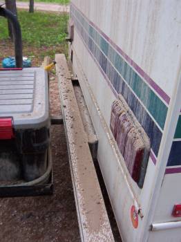
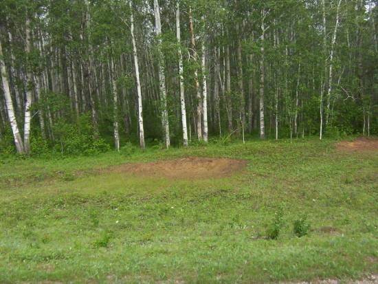
There were many patches of dirt on the side of the road.
These patches were created by the bison as they roll around to get covered in dirt to protect themselves from bugs.
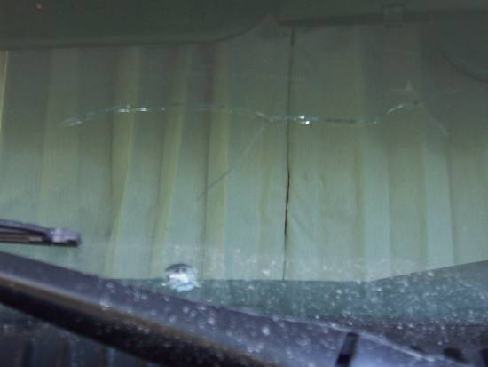
There was more truck traffic. When I did hit the pavement, a big truck, met me with rocks (lots of rocks) and one broke my windshield. Tabarnak! Oh well! It was bound to happen. I still cannot see through my rear window (mud).
The first stop is Hay River. I filled up, did some laundry and washed the motorhome. I could see through my rear window now. The motorhome must weigh at least 100lbs more just in mud. I left Hay River at around 2:30 pm, direction Kakisa. I was back on highway 1, what a nice road! In Enterprise, there was a sign on the road that stated "Fort Providence is Overflowed"???
What does that mean? We'll see when I get there.
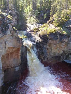
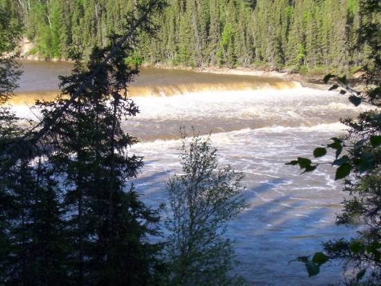
The next stop is McNallie Falls. Nice little falls.
The story of the fall is a special one. The name comes from a Foreman who was working on the construction of the first road (highway1). When he crossed the river on a canoe, he miss judged the current and was taken downstream toward the fall. He managed to get to shore, but not his canoe. His crew named (unofficially) the small creek with its name. Later on, the president of the company officially asked the government to name the creek in honour of McNallie. And they did!
In Kakisa, I found myself a campsite. Nice Park. $15 including showers. Back to the "I find myself a campsite". Another lesson. I always get out and look before I back up in a site. Well, this time it looked OK from inside the motorhome, I backed up... And a tree jumped and hit my cargo carrier.
Good thing, I removed my bike wheel before I left this morning. On the plate for tomorrow, biking the trails around Lady Evelyn Falls. Here is a little price info, 24 cans of beer, $47.89 in Hay River.
June 7, 2006
Brrr! A little chilly last night, a nice 0 C. Super campsite, you can hear the falls in the background. The washrooms were very clean. The picture was taken at 1130 pm, still daylight.
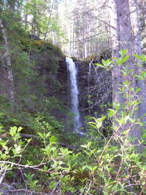
I did the Lady Evelyn Falls trail. A small 2km. The falls themselves were at the same level as the campground, but the trail took you lower than the falls. The water level in the river was very high and you could not walk on the river's shore. With the rain from the past 5 or 6 days, no wonder. The trail went upstream and came up to a very nice small fall.
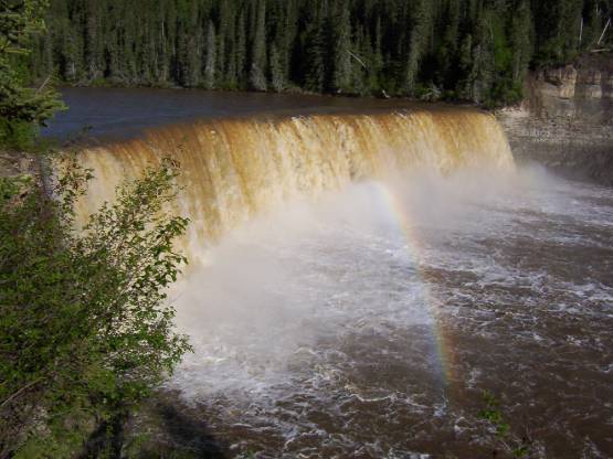
The Lady Evelyn Falls are 15 meters high and very nice with the rainbow.
A little further upstream, there was almost another set of falls, only 1 or 2 meters high.
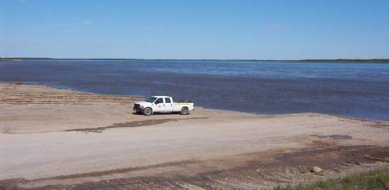
10 am, back on the road, on my way to Kakisa. A very nice looking Native village, nice houses, not poor at all. I have to say that all the Native villages were very clean and not poor looking. On Highway 1 at the junction of highway 1 and 3, there was a barricade that said the highway was closed? No explanation! Oh well! I turned onto highway 3 towards Yellowknife. 21km later I came to the ferry Merv Hardie for the crossing of the MacKenzie. Chocolate, it was a big river...
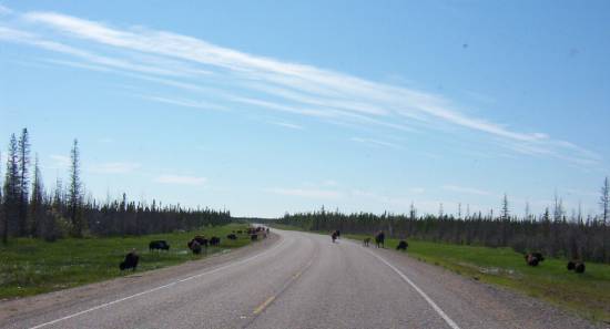
Out of the ferry, there was a sign that warns us about bison on the highway.
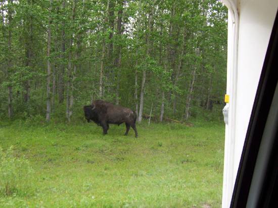
Not even 100 meters and... A bison.
At Fort Providence, I filled up. Onward for 200km towards Yellowknife. Nice road, lots of water in the ditches.
Remember I said it rained. Impressive the number of bison on the highway. Some bulls and some cows with little ones. Sometimes they just crossed the highway just as you get there... Stupid animals!!!
I was thinking, I had not seen any bears since I started my trip. Well, a sow and 2 cubs crossed the road in front of me not 10km later.
Yellowknife.
I got a campsite for 3 days. Nice campground, but located by the highway and just across the airport, a little noisy. At 5 pm I took off with my bike for the BIG city. I took a trail system end... chocolate... I had to come back because there was so much water and mud. Back on the road, into downtown. I was not visiting anything just checking the hours for the info center and the Prince of Wales museum... Chocolate... The museum was closed until August... Who closes a museum in the summer??? Back at the campground after a little 16km ride. Supper at 8pm and made plans for tomorrow...
June 8, 2006
I had a good sleep, but... Man, it really did not get dark here! That is why I have a second pillow, I used it to cover my head. 9:30 am and I was on my way to the city. I stopped at the info center. The guy that works there was awesome. I got to connect to the internet and updated my pages again and did some emails. After that I visited the info center, I found it to be very interesting, a lot to see. Even an elevator that was like a small airplane interior, with a TV and they take you for a tour of the Yellowknife/NWT area. Really neat way of presenting the area. By the way, Yellowknife got its name not from the gold, but from an explorer, Samuel Hearne, who, when he saw the Dene with their knives made out of almost pure copper. He called the Natives, Yellowknifes. Now you know the rest of the story...
I left my bike at the info center and took a walk downtown. I came across the "bad side" of town, lots of people, poor ones, sad to say, but mostly natives, drunk by noon. I know it is only a minority, but it sure is visible now! I found a small café with free internet, tomorrow I will treat myself to a good coffee and surfing for a while. I also visited the Diavik Corp. who exploit the Diavik diamond mine. WOW! What a nice info center. The Diavik and 2 other mine will give, in their lifetime (20 Years) about 40 billion $$ worth of diamonds. That is a sh*t load of money! Canada is the 3rd largest producer of diamonds in the world.
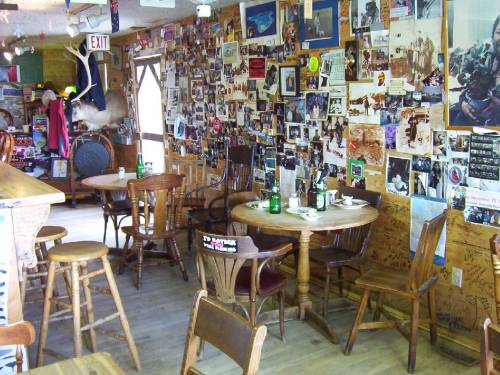
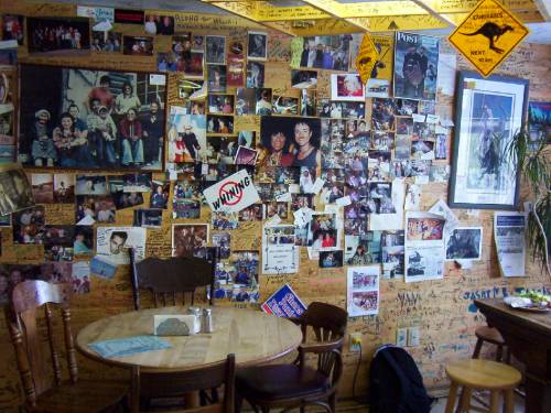
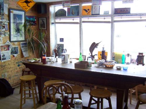
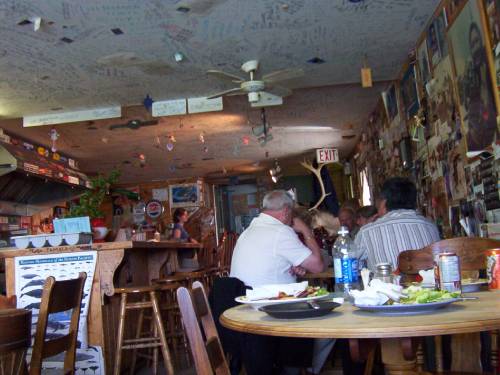
Back at the info center I picked up my bike and traveled to the Old Town. Lots of colours, even the garbage cans were painted. Some of the buildings were "kept" in a state of "old" for the tourists. On recommendation from the info center, I decided to have lunch at the Bullock restaurant. A little while back, the Reader's Digest ask/did a survey to find the 10 best places to have a Fish&Chips. This place was one of them. Really cool place, only 5 tables, a counter and about 5 outside tables.
All the walls and ceilings had writing on them from the people who were there before. It gave a style to the place.
A little note on the wall before you enter, "In keeping with the pioneer spirit on which Yellowknife was founded, we encourage you to enjoy the intimate nature of this place by joining another table". This sure reminded me of Germany. Back to the food.
I had Arctic Char, WOW! The size of the plate! The taste! Man, I am gonna have a hard time biking this afternoon! Chocolate it was good. A nice beer with that, it was worth the (high) price. I recommend this place at least once (or more) in your lifetime.
I continued my visit of the Old Town with a climb to Pilot's Monument which commemorates the Bush Pilots from year passed. It gives you a nice panoramic view of the Old Town and Latham Island.
We could see some of the floating houses on the bay.
I visited Latham Island, which is also an Indians Reserve for the D'Dilo. They are Dene. Before I left the Old Town, I had a little beverage (beer) at the Wild Cat Café.
The Wild Cat Café was built in 1937. Sometime later, it became the first Chinese restaurant in YK. The Wild Cat Café closed its door in the early '50s. In the '70s, there was talks about destroying the Wild Cat. A group got together to save and renovate the Wild Cat Café. In 1979 it was re-open for the summer.
What was that saying again?
Now you know the rest of the story... Again...
The same rules apply at the Wild Cat Café, a stranger can sit at your table. Another nice place, small, cozy, loved it.
On the menu for tomorrow, spend some time at the internet cafe. There are also some guided visits of the Legislature building of the NWT. A special place.
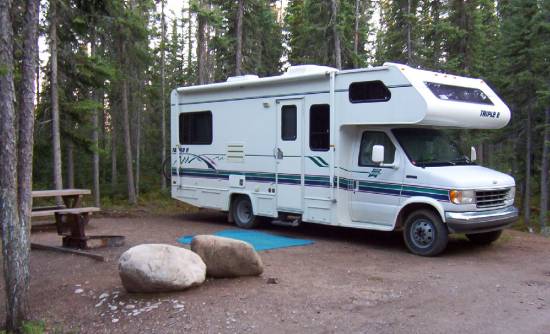
OK! Here are some pictures of my campsite here in YK.
A good dinner!
To finish on a good news, the road to Fort Simpson is now open.
June 9, 2006
Woke up at 8 am and, it rains! Really! Still! Chocolate! Oh well!
This was my day to take it easy. I took a couple of coffee while reading the local papers. The paper talked about the same problems as in Cold Lake. Because of the rain, I took the motorhome to go into town.
I filled up. Hummm! Only $1.134 per liters. WOW! I still get about 26L/100Km (or about 11 miles per gallon).
I emptied my used water reservoirs and filled my freshwater water tank with fresh water.
I took the guided tour of the Legislative Assembly Building at 10:30 am. WOW! Really good tour! The girl giving the tour was very knowledgeable about the building and the inner working of the NWT Legislative Assembly. There is no political party here, everyone is an independent, then they vote a "Premier", who in turn assign portfolios to "Minister" and the rest are the "opposition". This government works on a consensus system. I highly recommend a visit to this building.
For lunch, I went downtown to the Javaroma where the internet is free. I treated myself with a really good coffee and a Santa Fe Bagel. I surfed for a while, did emails, but could not update my pages. I looked outside at people on the street and watch the rain (still) coming down.
I got back to the info center and watched a few videos about the NWT.
I purchased a few souvenirs, an Inuksuk.
And a book titled "Yellowknife Tales", 60 years of stories from Yellowknife.
Back at the campground at 3:30 pm.
I read until 7 pm, I had a nice diner, worked on my page and continued reading for the rest of the evening.
June 10, 2006
Easy day today!
And... It is not raining!
I went back to the info center to watch a diamond cutter. I got there a little early to update my pages. I checked the weather for Yellowknife, rain, Fort Providence, sunny for the next week, something for Fort Simpson.
Back to the diamond cutter, he is from... France, really, Olivier came to Yellowknife at 18 (1998) because he wanted to live with the native in the wild country. He had to go back to France because his visa expired. Back in Yellowknife, he studied in diamond cutting, until he can get his Canadian citizenship. OK, back to diamond cutting, I am the only one here! This is super! We talked about the cutting of stones, how is a diamond build, composed of, I can touch and manipulate the diamond. The salary of a diamond cutter is about $17 per hour (2006), but with bonuses, it can easily double or even triple. My nose was even closer than his nose when he was cutting the diamond. He cuts and we talk for the next 2 hours. The information I got about diamonds! WOW!
Around noon, I got on the "Ingraham Trail". That's a road to "cottage country" for Yellowknife. Beautiful road with a maximum speed of 70 km. There was a group cleaning the ditches and to warn us, there was a spot-check. They gave you a little collapsible bucket.
I made a stop at the Prelude Lake Territorial Park and did a small trail of 4 km with my bike, mostly on rocks. On the way out, I continued on Highway 4 (68.9 km long), but the road was gravel, for the next 3km I tried, but I had to turn around because of the washboard. Even my Styrofoam plates and my carpet made noise. I turned around, I was even thinking this will make my motorhome fall apart. The highest speed I got was 15 km. I had never seen such a bad road.
Back in Yellowknife, I decided to stay at the same campground for one more night and leave tomorrow morning for Fort Providence.
The next picture is from around Yellowknife.
Slow night reading by the fire. Ah! I would like to talk about bugs... Compare to Cold Lake, Shawbridge or any other place... Chocolate, there is a lot here. The nice "Skin so soft" was good for about 10 minutes, you need ''OFF Deep Woods'' and put it on thick. Here, they call it the "perfume of the north".
Can't way to get back on the road...
June 11, 2006
This morning, I left for Fort Providence. It was 8:30 am and I was on highway n.3 southbound. Yes! I was going back on my tracks! I saw some (a lot) of bison, some I think I remember.
I got to Fort Providence at 1 pm. Nothing here! I decided to carry on until Sambaa Deh Falls. About 150 km away, I saw a bear, a baby bear with no mama! A little fox and a little I do not know what.
Before I took the ferry, I filled up. $126.16 for 103.495 liters at $1.219 for an average of 26L/100Km. (11 miles to the gallon).
The sun was out and I could tell the temperature was going up, it was getting warm inside the motorhome. The forecast was for +25 today.
Back on highway 1, westbound, on gravel. When I say gravel I mean hard pack dirt.
My first stop was at Wallace Creek where there was a trial that led to a small fall. The water was very high. The fall is pretty good. It was worth the stop.
After 575 km, 5 pm, I got to Sambaa Deh Park.
Pfiouuu!
The gravel road was not so bad, I could drive about 80 km without too much "shacking". Not much traffic on this road, I met, on average, one car every 45 minutes.
Nice campground, no electricity, but free showers, at $15 it was OK. I had the hood open just to let some of the heat escape that way so it did not seep in the motorhome.
I took the trail to the Coral Falls which were about 1 km to the south of here.
The falls were named this way because at the base you can get fossils from the shores, but the river was so high, it was not possible at that time. Back at the campground, I crossed the highway and got to the Sambaa Deh Falls (in another book it was called Wittaker falls).
WOW! Awesome falls.
I took the west side of the canyon of the Sambaa Deh river (in English, trout river).
There is even another small fall on the Eastside.
Back to the bridge, I did the east side trail that went along the river.
Dam! It is beautiful!
Sun was there, it was +28, almost no bugs (well, less than 25 around you).
What more did I need?
I forgot, my cracked windshield is now a form of a .... "T".
Back to the campground, a beer, a shower, a nice diner and updated my page and at about 12, sleep!
Next, June 12 to 18, 2006
 |
  © COPYRIGHT 2021 ALL RIGHTS RESERVED MICHELE-DENIS.COM |
 |