
Home
Archives Français
December 1 to June 3, 2006 June 4 to 11, 2006 June 12 to 18, 2006 June 19 to 23, 2006
Here we go. I decided sometime in December to do the "Deh Cho" road. I was thinking about this trip for a while. The only bad thing about this trip is that Michèle will not be with me.
Why this trip?
Why not! It is not too far from Cold Lake (so to speak).
For those of you who do not know me, my name is Denis and I am military, happily married, with 2 boys of 20 and 18 years old.
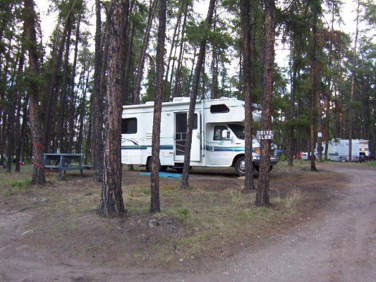
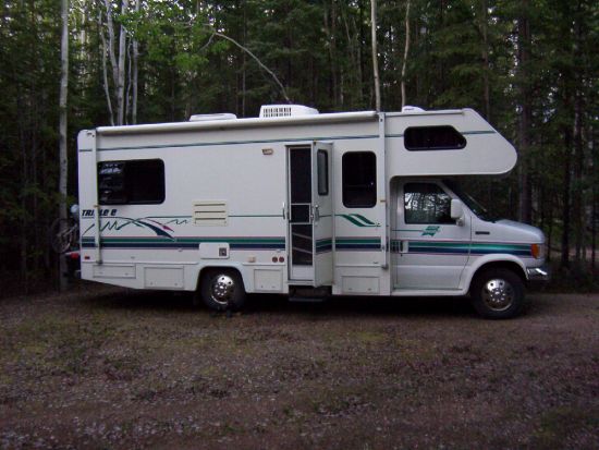
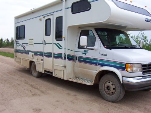
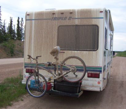
My "rig" is a 1996, class "C" of 24'' from Triple E.
I have never done a blog before, so I have to decide what I will talk about! I will describe the sight I see and the 'experience' I will have during my trip. Also, I will try to add a little humor to my text. Boys being Boys. I will also keep some statistics on things like $$$, the road, the people... And of course on me...
Friday, February 10, Michele and I went to the RV show in Edmonton. We were looking at our next motorhome/fifth wheel. We also are looking for some info on the NWT. The man at the info booth was great! He gave me some reason to visit and not to visit some of the places. During my research, I found some very interesting web sites on the Metis and on the treaty with the Native. Very interesting reading. The web is an amazing source of info, almost too much.
Salut.
I have bought myself a Cargo Carrier and modified it with my bicycle rack.
The purpose of this purchase is to allow me to carry my generator and gas and other things I do not want inside the motorhome.
It is decided! I will be leaving Monday the 29 at around 7 am. Let me tell you, I just can't wait. If my voyage is only half as interesting as the stuff I have seen/read on the web, it will be fun. The motorhome is slowly emptying the un-needed stuff to be replaced by the needed stuff, like the spare tire... I can't believe the stuff I need or think I need. Let us just say things are going well.
Today I only fine-tuned my blog. Everything is written in sand. Things can change and will more than likely change as time moves on. What? It is a voyage, not a job.
Here are some of the goals I set for myself and the blog.
For the blog:
I will maintain my blog every day, even if I can't update my site for a few days.
I will write everything that goes through my mind... and not change it later.
If I talk about $$$ it is only to compare our price with the one here... and yes, I will talk about $$$ for the gas, mile per gallon, etc... ( I'm a guy, I like that kind of stuff).
My goals:
Not to rush to do things (control time and not time controlling me).
To walk about 10 Km per day and/or bike 25 to 30 KM per day.
Take a day 'off' every 4 or 5 days.
When I get up in the morning, put on my "kids" eyes and look at things as if it were the first time.
To take my time in the museums, on the road, just plain enjoy the moment.
Got work to do!
Up at 6:30 am. It rains with a beautiful +8 C
My bike will travel inside for the first day.
Off I go at 7:30 am.
The rain stops around 9 am. The sun is coming through.
Ah yes! I have another goal to add, not to go faster than 90 km with the motorhome. I also have to modify one of my goals. When driving, only put one "kids" eye because I have a hard time keeping my eyes on the road.
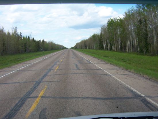
Chocolate, the roads are great in Alberta!
I fuel up in Slave Lake for $100 for 95 litres at $1.049. The lake is named 'Slave' not because the native were slave, but because the name of the Dene tribe is "Slavey". The early settlers gave it the name Slave.
Great weather to travel. It got a little worst in the afternoon when the wind picked up, right on my face! Well! If this is my biggest problem, I can live with it.
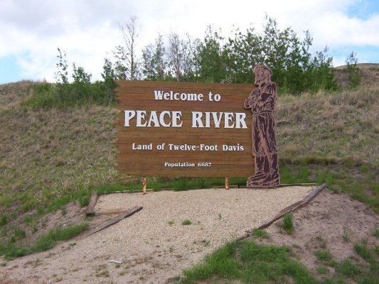
I arrive in Peace River at 4 pm.
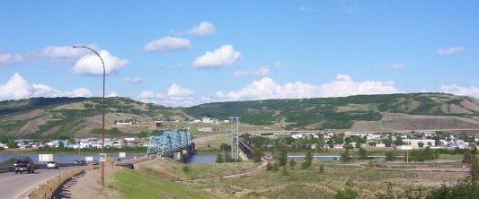
I decide to stop for the night and go see "Twelve Foot Davis" on my bike. By the time I got to the bridge and look behind me... Some big, black clouds were coming. Well, I went back to the motorhome.
Only a 4 km bike ride on day one, so much for goals... OK, I will have a beer as a punishment and forget about it.
Today, I drove 614 km.
I am camping at the Lions Park on the West side of the river. The town is on the East side of the river. The campers are mostly oil rig workers. All the campsites are full.
Well! The rain never came. If it does not rain tomorrow, I will go to town and see the statue of Davis and maybe the museum. If it rains, I will see it on the way back.
Up at 8:30 am. Bad news, I bought some black socks so dirt and stain would not show up after a wash. Well, they are in Cold Lake...Dam! And I drove past 2 WallMart. Oh well, next town. I left the campground at 10:30 and went downtown Peace River. I biked the bike path that follows the river's edge, very nice.
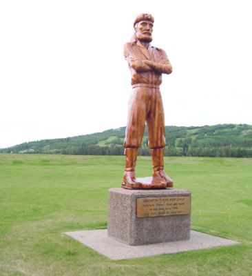
I have lunch by the "Twelve Foot Davis" statue. According to what I have read about him, he was one of the few good guys. He was liked by all, native and white alike. He worked very hard all his life and lived until 1900 at a ripe old age of 80. At 70, he was still packing a 200lbs load on his back to the Fort of the north. The Native named him "the Wolf". He was a nice and generous man.
I visited the Peace River Museum. Nice museum, the lady that works there was super nice.
I left Peace River at 11:30 after having topped up the gas. $1.089 for a total of $80.00 for a distance of 252 km traveled. So far, my average is 27.5L /100Km. Not too bad, but not very accurate until I have more km traveled.
My next stop is Grimshaw, 21 km away. Pfiou! It is far ... I camped at the Elks RV park with all services for a big $15... WOW!
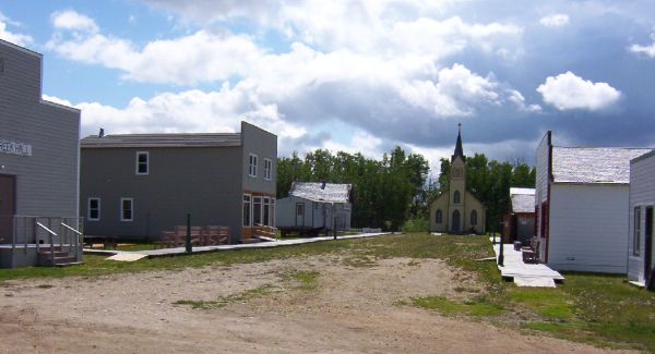
At 1:30 pm, I decided to visit the "Lake Cardinal Pioneer Village". It is a village of the '20s and '40s. I also discover that Mackenzie was the first white man to travel to the Pacific ocean, it is 12 years before Lewis and Clark (Americans), but the Americans say they were the first! I'm getting sidetracked here. Back to the village, it is all volunteer work, including restoration. They do beautiful work.
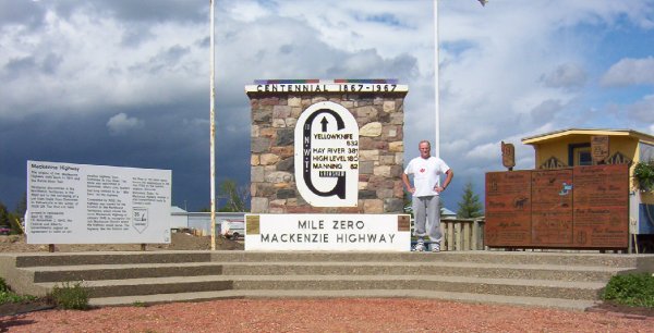
When I get back, I took my bike and went to the "Mile Zero Antique Truck Museum". It was closed, my guess is that on a Tuesday at 3 pm, they close early. I took pictures of the ''Mile Zero'' of the Mackenzie Highway.
When I got back to the campground, there were some mean looking clouds... I am next to the library. I went to check if I could get the Internet. No luck, they close in 10 minutes, no time to get the laptop and get back. It rains, it's windy, it's sunny, and freezing rain.
Sunny day!
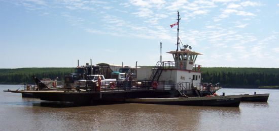
It is 7:30, I emptied my grey and black water. On my way to La Crête and Fort Vermilion. Very nice road, I took the ferry at Tompkin's Landing.
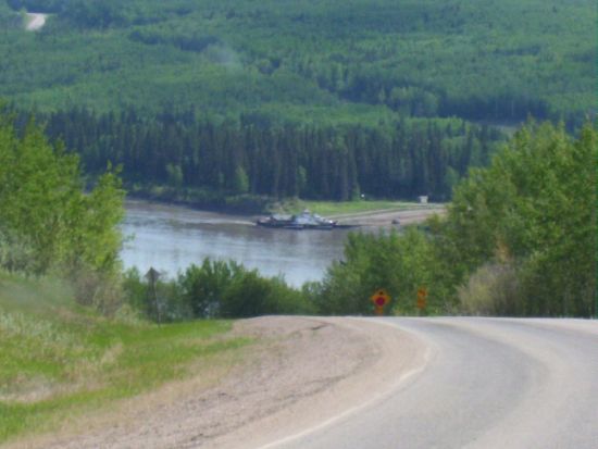
The ferry is free and only runs during daylight hours. This means about 22 hours a day in the summer.
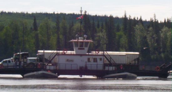
The ferry saves 90 km of driving for the traffic going south from La Crête or Fort Vermilion.
I arrived at the ''Heritage Village'', well, it is closed... A detour of 150 km for no reason. I am not impressed...oh well!
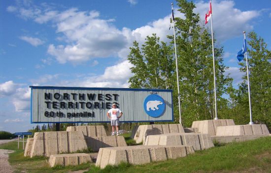
On my way to High Level and to the NWT. In High Level, the gas was at $1.089 and I took $125.50 worth of it. My average is 25.5 L /100Km. Driving 90 km sure makes a difference. Ah! Guess what? I am now the proud owner of 24 pairs of black socks. 12 in Cold Lake and 12 with me. High Level info center has a small museum, very nice, well laid out. High Level is on the 58 parallel and guess what? It has more frost-free days than Edmonton, H.L. 110 days, Ed. 104. It also has about 2000 hrs of sunshine per year, no wonder it is a farming country. At 4 pm I decided to continue to the NWT and spend the night at the 60th Parallel Park. The road is very nice, but from time to time I wonder what is on the road... Caterpillar...
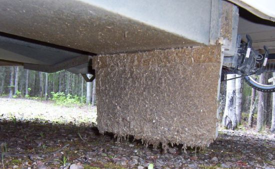
Lots of caterpillars... Enough caterpillar that when I stopped, the motorhome stunk like rotten meat because there was so much caterpillar meat on the mud flap.
The info center is OK, not very big.

The campground is OK (10 sites), shower at $3, sites at $16. Lots of deer flies. Slow night, updating my blog. BTW, for my goals of walking/biking, I think about it. I will make up for it (I think).
Last night, it was daylight until 11 pm. WOW!
Up at 7:45, breaky, brushed my teeth, found myself to be handsome and smart... OK. OK. OK! I am getting carried away here.
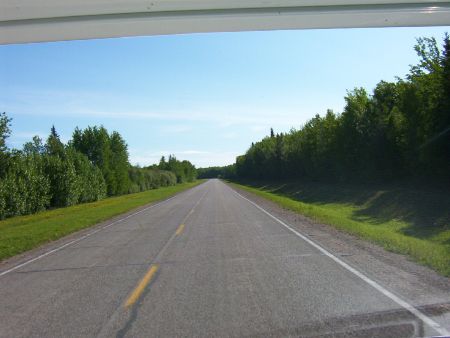
On the road to Hay River. Very nice road so far.
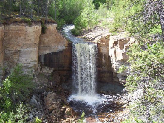
I stopped at the Louise, Alexandra and Escarpment falls. Man, it was pretty and wild. I stopped at Louise falls because it is centrally located. Backpack, water, camera and off I went to the falls.
Louise Falls are 14 meter high.
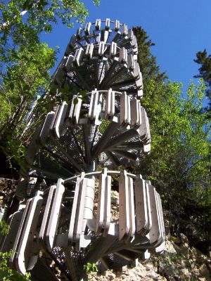
Really nice and with a very good lookout, a spiral staircase to get to the base of the falls.
It was very impressive with the gorge and the river. I followed the trail that joins Alexandra and Louise falls (6 km return). The lady at the campground mentioned that bears are in the area, let me tell you that my Bear Bell was ''belling away''. The trail was well-done and maintained. The trails have many lookout and some information stations relating the importance of the river and the falls to the Native.
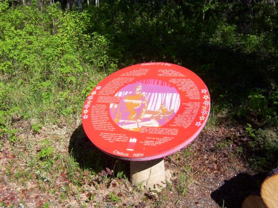
The stations explained the roles and social status of each individual in a tribe. It also mentioned why the native would leave the winter ground of Alberta and move up to the Great Slave Lake for the summer. The gathering on the shore of the lake could have as many as a 1000 person present, mostly from the Dene tribes. It was a time for trading, learning, settle disputes, and celebrations. It was the high time for the tribes of the North-West.
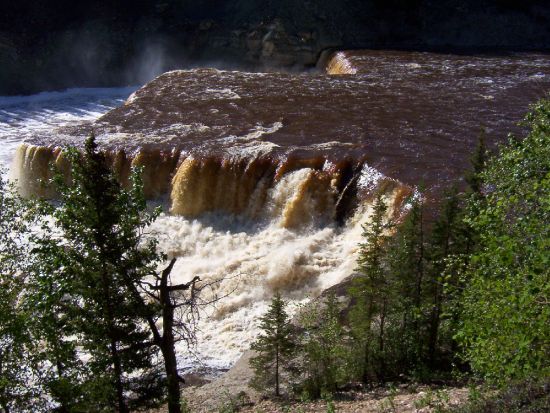
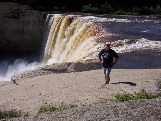
As I kept walking, it was weird to hear the noise of the fall diminish and the other fall getting louder. When I saw Alexandra falls... Chocolate it was gorgeous and big.
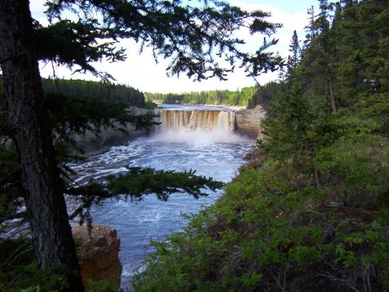
To see the gorge, the river the falls. WOW! Alexandra falls tumble 35 meters (Niagara falls are what? 50 meters!).
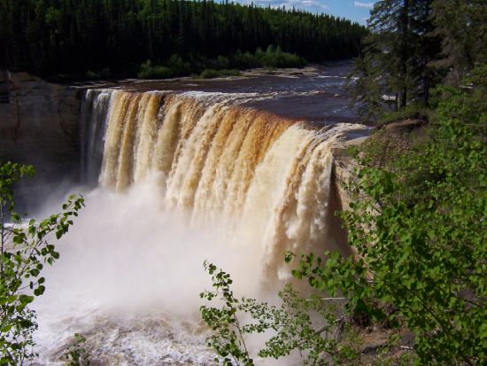
The ''Twin Falls Gorge Park'' is very well-done. You can go right to the edge of the falls, with no fence or guard rails. I guess they think that if you fall, you were too close, your fault dumb ass!
Back at the motorhome time for lunch before I went to Escarpment Falls. Pretty little falls.
After the Falls, I took the road North. Enterprise is 6 km to the north and my destination is Hay River, 38 km further. I blinked and I missed Enterprise, population 88.
Stopped at the info center in Hay River. I got lots of info. I decided to stop at the truck wash to get some of the caterpillar of the motorhome. Man, my motorhome stunk. Finally, I got most of the goo off.
Fuel topped up for $90.74 litres at $1.214, not bad. I expected $1.50. My average is 24L/100Km. I slowed down to 85 km and not using air conditioning, make a difference.
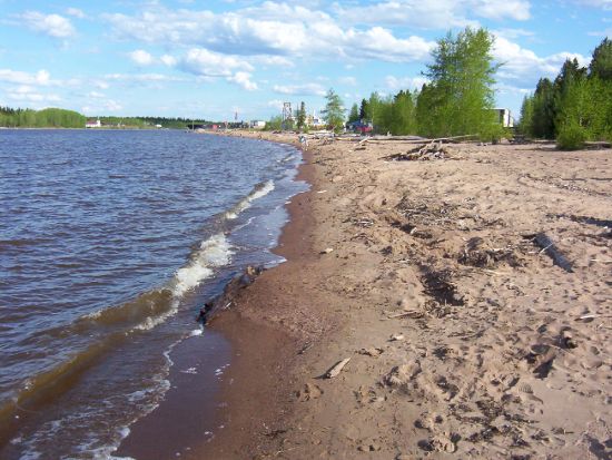
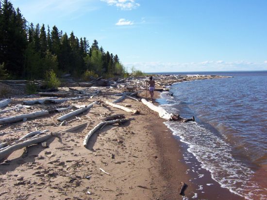
I camped at the Hay River Territorial park for $20 per night with electricity and free showers. My site was about 50 meters from the beach.
I spent the rest of the day and evening updating my blog and also making an English version of the blog for my Anglophone friends. Not to complain, but I never realize it would take 1 hour a night to update the blog, and I have not had a busy day yet. WOW! It is OK during the updates I have a beer, Scotch. Dam, I'm good-looking and intelligent... I'm drunk...Oh well :-)
Enough delirium.... What are people going to think? Too all, see you later!
Late morning, got up at 8 am. It has been daylight for the last 4 hours. Lazy morning, read the local papers. At 10 am I took my bike and went to town.
I followed a trail marked on the maps for the city. It is a quad trail, and muddy on top of that. Hay River is about 10 km from the campground. Even taking my time, it took me 30 minutes to do the whole town. 6 streets and 15 avenues. Not big! But there was something special in this town. A purple school.
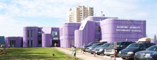
Really! When the school was built in 1971, they asked the student of the time what color they wanted and they picked purple.
OK! Some info on Hay River. The Dene chose this spot over 800 years ago for their summer camp. Later, the Hudson Bay Company and the Churches came to Hay River. During the second WW. The Americans came to Hay River and build a runway which served as a base camp for the building of the Canol Pipeline. In the 60, some mining companies, the Coast Guard and the Northern Transportation Company Limited which moves fret up to the villages in the arctic. This gave the nickname of ''Hub Of The North'' to Hay River. In 1963, tragedy struck with a big flood, which forced the town to re-locate the town up-stream. Today you have the "Old Town" by the shore of the lake and the "New Town", 6 km further up the river. Hay River has a population of 3835 souls. I have to say, the people of Hay River are very friendly.
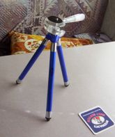
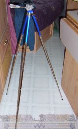
I bought a small tripod at the cost of $15 and let me tell you, it is very useful and easy to carry in a backpack.
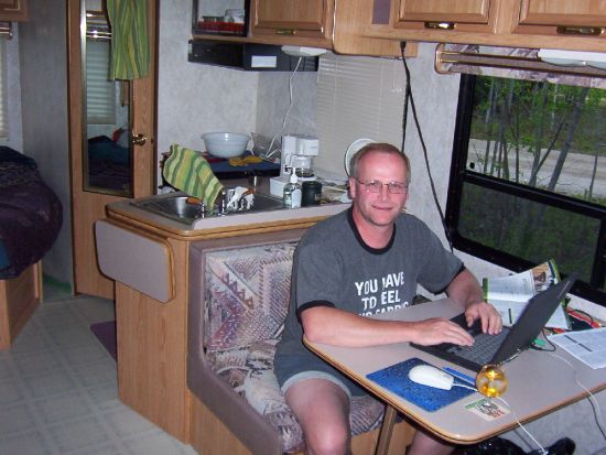
A picture of me working on my blog... Having a little Scotch.
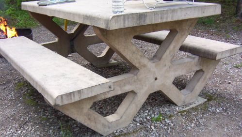
Let me tell you, nobody will ever steal a picnic table, they were made of cement.
Good news, I did 26 km on my bike today, watch out Lance Armstrong :-).
Tomorrow I will be on my way to Fort Resolution, 156 km east of Hay River.
Up at 7:30 am. I lied yesterday, the sun does not rise at 4 am, but at 2 am. And between midnight and 2, it's not dark! I was looking at a map of the world. I noticed that the 60th parallel is in the middle of Hudson Bay! Isn't there Eskimos live up there? Oh well! Let's continue. On the road by 8:40 am. I took road n.5 for Fort Resolution. Nice road. I turned onto n.6 to carry on to Fort Resolution. Let me tell you, there was not much between Hay River and Fort resolution Trees... Trees. I even counted them. 153,345,234 and now I am tired of it.
The further away I am from Hay River, the worst the road gets. Then I hit the gravel road for the next 66km. Not bad, just a few bad spots. Let's go back in time... When Michèle and I were at the RV show in Edmonton, the guy in the info booth for the NWT said that there is not much to see in Fort Resolution. Well, he was right! It was not worth the detour. But that was OK... Been there, did not get a t-shirt. Fort Resolution is a small native village of 525 souls. They must have good jobs because they all have new trucks, even a hummer! I was reading that there are 2 sawmills in the area. All the street names were in Chipewyan.
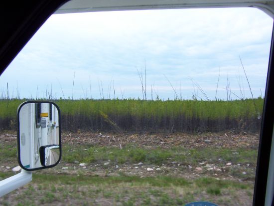
Not much to do or see here, lets go to Fort Smith, but not before I filled up for $60.00 at $1.279 for a total of 46 litres. I took road n.6 and then turned onto n. 5 to Fort Smith. It is about 200km away. Guess what? Trees... Treesssss. Big ones... Small ones... Burnt ones...Green ones... I will be dreaming in treesssss! Chocolate !!!
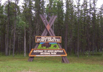
Then... I was in Wood Buffalo National Park.
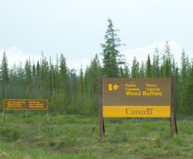
Created in 1922 to protect the Wood buffalo. It has an area of 44,800 sq km. It is bigger than Switzerland. When the Park was created, only 1500 wood buffalos were in the new park boundary. Soon after that, 6600 were brought up from the south. Now the heard stands at 3500 buffalos. They all are Hybrids. I saw my first buffalos at km 126, man it is big and ugly...
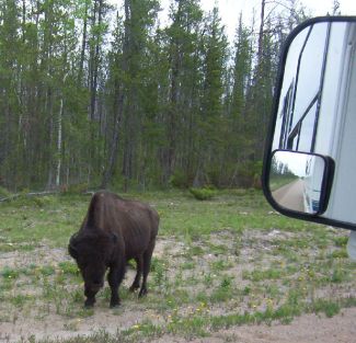
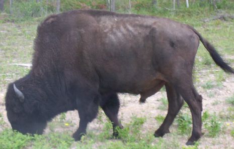
I was reading that the buffalos have a big head to plow into the snow to get to the food they need.
I stopped to see a Karst. Man! That is one hell of a big hole.
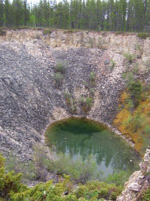
OK, that is created when an underground river forms a grotto and the roof collapse. This is the "hole", 18 meters deep and I do not know how wide. It will keep on growing in size, amazing.
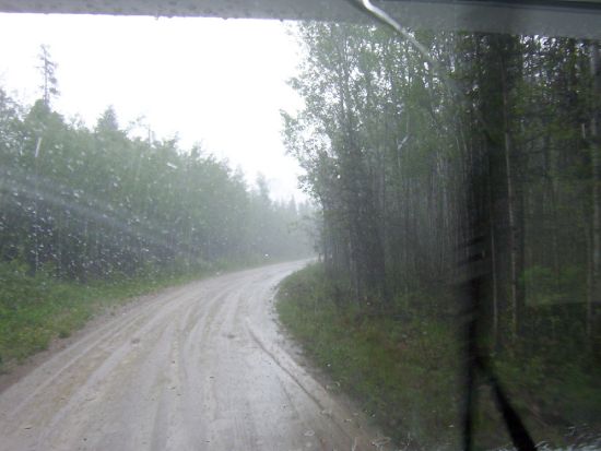
Back at the motorhome. Dam... I was missing a hub cap...Chocolate! Where did I lose it??? Should I go back? I can't remember hitting a big bump! What can I do? I removed the last 3 hub caps and carried on. Back on gravel roads, for the next 104 km. It was raining, nice job on the motorhome.
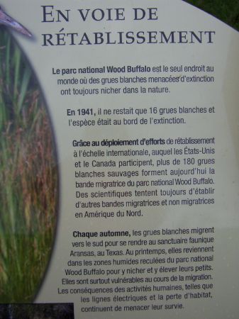
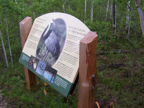
A little stop to see the wetlands. The Park protects the Whooping crane. Back in 1941, there were only 16 left. Now we have more than 180.
I took this picture to show you how ''bad'' Buffalo can be, look at the post...
Many, many km later, I hit the Salt plains. Following a nice... Little road for 13 km. Lucky for me, no traffic...
Decided to have supper as I waited for the rain to stop... OK, I go... Rain gear (can you see the bugs?).
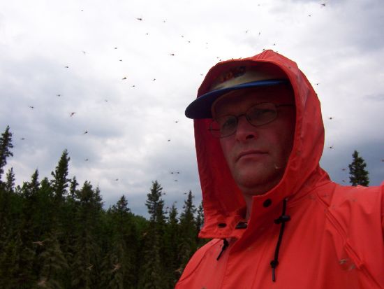
Gumby boots and bug juices. Very Nice site well laid out, nice lookout.
A little trail leads to the bottom onto the plains With the rain coming down, very little salt is visible. I found some anyway.
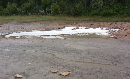
The natives were the first one to harvest the salt, its purity is unequal, I tasted it, very nice, made my blood pressure go up right away. The salt comes from the salt that was de-solved many years ago. The springs bring back the salt and the evaporation allows the salt to be seen and harvested. The only problem is the bugs, man...
Arrived in Fort Smith... After 518 km of driving...
I was camped at the Queen Elizabeth Territorial Park. $20 with power and free showers.
It is 7 pm I just got here. I did nothing, just shower and work on the blog.
Tomorrow, biking to town. if it rains... motorhoming to town
Next, June 4 to 11,
December 1 to June 3, 2006 June 4 to 11, 2006 June 12 to 18, 2006 June 19 to 23, 2006
Traveling the Deh Cho.
December 2005 to June 3, 2006.
Here are some of the preparation that happens before the trip.
Here we go. I decided sometime in December to do the "Deh Cho" road. I was thinking about this trip for a while. The only bad thing about this trip is that Michèle will not be with me.
Why this trip?
Why not! It is not too far from Cold Lake (so to speak).
For those of you who do not know me, my name is Denis and I am military, happily married, with 2 boys of 20 and 18 years old.
My "rig" is a 1996, class "C" of 24'' from Triple E.
I have never done a blog before, so I have to decide what I will talk about! I will describe the sight I see and the 'experience' I will have during my trip. Also, I will try to add a little humor to my text. Boys being Boys. I will also keep some statistics on things like $$$, the road, the people... And of course on me...
Some more preps.
Friday, February 10, Michele and I went to the RV show in Edmonton. We were looking at our next motorhome/fifth wheel. We also are looking for some info on the NWT. The man at the info booth was great! He gave me some reason to visit and not to visit some of the places. During my research, I found some very interesting web sites on the Metis and on the treaty with the Native. Very interesting reading. The web is an amazing source of info, almost too much.
May 14, 2006
Salut.
I have bought myself a Cargo Carrier and modified it with my bicycle rack.
The purpose of this purchase is to allow me to carry my generator and gas and other things I do not want inside the motorhome.
May 24, 2006
It is decided! I will be leaving Monday the 29 at around 7 am. Let me tell you, I just can't wait. If my voyage is only half as interesting as the stuff I have seen/read on the web, it will be fun. The motorhome is slowly emptying the un-needed stuff to be replaced by the needed stuff, like the spare tire... I can't believe the stuff I need or think I need. Let us just say things are going well.
May 25, 2006
Today I only fine-tuned my blog. Everything is written in sand. Things can change and will more than likely change as time moves on. What? It is a voyage, not a job.
Here are some of the goals I set for myself and the blog.
For the blog:
I will maintain my blog every day, even if I can't update my site for a few days.
I will write everything that goes through my mind... and not change it later.
If I talk about $$$ it is only to compare our price with the one here... and yes, I will talk about $$$ for the gas, mile per gallon, etc... ( I'm a guy, I like that kind of stuff).
My goals:
Not to rush to do things (control time and not time controlling me).
To walk about 10 Km per day and/or bike 25 to 30 KM per day.
Take a day 'off' every 4 or 5 days.
When I get up in the morning, put on my "kids" eyes and look at things as if it were the first time.
To take my time in the museums, on the road, just plain enjoy the moment.
Got work to do!
May 29, 2006
Up at 6:30 am. It rains with a beautiful +8 C
My bike will travel inside for the first day.
Off I go at 7:30 am.
The rain stops around 9 am. The sun is coming through.
Ah yes! I have another goal to add, not to go faster than 90 km with the motorhome. I also have to modify one of my goals. When driving, only put one "kids" eye because I have a hard time keeping my eyes on the road.
Chocolate, the roads are great in Alberta!
I fuel up in Slave Lake for $100 for 95 litres at $1.049. The lake is named 'Slave' not because the native were slave, but because the name of the Dene tribe is "Slavey". The early settlers gave it the name Slave.
Great weather to travel. It got a little worst in the afternoon when the wind picked up, right on my face! Well! If this is my biggest problem, I can live with it.
I arrive in Peace River at 4 pm.
I decide to stop for the night and go see "Twelve Foot Davis" on my bike. By the time I got to the bridge and look behind me... Some big, black clouds were coming. Well, I went back to the motorhome.
Only a 4 km bike ride on day one, so much for goals... OK, I will have a beer as a punishment and forget about it.
Today, I drove 614 km.
I am camping at the Lions Park on the West side of the river. The town is on the East side of the river. The campers are mostly oil rig workers. All the campsites are full.
Well! The rain never came. If it does not rain tomorrow, I will go to town and see the statue of Davis and maybe the museum. If it rains, I will see it on the way back.
May 30, 2006
Up at 8:30 am. Bad news, I bought some black socks so dirt and stain would not show up after a wash. Well, they are in Cold Lake...Dam! And I drove past 2 WallMart. Oh well, next town. I left the campground at 10:30 and went downtown Peace River. I biked the bike path that follows the river's edge, very nice.
I have lunch by the "Twelve Foot Davis" statue. According to what I have read about him, he was one of the few good guys. He was liked by all, native and white alike. He worked very hard all his life and lived until 1900 at a ripe old age of 80. At 70, he was still packing a 200lbs load on his back to the Fort of the north. The Native named him "the Wolf". He was a nice and generous man.
I visited the Peace River Museum. Nice museum, the lady that works there was super nice.
I left Peace River at 11:30 after having topped up the gas. $1.089 for a total of $80.00 for a distance of 252 km traveled. So far, my average is 27.5L /100Km. Not too bad, but not very accurate until I have more km traveled.
My next stop is Grimshaw, 21 km away. Pfiou! It is far ... I camped at the Elks RV park with all services for a big $15... WOW!
At 1:30 pm, I decided to visit the "Lake Cardinal Pioneer Village". It is a village of the '20s and '40s. I also discover that Mackenzie was the first white man to travel to the Pacific ocean, it is 12 years before Lewis and Clark (Americans), but the Americans say they were the first! I'm getting sidetracked here. Back to the village, it is all volunteer work, including restoration. They do beautiful work.
When I get back, I took my bike and went to the "Mile Zero Antique Truck Museum". It was closed, my guess is that on a Tuesday at 3 pm, they close early. I took pictures of the ''Mile Zero'' of the Mackenzie Highway.
When I got back to the campground, there were some mean looking clouds... I am next to the library. I went to check if I could get the Internet. No luck, they close in 10 minutes, no time to get the laptop and get back. It rains, it's windy, it's sunny, and freezing rain.
May 31, 2006
Sunny day!
It is 7:30, I emptied my grey and black water. On my way to La Crête and Fort Vermilion. Very nice road, I took the ferry at Tompkin's Landing.
The ferry is free and only runs during daylight hours. This means about 22 hours a day in the summer.
The ferry saves 90 km of driving for the traffic going south from La Crête or Fort Vermilion.
I arrived at the ''Heritage Village'', well, it is closed... A detour of 150 km for no reason. I am not impressed...oh well!
On my way to High Level and to the NWT. In High Level, the gas was at $1.089 and I took $125.50 worth of it. My average is 25.5 L /100Km. Driving 90 km sure makes a difference. Ah! Guess what? I am now the proud owner of 24 pairs of black socks. 12 in Cold Lake and 12 with me. High Level info center has a small museum, very nice, well laid out. High Level is on the 58 parallel and guess what? It has more frost-free days than Edmonton, H.L. 110 days, Ed. 104. It also has about 2000 hrs of sunshine per year, no wonder it is a farming country. At 4 pm I decided to continue to the NWT and spend the night at the 60th Parallel Park. The road is very nice, but from time to time I wonder what is on the road... Caterpillar...
Lots of caterpillars... Enough caterpillar that when I stopped, the motorhome stunk like rotten meat because there was so much caterpillar meat on the mud flap.
The info center is OK, not very big.
The campground is OK (10 sites), shower at $3, sites at $16. Lots of deer flies. Slow night, updating my blog. BTW, for my goals of walking/biking, I think about it. I will make up for it (I think).
June 1, 2006
Last night, it was daylight until 11 pm. WOW!
Up at 7:45, breaky, brushed my teeth, found myself to be handsome and smart... OK. OK. OK! I am getting carried away here.
On the road to Hay River. Very nice road so far.
I stopped at the Louise, Alexandra and Escarpment falls. Man, it was pretty and wild. I stopped at Louise falls because it is centrally located. Backpack, water, camera and off I went to the falls.
Louise Falls are 14 meter high.
Really nice and with a very good lookout, a spiral staircase to get to the base of the falls.
It was very impressive with the gorge and the river. I followed the trail that joins Alexandra and Louise falls (6 km return). The lady at the campground mentioned that bears are in the area, let me tell you that my Bear Bell was ''belling away''. The trail was well-done and maintained. The trails have many lookout and some information stations relating the importance of the river and the falls to the Native.
The stations explained the roles and social status of each individual in a tribe. It also mentioned why the native would leave the winter ground of Alberta and move up to the Great Slave Lake for the summer. The gathering on the shore of the lake could have as many as a 1000 person present, mostly from the Dene tribes. It was a time for trading, learning, settle disputes, and celebrations. It was the high time for the tribes of the North-West.
As I kept walking, it was weird to hear the noise of the fall diminish and the other fall getting louder. When I saw Alexandra falls... Chocolate it was gorgeous and big.
To see the gorge, the river the falls. WOW! Alexandra falls tumble 35 meters (Niagara falls are what? 50 meters!).
The ''Twin Falls Gorge Park'' is very well-done. You can go right to the edge of the falls, with no fence or guard rails. I guess they think that if you fall, you were too close, your fault dumb ass!
Back at the motorhome time for lunch before I went to Escarpment Falls. Pretty little falls.
After the Falls, I took the road North. Enterprise is 6 km to the north and my destination is Hay River, 38 km further. I blinked and I missed Enterprise, population 88.
Stopped at the info center in Hay River. I got lots of info. I decided to stop at the truck wash to get some of the caterpillar of the motorhome. Man, my motorhome stunk. Finally, I got most of the goo off.
Fuel topped up for $90.74 litres at $1.214, not bad. I expected $1.50. My average is 24L/100Km. I slowed down to 85 km and not using air conditioning, make a difference.
I camped at the Hay River Territorial park for $20 per night with electricity and free showers. My site was about 50 meters from the beach.
I spent the rest of the day and evening updating my blog and also making an English version of the blog for my Anglophone friends. Not to complain, but I never realize it would take 1 hour a night to update the blog, and I have not had a busy day yet. WOW! It is OK during the updates I have a beer, Scotch. Dam, I'm good-looking and intelligent... I'm drunk...Oh well :-)
Enough delirium.... What are people going to think? Too all, see you later!
June 2, 2006
Late morning, got up at 8 am. It has been daylight for the last 4 hours. Lazy morning, read the local papers. At 10 am I took my bike and went to town.
I followed a trail marked on the maps for the city. It is a quad trail, and muddy on top of that. Hay River is about 10 km from the campground. Even taking my time, it took me 30 minutes to do the whole town. 6 streets and 15 avenues. Not big! But there was something special in this town. A purple school.
Really! When the school was built in 1971, they asked the student of the time what color they wanted and they picked purple.
OK! Some info on Hay River. The Dene chose this spot over 800 years ago for their summer camp. Later, the Hudson Bay Company and the Churches came to Hay River. During the second WW. The Americans came to Hay River and build a runway which served as a base camp for the building of the Canol Pipeline. In the 60, some mining companies, the Coast Guard and the Northern Transportation Company Limited which moves fret up to the villages in the arctic. This gave the nickname of ''Hub Of The North'' to Hay River. In 1963, tragedy struck with a big flood, which forced the town to re-locate the town up-stream. Today you have the "Old Town" by the shore of the lake and the "New Town", 6 km further up the river. Hay River has a population of 3835 souls. I have to say, the people of Hay River are very friendly.
I bought a small tripod at the cost of $15 and let me tell you, it is very useful and easy to carry in a backpack.
A picture of me working on my blog... Having a little Scotch.
Let me tell you, nobody will ever steal a picnic table, they were made of cement.
Good news, I did 26 km on my bike today, watch out Lance Armstrong :-).
Tomorrow I will be on my way to Fort Resolution, 156 km east of Hay River.
June 3, 2006
Up at 7:30 am. I lied yesterday, the sun does not rise at 4 am, but at 2 am. And between midnight and 2, it's not dark! I was looking at a map of the world. I noticed that the 60th parallel is in the middle of Hudson Bay! Isn't there Eskimos live up there? Oh well! Let's continue. On the road by 8:40 am. I took road n.5 for Fort Resolution. Nice road. I turned onto n.6 to carry on to Fort Resolution. Let me tell you, there was not much between Hay River and Fort resolution Trees... Trees. I even counted them. 153,345,234 and now I am tired of it.
The further away I am from Hay River, the worst the road gets. Then I hit the gravel road for the next 66km. Not bad, just a few bad spots. Let's go back in time... When Michèle and I were at the RV show in Edmonton, the guy in the info booth for the NWT said that there is not much to see in Fort Resolution. Well, he was right! It was not worth the detour. But that was OK... Been there, did not get a t-shirt. Fort Resolution is a small native village of 525 souls. They must have good jobs because they all have new trucks, even a hummer! I was reading that there are 2 sawmills in the area. All the street names were in Chipewyan.
Not much to do or see here, lets go to Fort Smith, but not before I filled up for $60.00 at $1.279 for a total of 46 litres. I took road n.6 and then turned onto n. 5 to Fort Smith. It is about 200km away. Guess what? Trees... Treesssss. Big ones... Small ones... Burnt ones...Green ones... I will be dreaming in treesssss! Chocolate !!!
Then... I was in Wood Buffalo National Park.
Created in 1922 to protect the Wood buffalo. It has an area of 44,800 sq km. It is bigger than Switzerland. When the Park was created, only 1500 wood buffalos were in the new park boundary. Soon after that, 6600 were brought up from the south. Now the heard stands at 3500 buffalos. They all are Hybrids. I saw my first buffalos at km 126, man it is big and ugly...
I was reading that the buffalos have a big head to plow into the snow to get to the food they need.
I stopped to see a Karst. Man! That is one hell of a big hole.
OK, that is created when an underground river forms a grotto and the roof collapse. This is the "hole", 18 meters deep and I do not know how wide. It will keep on growing in size, amazing.
Back at the motorhome. Dam... I was missing a hub cap...Chocolate! Where did I lose it??? Should I go back? I can't remember hitting a big bump! What can I do? I removed the last 3 hub caps and carried on. Back on gravel roads, for the next 104 km. It was raining, nice job on the motorhome.
A little stop to see the wetlands. The Park protects the Whooping crane. Back in 1941, there were only 16 left. Now we have more than 180.
I took this picture to show you how ''bad'' Buffalo can be, look at the post...
Many, many km later, I hit the Salt plains. Following a nice... Little road for 13 km. Lucky for me, no traffic...
Decided to have supper as I waited for the rain to stop... OK, I go... Rain gear (can you see the bugs?).
Gumby boots and bug juices. Very Nice site well laid out, nice lookout.
A little trail leads to the bottom onto the plains With the rain coming down, very little salt is visible. I found some anyway.
The natives were the first one to harvest the salt, its purity is unequal, I tasted it, very nice, made my blood pressure go up right away. The salt comes from the salt that was de-solved many years ago. The springs bring back the salt and the evaporation allows the salt to be seen and harvested. The only problem is the bugs, man...
Arrived in Fort Smith... After 518 km of driving...
I was camped at the Queen Elizabeth Territorial Park. $20 with power and free showers.
It is 7 pm I just got here. I did nothing, just shower and work on the blog.
Tomorrow, biking to town. if it rains... motorhoming to town
Next, June 4 to 11,
 |
  © COPYRIGHT 2021 ALL RIGHTS RESERVED MICHELE-DENIS.COM |
 |