www.michele-denis.com

Home   Archives   Français
  December 1 to June 3, 2006    June 4 to 11, 2006    June 12 to 18, 2006    June 19 to 23, 2006

Traveling the Deh Cho.

June 12 to 18, 2006.

June 12, 2006


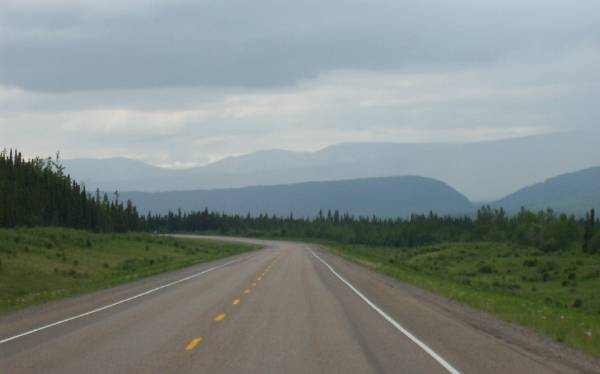
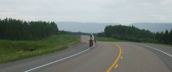
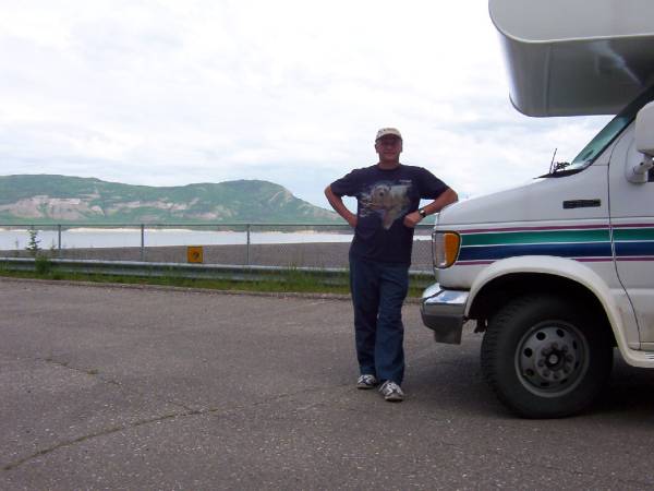
Left Sambaa Deh at 8:30 am, on my way for another 90 km of gravel.  It was not too bad.
An hour later, I was at Checkpoint (it is the real name of the place) and the pavement starts again for another 60 km until Fort Simpson.
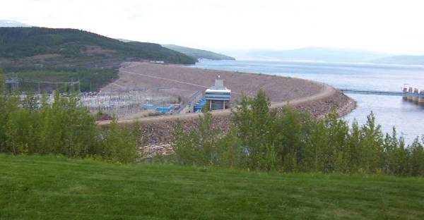
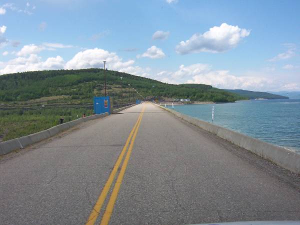
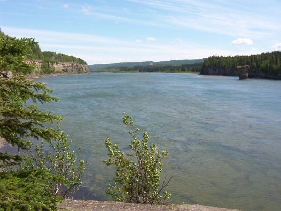
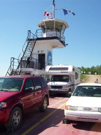
But before I get to Fort Simpson, I have to cross the Liard River with the ferry MV "Lafferty".


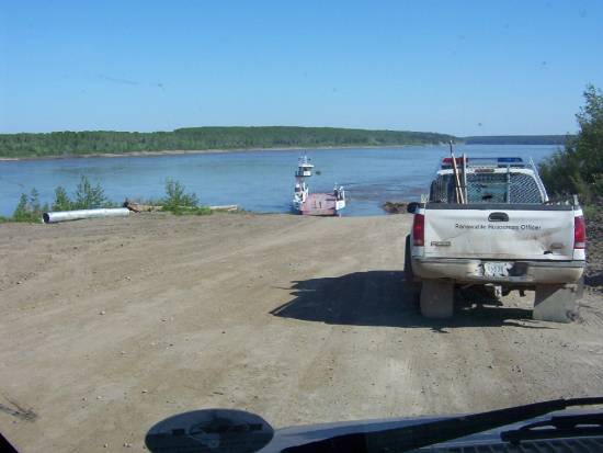
There was only me and this truck on the ferry.  The water was very high. The ferry employee had to put planks, lots of planks to keep my overhang from rubbing, or should I say, to keep me from "low" center myself.

In Fort Simpson, I filled up, and I treated myself to a Pizza Pan from Pizza Hut.  Hummmm!  I stopped at the info center. She was not the best resource person around.

I checked out the local airline for a flight to Nahanni National Park and Virginia falls.  I was out of luck. There was no flight schedule for Tuesday, Wednesday and Thursday.  They suggested I check back with them tomorrow as they might have an extra flight or a cancellation on the other flight.

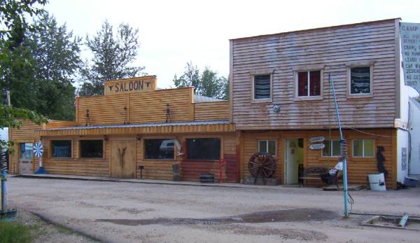
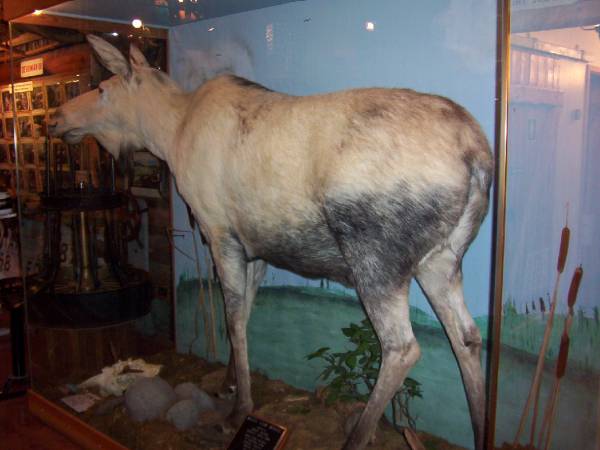
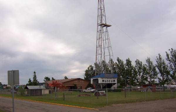
On the way back, I visited Fort Simpson on my bike.  With a population of 1200, the village of Fort Simpson is not very big.  The name Fort Simpson in Dene is "Liidii Kue," which means "The place where the rivers come together".

In the past, the Native used this area for its abundance of games and fish.
The North West Co. had a fort here in 1804. Later on, the Hudson Bay had one in 1822.

In 1987, Pope John Paul II came to Fort Simpson.

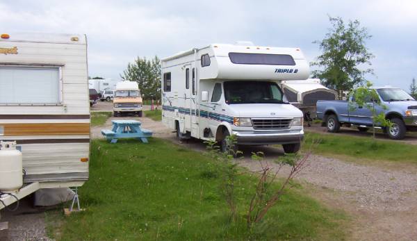
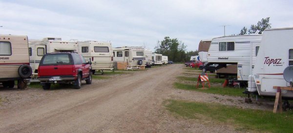
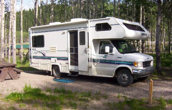
Back at the campground, I made myself a feast of salmon and potatoes.
After diner, I went to the library to connect to the internet.  Disappointment, it was the only connection to the internet in Fort Simpson. It has been down for the last 3 weeks.
Oh well!
I came back to the campsite and had a shower. I then worked on my blog.  I am on page 3 already!
Got to bed at around 11 pm.

Useless information. 
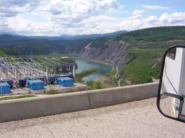
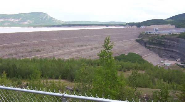
By Fort Simpson, 2.5 million gallons of water goes by each second on the Mackenzie River.
The Mackenzie river carries very little sediments, but the Liard river contains lots.
In spring, the Liard river "gives" everything she's got to the Mackenzie.  So the Mackenzie carries about 1.5 million tons of sediments a day.
In summer, it carries only 220,000 tons a day.
The most the Mackenzie has ever carried, 10.8 million tons in a single day and that was in 1974, that must hurt the eyes of the fish.


June 13, 2006


Yesterday was a beautiful +25.
I even slept with the windows open.
Lazy morning, coffee, breakfast and reading.
I will wait until 1 pm for a possible flight to Nahanni Park.
At 10 am, I went to all 3 companies to check on a possible flight, no changes. I tell them I will be at the info center from noon until 1 pm just in case there is a flight.
A little shopping, 5 minutes and I am done in the only "big" store in town.  Back at the campsite, I read the local paper, which covers all of the NWT.  Even the little hamlets next to the North Pole!
At noon, I was at the info center. I waited!
An employee came and let me know that they can set up a flight for $1000.00.  I said, "no, thank you!".
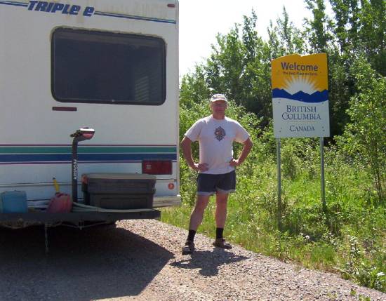
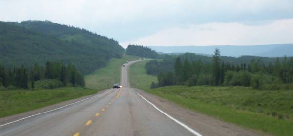
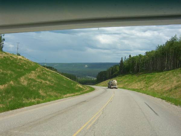
By 12:30 pm, I was on my way to the Liard Trail, towards B.C.
The crossing of the Liard River was without any problems.


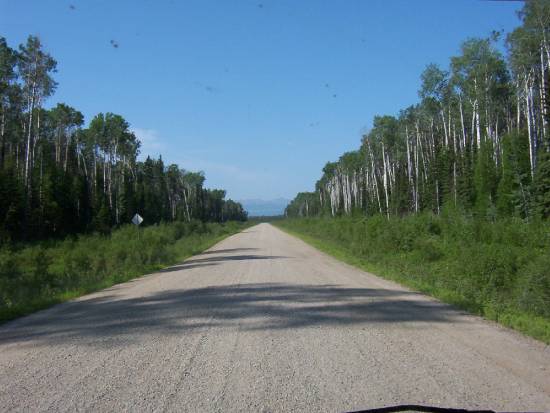
I backtracked for 60 km to Checkpoint where the Liard Trail starts (or ends).


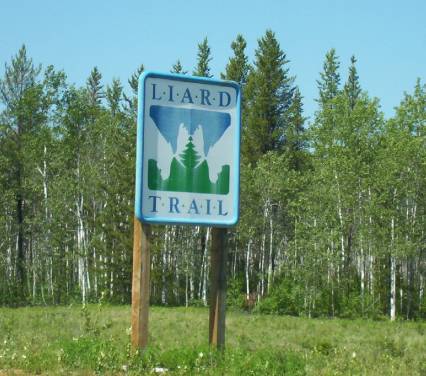
They say that "Liard" is a French word for black poplar.  I will have to check that out when I get home!
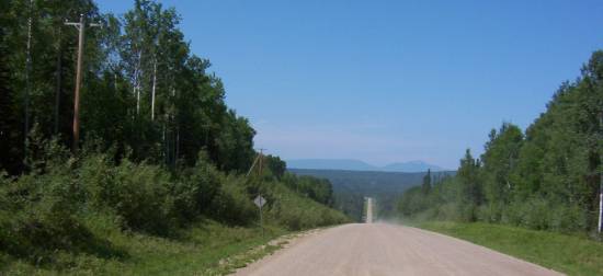
The Liard Trail is 390 km long from Checkpoint to the B.C. border.  The trail was open in 1984 with this description. When dry, it is dusty. When wet, it is muddy!  It was named Liard because of the river it follows.  Speaking of dust, I complained when it was raining because of the mud.  Well!  Now I am complaining because it was dry and the dust was getting everywhere there was a small opening in the motorhome.  All my cupboards on the floor were full of dust, my outside storage was full of dust!
Chocolate!
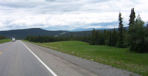
I stopped at the Blackstone territorial park at around 3 pm.


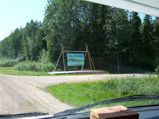
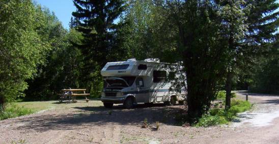
I had been on a gravel road since 1:30 pm. It was not so bad. I could drive at 80 km, even some 90 km stretches.  The park had a nice info center, for being in the middle of nowhere.  The campground was small, only 19 sites without power, but they had showers.  I wish we had power because at +32 with no wind...


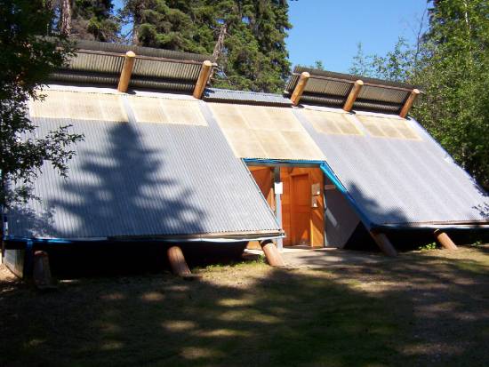
All the buildings in the park were built like a teepee. It gave a certain style...


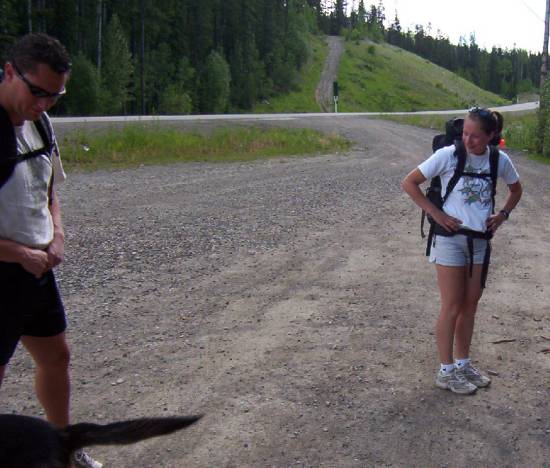
Before diner, I hiked 2 trails for a total of about 3 km.  I could not get to the Blackstone river because the trail was flooded.
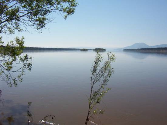
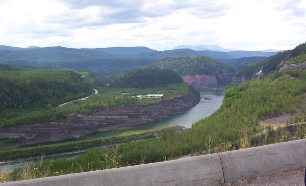
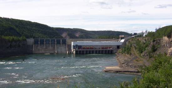
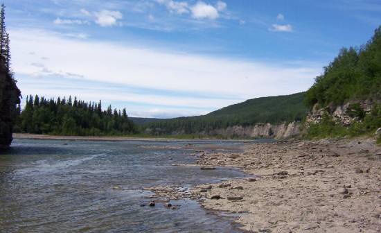
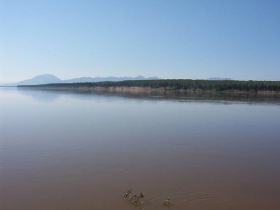
Here is a picture of the Liard River.  In the background, on the left, you can see the "Nahanni Butte" and the mountain range Nahanni, which is part of the Mackenzie range.


Back at the campsite, I had a cold beer...  Then I took off on my bike to go to the Blackstone river by the road, a little ride of 14 km.  Back at the campsite, it was a nice +29. I had a few cold ones.  I finished the evening inside as when you have taken your shower, the bugs get you in no time.

Oh well!

It is 10:30 pm and +26.


June 14, 2006


WOW!  It was hot last night. +31.
I finally went to bed at 1 pm because it was so hot.  But that's OK!
I was up at 8 am. After I got ready, I went to the info center and got a free coffee.  They had free coffee at every Territorial Parks.   I went to the back of the info center and sat with the operator of the campground.  He told me that the river was very high because of the melting snow in the mountains.
The Nahanni River carries lots of debris (tree) which end up in the Liard River, which in turn end up in the Mackenzie River and the arctic ocean.  This is funny because there is no tree up there.
But they have driftwood!


Almost no bugs, dam, I feel good!
With regrets, I left at 9:30 am. Carried on to Fort Liard, 120 km further south.
Just another 150 km of gravel.  But nice scenery.


The last 40 km before Fort Liard were just terrible.  The maximum speed was 60 km, even my q-tips were making noise.
Fort Liard has for language the South Slavey, the "Acho Dene Koe, which means "Place of Land of the Giants".  When you get to Fort Liard, you can see the Giant sleeping.  Can you see it?


I visited the hamlet, the info center was super. The natives of Fort Liard are world renowned for their Birch Bark Baskets and quillwork from Porcupine needles that they make.  Very pretty and very expensive!  Out of Fort Liard, only 36 km of gravel left, I can't wait to hit the pavement!
Here I am in B.C.


220 km later, I hit Fort Nelson.  It is the capital of the forest for B.C.  I was camping at the Westend Campground.  All campgrounds in Fort Nelson are geared towards the traveler of the Alaskan Highway.  Good news, I had wireless internet on y site... +32.  I am staying put, having a couple of beers, surfing and answering e-mail.  Forecast for tonight?  Thunderstorms.  More to follow...


June 15, 2006


No severe thunderstorms last night!
Just some rain. This morning it was over!
Here are some pictures of the entrance to the campground and my site, a little tight, but OK.


I treated myself to a nice breakfast at Mag & Mel.  Good egg & bacon.  Hummmm !
OK!  To Fort Nelson Museum.
WOW!  I spent over 2 hours in there.
Inside, there was lots to see.


I started with a 30 minutes video on the construction of the Alaskan highway.  The movie must have been done in about the same year.
For those that have seen my "Whoop mill", well, I saw one at the museum!


Even an albinos moose...


Anybody used those roller skates?
I think I used them when I was a kid!


For the military, here is the pre-Hermann Nelson.


Old chainsaws.


Lot of old cars in the garage.


Most of these cars belong to the bearded man, Marl Brown.  He is the one that founded the museum, worked and restored most of what you see in the museum.
A 1908 Buick.


Which still runs.  Marl wants to take it to Whitehorse in 2008 when the car will be 100 years old.  A trip of about 1000 km.  He started the engine. It took only a quarter of a turn and it went.
WOW!
Weird to see the valves spring outside.
While visiting the outside of the museum you could tell lots of individuals and companies gave items to the museum.
There is even an old culvert made out of wood. It is 50 years old. It is in the museum now.
WOW!


Of course, there was machinery that was used in the construction of the Alaskan Highway.  Which I am sad to say was first made by the Americans. Right after, made better by the Canadians.
Sounds familiar?


A 3 wheeler, all-wheel drive, homemade.


I loved the museum.  If I lived closer, I would spend lots of time here.
1:30 pm, I filled up and hit the road toward Fort St-John.
Almost 400 km...  Of nothing...  Except a beautiful scenery's.
Chocolate!  The BC roads were nice.
I set the cruise control at 90 km on the way out of Fort Nelson.  I traveled by the and into the Rockies.
Just plain... Beautiful!


A little bit of rain here and there.


Not much traffic, I would say that 4 out of 5 vehicles were RV. All on their way to Alaska.


The road was nice. I caught myself smiling.
Chocolate, it is beautiful.
To my brother...  You should be here with me now!


Hey! Jérémy!
Bikers!

 
I got to Fort St-John at 6 pm.
I found a site at the Sourdough Pete's & RV park.
Being a Good Sam member. I got a site with electricity for $16.
Not bad.
This campground is open year-round, and you can tell by some of the regular.  It was also a stopover for the people on their way to Alaska, which means it is almost a parking lot.
For supper, deer steak, potatoes and some green stuff.
Easy night, updated the blog and bedtime at 12:30 am.
It was weird. It got dark at 10:30 pm here.  I was used to not getting dark at all in the NWT.

Darn!  Life is good :-)
Take time (make time?)...  To live...


June 16, 2006


Here is a picture of my campsite in Fort St. John.


One of the campground.


I went to visit the museum of Fort St.John.


30 minutes later, I was out!  OK, but that's about all!  I got back to the info center to update my blog.
I asked for some information about the dams located on the Peace River.  It is only 100 km away!
Like I said, nothing is in concrete.

I left for Hudson's Hope at 10:30 am.
I got to the info center in Hudson's Hope at 11:40 am.  They told me that there was a guided tour at 12:30 pm and 4:30 pm for the W.A.C. Bennett Dam.  The other dam is the Peace Canyon Dam.

I decide to go to the 4:30 pm tour of the W.A.C. Bennett Dam and find a campsite as soon as possible because they fill up fast here on the weekend.
Lots of road construction here for the last 20 km or so!
So I made a mistake/got lost, and found myself at the visitor center for the dam.  I did the 12:30 visit.
The 2 dams produce about 33 % of BC's electricity.  Both dams are 23 km apart. They were constructed here because the Peace river canyon made a perfect building place for dams and reservoirs.
The dam I am visiting is the W.A.C Bennett Dam.


The tour was about 1 hour long and very interesting. It was worth the detour.
We could still drive on the dam.  COOL!


On the way back to town, there was one hell of a hill to go down, I mean really go down.
The truck in front of me was going at a breakneck speed of 20 km/hr!  Let me tell you that I am using my breaks to stay at 20 km/hr.


I camped at the "Dupont Ent. RV Park" in Hudson's Hope.


Yes!  The owner is Jean-Nil Dupont and he was French.  We shot the poop for a while.  After dinner, I went for a bike ride in town, 10 minutes later, I was done.
Back to the info center, I asked about the town of Tumbler Ridge.  They have Falls in that area.  Oh well! Tumbler Ridge, here I come (tomorrow).
Tomorrow I will visit the small museum in Hudson's hope and then tour the Peace Canyon Dam and go to Tumbler Ridge.

Useless information:
The dam was completed in September 1968 at a cost of 1 billion $ in 1968 dollars.
It is an earth dam, at the base, it measures 850 m wide and at the top only 9m.  It is 2 km long and 183 m high.
10 generators are working to produce 2,725,000 kilowatt of electricity.
The reservoir, Williston Lake, is the largest lake in BC and the 9th largest reservoir in the world.
During the digging for the base of the dam, they found dinosaur's tracks.


June 17, 2006


Up at 7:30 am, breakfast with banana bread with Almond.  I also had some wild blueberry jam from the Farmer's Market here in Hudson's Hope.  Hummmm!
The museum does not open until 9 am.
It is 8:15 am.
Got myself a coffee and went to watch a softball game in town.  There was a tournament this weekend.
9 am, off to the info center to update my blog.  I cannot connect to the internet with my laptop.
Oh Well!
I went to the museum.
It was small, but nice, I spent 45 minutes in there.
Off to the Peace Canyon Dam for a visit.  I got the Royal treatment because I was the only one here.  The tour was a little of info center and Museum.


View of the  "Peace Canyon Dam".


You cannot go inside the dam.  But I still spent over an hour in there.  Super!
I was surprised to find out how riches this area is for fossils.
Here were some of the ones that lived here.


The guide recommended to take a look at a small municipal park by the river where you can take a walk on the river's edge.  Many people were camped on the shores of the river.
Upstream!


And downstream...


By noon I was off to Tumbler ridge.  Nice road, nice scenery.
The road was an up and down kind of road because I am in the Rockies.  I figured I will be taking lots of gas, but when I filled up in Tumbler Ridge, I still got 12 m/g?

I forgot!
Just as I was starting a downgrade of 10%, a deer jumped out of the ditch on my right side and decides to have a race with me.
I hit the brakes. He decided to cross the road in front of me.
A motorhome does not stop on a dime, more so when you are on a 10% downhill road.
I almost touched him with my bumper, but missed him...
My heart was racing...
Now I have to "fix" all my cupboards.
Once in Tumbler Ridge, I went to the info center. She told me that the road is 40 km of paved road and 12 of gravel, all I have to do is follow the signs.
As I read the information on the road for the Falls, it more like 20 km of paved road and 43 of gravel.
She also told me the gravel road was well maintained.
Let's go!
After 10 km, I CANNOT TAKE IT NO MORE!!!
My max speed has been 25 km/h.
The road was just one long washboard.  It was so rough, I taught the motorhome would fall apart.
I got myself back in town at the Lions Campground by the Flatbed creek.


I signed up for the guided tour of the riverside tracks tour for tomorrow morning.
Easy night and a nice campfire.


June 18, 2006


Before I start my day, I have to talk about  the history of Tumbler Ridge.
25 years ago, Tumbler Ridge did not exist.  The village was built for the workers of the mine.
Even the roads or train tracks did not come here.  So it is a young village.

Let's carry on.
At the info center I asked where I can get internet.
Well!  The Library.
But!  It is not open.
I drove around the village to find an open connection.
None!

Got back to the info center and decided to get myself a coffee.
I met this francophone couple from Québec and found out we were on the same guided tour at 11 am.
His name is Jean-Guy, but I forgot her name :-(
The guide told us where the trail starts and we have to take our vehicle to get there.
Jean-Guy offers me a ride and I took it.
Our guide was good looking young lady (They all look young to me).  She had the equipment to scare the bears.


I was talking about pepper spray, whistle, etc.
The trail was about 3 km return.  Mostly sunny day.
To get to the dinosaurs tracks, she talked a little bit about the dino tracks and the plants.
The trails went by a very old cabin (I forgot to take a picture, not much of a cabin).
But she told us this cabin had a very particular story.
25 years ago, when the village was being built, there was a lot of transient workers.  At the same time, in southern BC, a double murder was committed.  You see it coming, don't you?  Well!  Our killer lived in that cabin for almost a year and was, kind of, hidden in Tumbler Ridge.  Someone must have recognized him.  The Dawson Creek RCMP came and got the killer.
At the creek, we were on a flat rock where we could see almost 200 tracks of Ankylosaur, Ornithopod and Theropode.


WOW!
The tracks are about 90 million years old.
At this point, I was wondering why I had paid $12 for this tour.
Well, let me tell you, at that point, she got going and did she know what she was talking about.


The tracks were found by 2 boys that were tubing down the creek.  One of them tipped and got to the shore and notice dino "tracks".  Back home, they told their parents which...  Had big doubts about the story. Finally, pictures were taken and sent to the Royal Tyrrell Museum so they could study them.  In the fall of 2000, the response back was... They are tracks of dinosaurs.  But they will not be able to check them out until next spring.  This is the only site in the world with fossils and tracks side by side. Also!  It is the only place where you can find 26 tracks in a row of the same Ankylosaur, in the world.
The guide asked us to check all the rocks and see if we could find fossils.  We found quite a few of them.
In the creek, there was a rock with fossils of ocean life from way back when.


Back in the village, Jean-Guy let me off and I did some shopping for food.
I decided to go and see the Quality Falls which are a little out of town.
Nice falls of 7 meter high.


Really nice falls!
I am staying in Tumbler Ridge for another night.  On my way to Dawson Creek, there is another fall I want to check out, but it is a hike of 10km and I think they are pretty far from here.
Evening by the fire and some chicken wings!

Next, June 19 to 23, 2006


Document made with KompoZer
Province Visitée  États visités
© COPYRIGHT 2021 ALL RIGHTS RESERVED MICHELE-DENIS.COM

Profile for DM1960